Anatolia: The History and Geography of Asia Minor
Anatolia, often referred to as Asia Minor, is a vast peninsula in West Asia that forms the heart of modern-day Turkey. Its name is derived from the Greek word Anatolḗ, meaning "The East" or "sunrise." Spanning approximately 537,886 square kilometers, this region serves as a critical land bridge between Europe and Asia, shaped by a complex geological history and a succession of powerful civilizations.
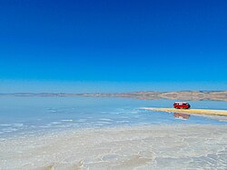
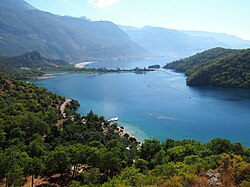
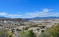
Geographically, Anatolia comprises about 97% of Turkey's total landmass. It is delineated by the Black Sea to the north, the Mediterranean Sea to the south, and the Aegean Sea to the west. The region's landscape is diverse, ranging from the rugged Pontic Mountains in the north to a dry central plateau and the lush Mediterranean coastline known as the Turkish Riviera.
![Europe during the Last Glacial Maximum, c. 20,000 years ago. Anatolia was connected to the European mainland until c. 5,600 BCE,[8][9][10] when the melting ice sheets caused the sea level in the Mediterranean to rise around 120 m (390 ft),[9][10] triggering the formation of the Turkish Straits.[8][9][10] As a result, two former lakes (the Sea of Marmara and the Black Sea)[8] were connected to the Mediterranean Sea, which separated Anatolia from Europe.](/images/94/ce/94ce856ef1c8cfdb0f1788d5f598e1b70246795cab0f023dc60df04d8ce13bf5.png)
Key Facts
- Location: West Asia, predominantly encompassing the Asian portion of Turkey.
- Area: Approximately 537,886 km².
- Etymology: From the Greek Anatolḗ, meaning "The East."
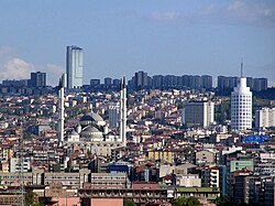
- Major City: Ankara, the largest settlement with a population of over 5.8 million.
- Geological Event: The formation of the Turkish Straits occurred around 5,600 BCE due to rising sea levels.
- Demographics: Predominantly Turkish-speaking, with minority populations including Kurds, Zaza, and others.
Geological Evolution and Climate
The physical separation of Anatolia from the European mainland was a gradual process. During the Last Glacial Maximum roughly 20,000 years ago, the region was connected to Europe. However, as ice sheets melted around 5,600 BCE, Mediterranean sea levels rose by approximately 120 meters (390 ft). This event triggered the formation of the Turkish Straits, connecting the Sea of Marmara and the Black Sea to the Mediterranean and effectively isolating the peninsula.
The climate of the region varies significantly by zone. The coastal areas enjoy a Mediterranean climate, while the interior is characterized by a dry central plateau. These environmental differences have historically influenced settlement patterns and agricultural practices across the peninsula.

A Journey Through History
Prehistoric and Ancient Civilizations
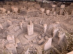
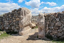
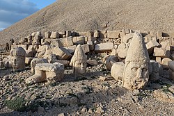
Anatolia is home to some of the world's earliest evidence of complex human society. The henges of Göbekli Tepe, dating back to 9,600 BCE, represent a pivotal moment in human architecture and ritual. Following this era, the region saw the rise of the Hattians and Hurrians, and later the powerful Hittite Empire, along with the Luwians and Palaians.
Classical and Hellenistic Eras
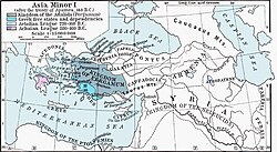
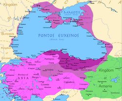
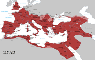
Greek influence began with colonies along the Aegean coast, established by Aeolian, Ionian, and Dorian settlers. Over time, this influence expanded, particularly during the Hellenistic period following the conquests of Alexander the Great. The region later became a vital part of the Roman Empire, reaching its greatest extent under Emperor Trajan in 117 CE.
The Medieval Period and the Byzantine Empire
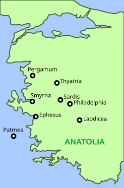
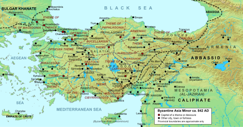
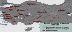
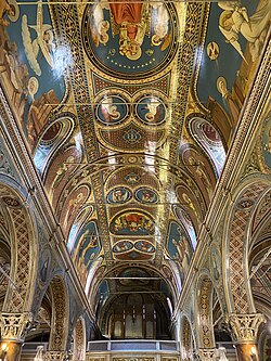
As the center of the Byzantine Empire, Anatolia became a bastion of Early Christianity and a frontier zone against Arab expansions during the mid-9th century. The region was also a site of significant religious importance, housing the Seven Churches of Asia. However, the 13th century brought Mongol invasions, with the Ilkhanate establishing a garrison near Ankara until 1335.
The Ottoman Empire and Modern Transition
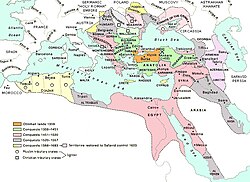
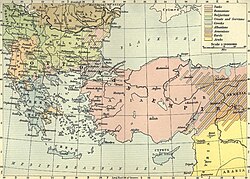
The rise of the Ottoman Empire saw the gradual Turkification of the region. Between 1359 and 1683, the empire expanded significantly from its Anatolian roots. Until the early 20th century, Anatolia remained a multi-ethnic mosaic. However, the period between 1894 and 1924 saw the ethnic cleansing of approximately 4 million Christians, including the Armenian, Greek, and Assyrian genocides. The 1923 population exchange between Greece and Turkey further reduced the indigenous Greek population to a small minority.
Regional Summary
The following table provides a concise overview of Anatolia's primary characteristics.
| Category | Details |
|---|---|
| Total Area | 537,886 km² |
| Primary Administration | Turkey |
| Dominant Language | Turkish |
| Key Geographic Features | Central Plateau, Pontic Mountains, Turkish Straits |
| Major Historical Empires | Hittite, Roman, Byzantine, Ottoman |
Frequently Asked Questions
What does the name Anatolia mean?
The name comes from the Greek word Anatolḗ, which translates to "The East" or "sunrise."
How did Anatolia become a peninsula?
Anatolia was connected to Europe until approximately 5,600 BCE. The melting of ice sheets caused Mediterranean sea levels to rise by about 120 meters, creating the Turkish Straits and separating the landmass.
Which ancient civilizations inhabited Anatolia?
The region was home to many civilizations, including the builders of Göbekli Tepe, the Hattians, Hurrians, Hittites, Luwians, and later the Greeks and Romans.
What is the current demographic makeup of the region?
The majority of the population is Turkish. Minority groups include Kurds, Zaza, Arabs, Circassians, Laz, Georgians, and a very small number of Greeks (fewer than 5,000).
What is the significance of the central plateau?
The central plateau is a defining geographic feature of Anatolia, characterized by a dry climate that contrasts with the Mediterranean and Black Sea coastal regions.