Amazon RiverAmazon BasinRio AmazonasSolimões RiverRio Negro

Amazon River: The World's Most Powerful River System

Amazon River: The World's Most Powerful River System The Amazon River, known in Portuguese and Spanish as the Rio Amazonas or Río Amazonas, is a colossal waterway that defines the landsca...

Amazon River: The World's Most Powerful River System

The Amazon River, known in Portuguese and Spanish as the Rio Amazonas or Río Amazonas, is a colossal waterway that defines the landscape of South America. Flowing primarily through Brazil, Peru, and Colombia, it is not merely a river but a vast network of tributaries and basins that sustain one of the most biodiverse regions on Earth.

From its high-altitude origins in the Andes to its massive discharge into the Atlantic Ocean, the Amazon represents a critical component of the global hydrological cycle. Its sheer scale—both in length and volume—makes it a subject of constant scientific study and geographical fascination.
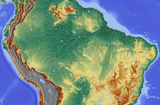
Topography of the Amazon River Basin

Key Facts

Old drawing (from 1879) of Arapaima fishing at the Amazon River. The arapaima has been on Earth for at least 23 million years.[49]
  • Total Length: Approximately 6,575 km (4,086 mi).
  • Basin Size: 6,925,674 km², the largest drainage basin in the world.
  • Average Discharge: 223,700 m³/s at the delta.
  • Primary Countries: Peru, Colombia, and Brazil.
  • Source: Apurímac River at Mismi Peak, Peru.
  • Mouth: Atlantic Ocean, Brazil.

Geography and Course
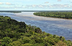
Amazon tributaries near Manaus

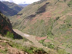
The Amazon's journey begins at an elevation of 5,220 meters (17,130 ft) at Mismi Peak in the Arequipa Region of Peru. While historically debated, the Apurímac River is recognized as a primary source.
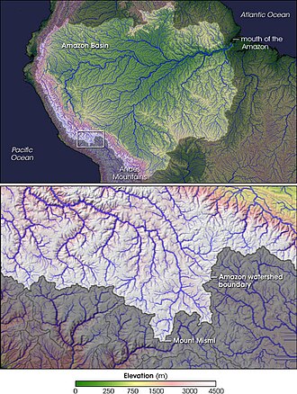
Nevado Mismi, formerly considered to be the source of the Amazon

The river's course is traditionally divided into several distinct sections:

The Upper Amazon (Solimões)

The Upper Amazon begins at the confluence of the Ucayali and Marañón rivers. In this region, the river is known as the Solimões. It is characterized by a narrower width, starting at approximately 700 meters, and flows through the heart of the Peruvian and Colombian Amazonia.
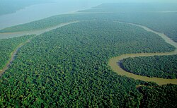
Solimões, the section of the upper Amazon River

The Middle and Lower Amazon

As the river progresses, it widens significantly. In the Middle Amazon, the average width is 3 km, expanding to 5 km in the Lower Amazon. At its widest points in the lower reaches, the river can stretch between 10 and 14 km, eventually opening into a massive estuary reaching 340 km in width.
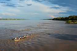
Amazon River near Iquitos, Peru

The Mouth and Delta

The river terminates in a vast delta on the coast of Brazil, where it empties into the Atlantic Ocean. This region is characterized by an immense volume of water and sediment discharge that influences ocean currents and salinity far beyond the coastline.
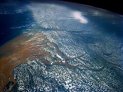
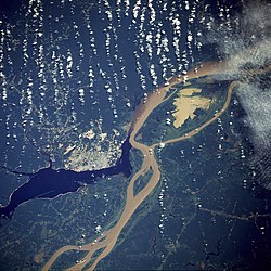
Satellite image of the mouth of the Amazon River, from the north looking south

Hydrology and Tributaries

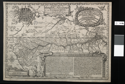
Samuel Fritz's 1707 map showing the Amazon and the Orinoco

The Amazon is fed by a complex system of tributaries that contribute varying types of water. One of the most striking examples is the Meeting of Waters (Encontro das Águas) near Manaus, where the dark, acidic waters of the Rio Negro meet the sandy, sediment-rich waters of the Rio Solimões. These two rivers flow side-by-side for several kilometers without mixing due to differences in temperature, speed, and density.
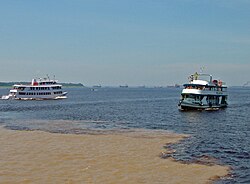
Meeting of Waters; the confluence of Rio Negro (blue) and Rio Solimões (sandy) near Manaus, Brazil

The Madeira River is the largest tributary by volume, contributing roughly 14.1% of the total discharge. Other significant tributaries include the Rio Negro, Japurá, and Xingu rivers.
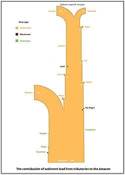
The contribution of the sediment load from tributaries to the Amazon.

River Discharge Data

The volume of water moved by the Amazon is staggering. The average discharge at the delta is 223,700 m³/s, though this fluctuates seasonally. Peak flows typically occur between June and August, while the lowest levels are seen in December.

Average Monthly Discharge at the Amazon Delta
Month Amazon Discharge (m³/s) Pará Discharge (m³/s)
January 126,100 7,300
March 186,300 18,200
June 275,600 40,500
July 296,900 32,600
September 262,500 6,100
December 82,400 1,000

Biodiversity and Wildlife

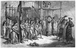
Masked-dance, and wedding-feast of Ticuna Indians, engravings for Bates's 1863 The Naturalist on the River Amazons

The river system supports an extraordinary array of species. Among the most famous are the Amazon river dolphin and the green anaconda, one of the heaviest snake species in existence. The waters are also home to the arapaima, a prehistoric fish that has existed for at least 23 million years.
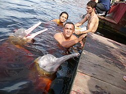
Amazon river dolphin

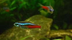
Fisheries are vital to the region, with species like the tambaqui playing a key role. Smaller, more aggressive fish such as piranhas (characins) are common, while the colorful neon tetra has become a staple in global aquariums.
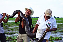
The green anaconda is the heaviest and one of the longest known extant snake species.

Human Presence and Exploration

Amazonas state
Amazonas state

Human settlement along the river ranges from indigenous communities, such as the Ticuna Indians, to major urban centers. Manaus, the largest city in the Amazonas state, serves as a critical hub for trade and transport, famously featuring the Amazon Theatre opera house built during the rubber boom of the late 19th century.
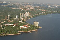
City of Manaus
City of Manaus

The river has long attracted explorers and naturalists. Notable figures include Alexander von Humboldt, Henry Walter Bates, and Alfred Russel Wallace, whose expeditions in the mid-19th century provided foundational knowledge of the region's biology and geography.
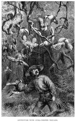
Henry Walter Bates was most famous for his expedition to the Amazon (1848–1859).

Frequently Asked Questions
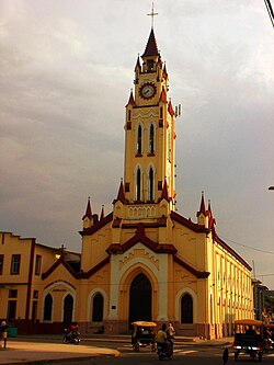
Iglesia Matriz in Iquitos, Peru
Manaus, the largest city in Amazonas, as seen from a NASA satellite image, surrounded by the dark Rio Negro and the muddy Amazon River
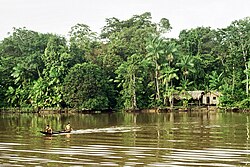
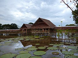
Floating houses in Leticia, Colombia
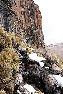
The Amazon was thought to originate from the Apacheta cliff in Arequipa at the Nevado Mismi, marked only by a wooden cross.
Marañón River in Peru
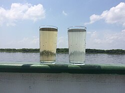
Water samples of the Solimões (right) and Rio Negro (left)
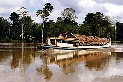
River taxi in Peru
River taxi in Peru
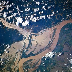
NASA satellite image of a flooded portion of the river
ภาพประกอบบทความ
ภาพประกอบจากบทความต้นฉบับ
ภาพประกอบบทความ
ภาพประกอบจากบทความต้นฉบับ
ภาพประกอบบทความ
ภาพประกอบจากบทความต้นฉบับ
ภาพประกอบบทความ
ภาพประกอบจากบทความต้นฉบับ
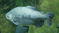
The tambaqui, an important species in Amazonian fisheries, breeds in the Amazon River.
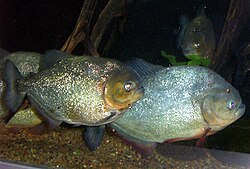
Characins, such as the piranha species, are prey for the giant otter, but these aggressive fish may also pose a danger to humans, although this is rare.
The neon tetra is one of the most popular aquarium fish.
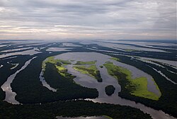
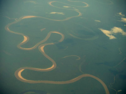
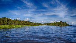
Aerial view of an Amazon tributary

Where does the Amazon River start?

The river originates in the Peruvian Andes at Mismi Peak, specifically starting with the Apurímac River at an elevation of 5,220 meters.

Which is the largest tributary of the Amazon?

The Madeira River is the largest tributary, contributing the highest volume of water (approximately 14.1% of the total discharge) to the main stem.

Why do the Rio Negro and Rio Solimões not mix immediately?

The two rivers have different water temperatures, flow speeds, and densities (the Rio Negro is dark and acidic, while the Solimões is sandy and sediment-heavy), which prevents them from mixing instantly at their confluence.

How long is the Amazon River?

The Amazon River is approximately 6,575 kilometers (4,086 miles) long, though this measurement is sometimes subject to scientific dispute depending on the identified source.

What are some of the most iconic animals found in the river?

Iconic species include the Amazon river dolphin, the green anaconda, the arapaima, and various species of piranhas and tetras.

References

  1. Confluence of Marañón and Ucayali rivers to mouth 3,750 km (2,330 mi).[1][2][3] Amazon–UcayaliTamboEnéApurímac–Hornillos 6,575 km (4,086 mi)[4]
  2. Entire Amazon–Tocantins basin (6,743,000–7,050,000 km2 (2,603,000–2,722,000 mi2).[9][10][11][5] Amazon without Tocantins 5,956,000–6,112,000 km2 (2,300,000–2,360,000 mi2)[12][13][10]
  3. Amazon without Tocantins 206,000–215,000 m3/s (7,300,000–7,600,000 cu ft/s) and 209,000 m³/s (1973–1990);[12][10][18] The Rio Pará is a tidally influenced estuary south of the Amazon River and Marajó Island. From the mouth of the Anapu River and the Furo do Tajapuru Channel (Amazon branch) to the Atlantic Ocean, it is about 350 km long. From the mouth of the Tocantins River, it is called the Marajó Bay. The Rio Pará estuary receives a significant amount of water from the north through the Amazon River. Some scientists advocate classifying it as part of the Amazon basin, since a significant amount of water (on average 6,000 m³/s) enters the system from the Amazon.[12] If Amazon with Rio Pará considered as a water system, the catchment area is 6,925,674 km²,[8] the total discharge averages at Amazon Delta 223,700 m³/s (or 220,800 m³/s for the period 1973–1990; 230,000 m³/s for the period 2003–2015).[9][19][20][18][10][21][22][23][24][25]
  4. (Period: 1903–2023) 165,829.6 m3/s (5,856,220 cu ft/s)[27] (Period: 1971–2000) 173,272.6 m3/s (6,119,060 cu ft/s)[11] (Period: 1928–1996) 176,177 m3/s (6,221,600 cu ft/s)[28] (Period: 1997–2015) 178,193.9 m3/s (6,292,860 cu ft/s)[29]
  5. The Nile is usually said to be the longest river in the world, with a length of about 6,650 km (4,130 mi),[32] and the Amazon the second longest river in the world, with a length of at least 6,400 km (4,000 mi).[5] In 2007 and 2008, some scientists claimed that the Amazon has a length of 6,992 km (4,345 mi) and was longer than the Nile, whose length was calculated as 6,853 km (4,258 mi).[33][34] A peer-reviewed article, published in 2009, states a length of 7,088 km (4,404 mi) for the Nile and 6,575 km (4,086 mi) for the Amazon, measured by using a combination of satellite image analysis and field investigations to the source regions.[4] According to the Encyclopædia Britannica, as of 2020, the length of the Amazon remains open to interpretation and continued debate.[5][35]