A82 Road: Scotland's Scenic Lifeline from Glasgow to Inverness
The A82 is one of Scotland's most iconic thoroughfares, stretching 167 miles (269 km) from the urban heart of Glasgow to the Highlands of Inverness. While it is the second longest A-road in Scotland, it is widely regarded as the more scenic alternative to the A9. More than just a transport link, the A82 has been described by former Scottish Transport Minister Keith Brown as a "vital economic and social lifeline."
The road's history is a tapestry of military strategy and civil engineering. Its foundations lie in the 18th-century military roads built by General George Wade and Major William Caulfeild, later refined by the legendary engineer Thomas Telford in the 19th century. Today, the route blends these historic alignments with modern improvements from the 1920s and 30s, creating a journey that traverses some of the most dramatic landscapes in the United Kingdom.
Key Facts
- Total Length: 167 miles (269 km).
- Primary Route: Connects Glasgow in the south to Inverness in the north.
- Historical Origins: Based on 18th-century military roads and 19th-century Telford designs.
- Key Landmarks: Passes through Glencoe, along Loch Lomond, and the shores of Loch Ness.
- Management: Primarily managed by Transport Scotland as the "Dalnottar – Inverness Trunk Road."
Route Breakdown: From City to Highlands
Glasgow to Alexandria
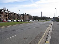
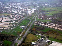
The journey begins at St George's Cross in central Glasgow. The first leg follows the Great Western Road, a route originally established as a turnpike road in 1816. This section is noted for its architectural beauty, passing the 1867 Great Western Terrace designed by Alexander "Greek" Thomson. The road transitions into a high-quality dual carriageway through Dumbarton before bypassing Alexandria and Bonhill.
Alexandria to Crianlarich
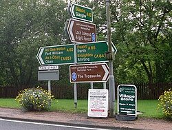
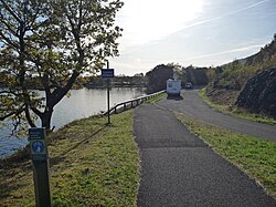
Entering the Loch Lomond and The Trossachs National Park, the A82 follows the western shores of Loch Lomond. Much of this section was upgraded to a high-quality single carriageway in the 1980s at a cost of approximately £24 million. The route passes through Luss—which was bypassed between 1990 and 1992—and continues through the glacial valley of Glen Falloch toward Crianlarich, where a new bypass was completed in 2015.
Crianlarich to Fort William
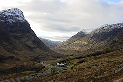
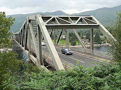
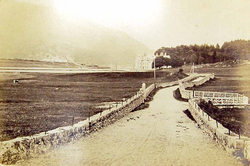
As the road pushes further north, it traverses the rugged terrain of Glencoe and the south shore of Loch Leven. A pivotal point in the journey is the Ballachulish Bridge. Opened in December 1975, this asymmetrical N-truss bridge replaced a ferry service that had previously been the only way to cross the mouth of the loch, saving travelers a 16-mile round trip.
Fort William to Inverness
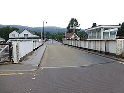
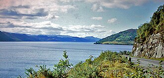
The final stretch takes the traveler past the Bridge of Oich and through Fort Augustus, where the road crosses the Caledonian Canal via a swing bridge. The last 36 miles (58 km) follow Thomas Telford's 1805 alignment along the western shore of Loch Ness. This section was specifically designed to connect local communities, unlike the earlier military roads. Notable landmarks here include Urquhart Castle and a memorial to water speed record attempt John Cobb.
Engineering and Historical Evolution
The A82 has undergone significant transformations to meet modern demands. In the 1920s and 30s, major diversions were created across Rannoch Moor and around Loch Leven. The latter was a response to the development of aluminium works at Kinlochleven and the construction of the Blackwater Dam in 1907, which necessitated an all-day route to replace the restricted ferry service.
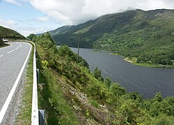
While the road is celebrated for its beauty, it has faced scrutiny regarding safety. Various studies have highlighted the dangers of certain sections, particularly between Tarbet and Tyndrum. This has led to the formation of the A82 Partnership, a campaign group urging the Scottish Government to prioritize ongoing safety and functional improvements.

Route Summary Table
| Section/Junction | Key Feature/Destination | Historical/Technical Note |
|---|---|---|
| Glasgow | St George's Cross / M8 | Starting point; Great Western Road |
| Dumbarton | A898 Junction | Transition to high-quality dual carriageway |
| Loch Lomond | Luss / Ardlui | National Park entry; 1980s widening |
| Crianlarich | A85 Junction | Bypass completed in 2015 |
| Ballachulish | A828 Junction | Asymmetrical N-truss bridge (1975) |
| Fort William | A830 Junction | Gateway to the West Highlands |
| Fort Augustus | Caledonian Canal | Swing bridge crossing |
| Inverness | A9 Junction | Northern terminus |
Frequently Asked Questions
Is the A82 the longest road in Scotland?
No, the A82 is the second longest A-road in Scotland, following the A9.
Who were the primary engineers behind the A82?
The road's origins are linked to General George Wade and Major William Caulfeild in the 18th century, with the modern alignment largely based on the work of Thomas Telford in the 19th century.
Why was the Ballachulish Bridge built?
The bridge was constructed to replace a ferry service that was expensive and closed nightly between 8 p.m. and 8 a.m., thereby providing a continuous through-route and saving a 16-mile detour.
Which section of the A82 is considered the most scenic?
While the entire route is praised for its beauty, the sections passing through Glencoe and along the western shore of Loch Ness are particularly renowned for their dramatic landscapes.
Who is responsible for maintaining the A82?
The majority of the route (the Dalnottar – Inverness Trunk Road) is managed by Transport Scotland, while the section from Glasgow to Dalnottar is the responsibility of Glasgow City Council and West Dunbartonshire Council.