Whitkirk History: From Anglo-Saxon Origins to Local Landmarks
Nestled within the landscape of Leeds, Whitkirk possesses a rich historical tapestry that stretches back to the early medieval period. From its linguistic roots to its connection with pioneering engineering, the area serves as a fascinating window into the evolution of Yorkshire's settlements.
The Origins of the White Church
The history of Whitkirk is inextricably linked to its ecclesiastical roots. The Domesday Survey of 1086—a comprehensive land survey commissioned by William the Conqueror—records a church belonging to the manor of Gipton and Colton. Given that Whitkirk is the only known medieval church in this specific area of Leeds, historians believe this record refers to an earlier building that preceded the current Whitkirk church.
This evidence suggests the presence of a late Anglo-Saxon church on the site, establishing the area as a center of spiritual and community life long before the Norman Conquest.
Etymology and Early Records
The first explicit mention of the settlement appears in the Early Yorkshire Charters between 1154 and 1166. At the time, it was referred to as Witechirche, an Old English term meaning "white church." Over time, the Old English word for church, "chirche," was replaced by the Old Norse equivalent, "kirkja," resulting in the modern name Whitkirk.
It is highly probable that the church acted as the primary catalyst for settlement activity, drawing residents to the area throughout the later medieval era.
Local Geography and Landmarks
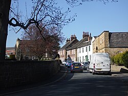
The physical layout of the area also tells a story of the natural environment. Hollyshaw Lane, which currently connects Whitkirk with Cross Gates, was originally known as "Allershaw." This name is a reference to the alder trees that once dominated the local landscape, a naming convention similar to that found in the nearby suburb of Chapel Allerton.
Historically, this lane served as a vital northern route, leading travelers from Whitkirk toward Seacroft.
A Connection to Engineering Excellence
Whitkirk is also the final resting place of John Smeaton, a world-renowned civil engineer. Born in the local parish of Austhorpe, Smeaton's contributions to engineering are immortalized by his burial in the Whitkirk churchyard, linking the village to global industrial progress.
Key Facts
- Earliest Record: A church is mentioned in the 1086 Domesday Survey.
- Meaning of Name: Derived from "Witechirche," meaning "white church."
- Linguistic Shift: The name evolved from Old English to include the Old Norse "kirkja."
- Historical Route: Hollyshaw Lane (formerly Allershaw) linked Whitkirk to Seacroft.
- Notable Figure: Civil engineer John Smeaton is buried in the churchyard.
| Period/Date | Event/Detail | Significance |
|---|---|---|
| 1086 | Domesday Survey record | Evidence of an early church in Gipton and Colton manor |
| 1154–1166 | Early Yorkshire Charters | First mention of "Witechirche" |
| Medieval Era | Settlement growth | Church serves as the focus of local activity |
| Post-Medieval | John Smeaton's burial | Connection to renowned civil engineering |
Frequently Asked Questions
What does the name Whitkirk mean?
The name originates from the Old English "Witechirche," which translates to "white church." The "kirk" portion of the name later came from the Old Norse word "kirkja."
Is there evidence of an Anglo-Saxon church in Whitkirk?
Yes. While the current church is newer, the 1086 Domesday Survey records a church in the manor of Gipton and Colton, suggesting a late Anglo-Saxon building existed on the site.
Who was John Smeaton and what is his link to Whitkirk?
John Smeaton was a famous civil engineer born in the parish of Austhorpe. He is buried in the Whitkirk churchyard.
What was Hollyshaw Lane originally called?
Hollyshaw Lane was formerly known as "Allershaw," a name referring to the alder trees that were common in the area.
Where did Hollyshaw Lane lead in the past?
The lane originally served as a route leading northwards from Whitkirk to Seacroft.