Timberland: A Geographic Profile of a Lincolnshire Fen Village
Nestled within the characteristic patchwork of fields that define the Lincolnshire Fens—a region of low-lying wetlands—lies the village of Timberland. This settlement is defined by its relationship with water, situated just south of the River Witham and historically linked to the Car Dyke, an ancient waterway that was once navigable before being drained via small canals to create fertile farmland.
The village serves as a quiet waypoint in the region, positioned 6 miles (10 km) west of Tattershall, 9 miles (14 km) north-east of Sleaford, and 5 miles (8 km) south-west of Woodhall Spa.
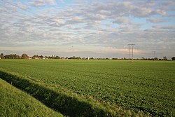
Key Facts
- Location: Situated in the wetlands of the Lincolnshire Fens, south of the River Witham.
- Waterways: Historically linked to the Car Dyke and bordered by Timberland Delph.
- Cultural Note: Home to Thorpe Tilney Hall, used as Longbourn Hall in the 1980 BBC production of Pride and Prejudice.
- Proximity: Located near the village of Martin and the Metheringham Airfield Visitor Centre.
Regional Geography and Landmarks
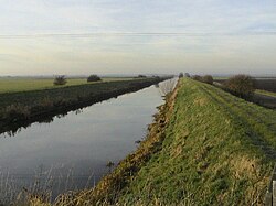
Timberland's landscape is a testament to human engineering in the Fens. The Car Dyke, once a navigable route, now exists as part of a drainage system that transformed the wetlands into productive agricultural land. This history is commemorated by a local illustrated signpost featuring a plaque dedicated to the waterway.
To the south-west lies Thorpe Tilney Hall, a site of cinematic interest known for its role as the ancestral home of the Bennet family in the 1980 BBC adaptation of Jane Austen's Pride and Prejudice.
Parish Boundaries and Connectivity
The parish of Timberland shares complex boundaries with several neighboring areas. To the south, the boundary with Walcott crosses the B1189 at Thorpe Tilney. Moving west, it meets Digby, and further north, it borders Scopwick, crossing the B1191 and following the Sleaford-Lincoln railway line.
The eastern boundary is defined by its proximity to Martin and the Metheringham Airfield Visitor Centre. Between Timberland and Martin, the boundary follows a section of the Car Dyke around Martin Wood and continues along Timberland Delph (a narrow drainage channel) to the north-east.
The parish is further divided into distinct areas: Timberland Dales, located at the River Witham where it meets East Lindsey and Woodhall Spa, and Thorpe Tilney Dales to the south, which borders Tattershall Thorpe.
Waterways and Drainage Systems
The boundary continues from the River Witham westward at Engine Drain, meeting Dogdyke. At the junction of Dales Head Dike, it meets Walcott and follows Walcott Delph and Walcott Bank across Thorpe Tilney Fen, briefly following the Car Dyke northwards toward Walcott.
| Nearby Location | Distance | Direction from Timberland |
|---|---|---|
| Tattershall | 6 miles (10 km) | East |
| Woodhall Spa | 5 miles (8 km) | North-east |
| Sleaford | 9 miles (14 km) | South-west |
Frequently Asked Questions
What is the Car Dyke?
The Car Dyke is a waterway near Timberland that was once navigable but was later drained using small canals to make the surrounding Fenland suitable for farming.
Which famous TV show was filmed at Thorpe Tilney Hall?
Thorpe Tilney Hall served as the setting for Longbourn Hall in the BBC's 1980 production of Pride and Prejudice.
What are the 'Dales' in the Timberland parish?
The parish includes two specific areas known as Timberland Dales and Thorpe Tilney Dales, located near the River Witham.
Which railway line forms part of the parish boundary?
The Sleaford-Lincoln railway line forms part of the boundary where the parish meets Scopwick to the north.
Where is Timberland located in relation to the River Witham?
Timberland is situated just south of the River Witham within the wetlands of the Lincolnshire Fens.