Tanggula Town: A High-Altitude Exclave of Qinghai Province
Located in the southwestern corner of Qinghai province, Tanggula Town is a vast administrative unit covering 47,540 square kilometres (18,360 sq mi). This remote region is characterized by its extreme elevation and unique political geography. Because the western "panhandle" of Yushu Prefecture separates it from the rest of Haixi Prefecture, Tanggula Town exists as an exclave—a portion of territory geographically separated from the main part by surrounding land—of both Golmud City and the Haixi Mongol and Tibetan Autonomous Prefecture.
While the town is roughly 500 kilometres (310 mi) from both the central city of Golmud and the town of Gyêgu (the seat of Yushu Prefecture), it maintains practical road and rail connections only with Golmud.
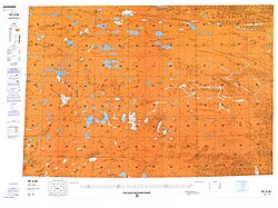
Geography and Natural Landmarks
The heart of the region is the Tanggula settlement, also known as Marquwo, Tuotuoheyan, or Togtogquwo. Sitting at an elevation of 4,535 metres (14,879 ft), the settlement is nestled within the central Tanggula Mountains.
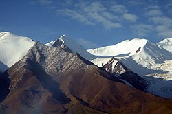
One of the most significant geographical features in the area is the Geladaindong Peak, which reaches a height of 6,621 metres (21,722 ft). This peak is of particular scientific and environmental importance due to its proximity to the source of the Tuotuo River, which serves as one of the primary headwaters of the Yangtze River. To protect these vital water sources, the area surrounding the peak is part of the Sanjiangyuan National Nature Reserve.
Infrastructure and Settlements
The main settlement is strategically located near the crossing of the highway and railway over the Tuotuo River and is served by the Togtogquwo railway station. Along the corridor formed by the Qinghai-Tibet Railway and China National Highway 109, several other small settlements exist, including:
- Tongtian Heyan ("Tongtian Riverside")
- Yanshiping
- Wenquan
- Tanggula Bingzhan ("Tanggula Military Post")
It is important to note a distinction regarding the Tanggula railway station. While the Tanggula Pass marks the southern border of the province, the station itself is located slightly south of the pass, placing it within the Tibet Autonomous Region rather than within Tanggula Town.
Demographics and Land Use
The landscape of Tanggula Town is dominated by mountains and open grasslands. Due to environmental protections, grazing is either prohibited or strictly regulated across much of the region's grasslands.
The area is sparsely populated. As of 2006, the registered population was 1,286, with current estimates placing the population at approximately 1,900. Administratively, the town is divided into eight village-level units, consisting of seven nomads' committees and one villagers' committee. Most residents are concentrated in small villages along the primary transport corridor connecting Golmud and Lhasa.
Key Facts
- Total Area: 47,540 square kilometres.
- Highest Point: Geladaindong Peak at 6,621 metres.
- Water Significance: Contains the source of the Tuotuo River, a headwater of the Yangtze.
- Administrative Status: An exclave of Golmud City and Haixi Prefecture.
- Climate Type: Alpine (Köppen ET).
- Population: Estimated at 1,900 residents.
Climate Analysis
Tanggula Town experiences an alpine climate (classified as Köppen ET), which is defined by long, frigid, and very dry winters and short, cool, damp summers. The region is characterized by extreme temperature swings and significant sunshine hours throughout the year.
| Metric | Winter (Jan) | Summer (Jul) | Annual Average/Total |
|---|---|---|---|
| Mean Daily Max Temp | −6.0°C (21.2°F) | 15.1°C (59.2°F) | 5.1°C (41.1°F) |
| Daily Mean Temp | −15.3°C (4.5°F) | 8.4°C (47.1°F) | −3.1°C (26.4°F) |
| Mean Daily Min Temp | −23.2°C (−9.8°F) | 2.9°C (37.2°F) | −9.9°C (14.2°F) |
| Average Precipitation | 1.5 mm (0.06 in) | 80.3 mm (3.16 in) | 313 mm (12.33 in) |
| Average Snowy Days | 7.1 days | 3.0 days | 94 days |
Frequently Asked Questions
What makes Tanggula Town an exclave?
Tanggula Town is an exclave because the western "panhandle" of Yushu Prefecture physically separates it from the rest of the Haixi Mongol and Tibetan Autonomous Prefecture, to which it administratively belongs.
Which major river originates in this region?
The Tuotuo River, which is one of the primary sources of the Yangtze River, originates near the Geladaindong Peak within the town's boundaries.
Is the Tanggula railway station located in Tanggula Town?
No. Although it is named after the area, the Tanggula railway station is located south of the Tanggula Pass, placing it within the Tibet Autonomous Region.
What is the climate like in Tanggulashan?
The region has an alpine climate characterized by very cold, dry winters and short, cool, moist summers, with annual average temperatures remaining below freezing (approximately −3.1°C).
How is the land used in Tanggula Town?
The land is primarily mountainous with open grasslands. Because of its ecological importance, grazing on these grasslands is either highly regulated or completely prohibited.