South East Dorset Suburban Roads
The South East Dorset conurbation—comprising the interconnected urban areas of Poole, Bournemouth, and Christchurch—is served by a network of key suburban roads. Rather than following straight lines, the A341, A347, A348, A349, A3049, and A3060 link together to form an asymmetrical ring road that encircles the built-up region, facilitating movement across the suburbs.
Key Facts
- The road network forms an asymmetrical ring road around the Poole, Bournemouth, and Christchurch area.
- The A341 serves as a primary east-west link across the north of Bournemouth and Poole.
- The A347 is a major north-south artery connecting Ferndown to Richmond Hill.
- The A348 and A349 provide critical access to the Fleetsbridge area in Poole.
- The A3060 connects the Redhill Roundabout to the A35 at the River Stour.
The A341: Northern East-West Link
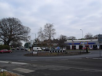
The A341 begins in the northwest of the conurbation at Merley. From there, it travels east via Queen Anne Drive at Gravel Hill, transitioning into Magna Road. The route continues through Bear Cross and Kinson before reaching its terminus at the Northbourne Roundabout.
The A347: North-South Connectivity
Starting in Ferndown, the A347 runs south along New Road through West Parley. Upon reaching the Northbourne Roundabout, it transitions onto Wimborne Road. The route then follows a complex path: turning into Whitelegg Way to skirt the northeast boundary of Northbourne, then heading south from the Redhill Roundabout via Redhill Avenue.
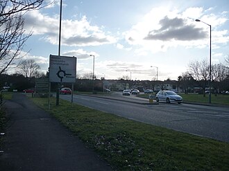
From the Ensbury Park junction, the A347 crosses onto Boundary Road toward the Boundary Roundabout at Bournemouth University. It then proceeds east along Talbot Avenue, crosses the Talbot Roundabout, and reaches the East Avenue Roundabout to rejoin Wimborne Road at South Winton. Finally, it turns south at Cemetery Junction and follows Wimborne Road to its end at the Richmond Hill Roundabout.
The A348 and A349: Access to Poole
The A348 begins at Trickett's Cross in Ferndown, traveling south along Ringwood Road toward Longham. It passes through the Bear Cross Roundabout and continues south toward Turbary Park, crossing the West Howe Roundabout. The route continues via Ringwood Road over the Mountbatten Roundabout at Knighton Heath and Wallisdown Road.
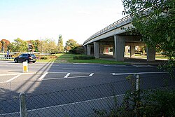
At the Alderney Roundabout, the route becomes the A3049 and turns onto Canford Way toward Canford Heath. From the Mannings Heath Roundabout, it turns south onto Dorset Way, passing Tower Park and its associated roundabout. The road then travels west, marking the border between Canford Heath and Oakdale, before crossing the Fleetsbridge gyratory—a large circular intersection—and terminating at the Upton Services at Holes Bay North Roundabout.
Complementing this is the A349, which begins at Oakley and travels south via Gravel Hill, passing through Broadstone, Creekmoor, and Waterloo before terminating at Fleetsbridge.
The A3060: Eastern Suburban Route
The A3060 starts at the Redhill Roundabout with a short section of Wimborne Road. It heads east along Castle Lane West, passing through the suburbs of Throop and Muscliff. After crossing the Broadway and Yeomans Way roundabouts, it enters Strouden Park and passes the Castlepoint Shopping Centre.
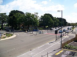
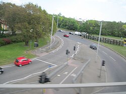
Continuing east past Townsend, the A3060 crosses the Cooper Dean Roundabout onto Castle Lane East, passing the Royal Bournemouth Hospital and Littledown. After the Riverside Avenue junction, the road terminates at the Iford Roundabout, where it meets the A35 road at the River Stour.
Route Summary Table
| Road | Start Point | End Point | Key Landmarks/Areas |
|---|---|---|---|
| A341 | Merley | Northbourne Roundabout | Bear Cross, Kinson |
| A347 | Ferndown | Richmond Hill Roundabout | West Parley, Bournemouth University |
| A348 | Trickett's Cross | Holes Bay North Roundabout | Knighton Heath, Tower Park, Fleetsbridge |
| A349 | Oakley | Fleetsbridge | Broadstone, Creekmoor |
| A3060 | Redhill Roundabout | Iford Roundabout | Castlepoint Shopping Centre, Royal Bournemouth Hospital |
Frequently Asked Questions
What is the general layout of the suburban roads in South East Dorset?
The roads (A341, A347, A348, A349, A3049, and A3060) do not follow a straight line but instead link together to form an asymmetrical ring road around the built-up area of Poole, Bournemouth, and Christchurch.
Where does the A341 road terminate?
The A341 road terminates at the Northbourne Roundabout after traveling east from Merley through Bear Cross and Kinson.
Which road provides access to the Castlepoint Shopping Centre?
The A3060 road provides access to the Castlepoint Shopping Centre as it passes through Strouden Park.
How does the A348 connect to the A3049?
The A348 route becomes the A3049 road at the Alderney Roundabout, where it turns onto Canford Way toward Canford Heath.
Where does the A3060 end?
The A3060 ends at the Iford Roundabout, where it meets the A35 road at the River Stour.