SODO Busway: History and Evolution of Seattle's Industrial Transit Corridor
The SODO Busway serves as a critical transit artery in Seattle, cutting through the city's industrial heart. Originally designed to streamline commuter travel and bypass freeway congestion, this dedicated corridor has evolved from a repurposed railway right-of-way into a multimodal transit hub that integrates bus and light rail services.
From Railways to Rapid Transit
The land currently occupied by the busway was historically used for industrial purposes and remains largely zoned for industry today. Long before buses arrived, the right-of-way was utilized by the Milwaukee Road and Union Pacific railroads to provide access to Union Station. Passenger services on these lines ended in 1961 for Milwaukee Road and 1971 for Union Pacific, though freight railway spurs continue to serve local industrial customers.
In the late 1980s, the Washington State Department of Transportation (WSDOT) undertook a $4.5 million project to transform this corridor. Developed as part of a broader set of improvements to Interstate 90, the project included significant bus infrastructure on the freeway. During its planning and construction phase, the project was known as the "E3 Busway," a name derived from the final selected design choice: Alternative E, Option 3.
Infrastructure and Operational Launch
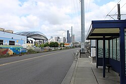
The busway was engineered for efficiency, featuring four strategic stops located at the intersections of South Spokane Street, South Lander Street, South Holgate Street, and South Royal Brougham Way. To further reduce delays, the roadway was equipped with transit signal priority—electronic sensors buried in the pavement that trigger traffic signals to favor approaching buses.
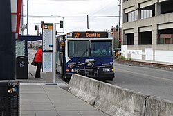
When the SODO Busway officially opened on December 8, 1991, it immediately improved commute times, saving passengers at least three minutes per trip, with even greater savings during peak traffic on Interstate 5. Initial ridership was robust, with King County Metro operating 350 daily trips for 10,000 passengers, while Pierce Transit express routes handled 43 daily trips for 1,500 passengers.
Integration with Sound Transit and Light Rail
The transit landscape of the corridor shifted in September 1999 when Sound Transit Express routes replaced the previous Pierce Transit express services. This transition further integrated the busway into the regional transit network.
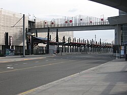
The most significant physical transformation began in November 2003 with the construction of the Central Link light rail line. This massive project required the relocation of utilities along the busway. By August 2005, the first rails were laid between Holgate and Lander. The construction of the SODO and Stadium stations was finalized in May 2006, and both opened to the public on July 18, 2009, creating a seamless connection between bus and rail.
Key Facts
- Opening Date: December 8, 1991.
- Construction Cost: $4.5 million.
- Original Name: E3 Busway.
- Key Technology: Buried electronic sensors for transit signal priority.
- Primary Stops: S. Spokane St, S. Lander St, S. Holgate St, and S. Royal Brougham Way.
- Rail Integration: SODO and Stadium light rail stations opened July 18, 2009.
| Transit Agency | Daily Trips | Daily Passengers |
|---|---|---|
| King County Metro | 350 | 10,000 |
| Pierce Transit | 43 | 1,500 |
Frequently Asked Questions
What was the SODO Busway before it became a transit corridor?
The right-of-way was originally used by the Milwaukee Road and Union Pacific railroads to access Union Station before passenger services were discontinued in 1961 and 1971, respectively.
Why was the busway called the "E3 Busway"?
The name was used during the planning and construction phase, referring to the specific design choice selected: Alternative E, Option 3.
How does the busway reduce travel times?
The busway provides a dedicated path that bypasses Interstate 5 traffic and utilizes buried electronic sensors to provide transit signal priority at intersections.
Which light rail stations are located along the busway?
The SODO and Stadium stations were constructed adjacent to the busway and opened on July 18, 2009.
Who funded and built the original busway?
The busway was built by the Washington State Department of Transportation in the late 1980s at a cost of $4.5 million as part of Interstate 90 improvements.