Slavonia: The Heart of Croatia's Fertile Plains
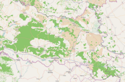
Slavonia is a storied historical region of Croatia, characterized by its vast, fertile plains, winding rivers, and a rich tapestry of cultural heritage. Stretching across the eastern part of the country, it serves as a vital agricultural hub and a crossroads of Central European history. From the ancient settlements of the Vučedol culture to the modern urban center of Osijek, Slavonia blends natural beauty with a resilient human spirit.
The region is defined by its unique landscape, where the rolling hills of the Papuk and Psunj mountains meet the expansive lowlands. This geography has not only shaped the economy but has also influenced the strategic importance of the region throughout the centuries.
Key Facts
- Largest City: Osijek serves as the primary urban and economic center.
- Total Area: Approximately 12,556 square kilometers.
- Population: 665,858 (as of 2021).
- Major Rivers: The Drava, Sava, and Danube define the region's borders and transport.
- Heraldic Symbol: The marten, depicted on the regional coat of arms.
Geography and Natural Landscape
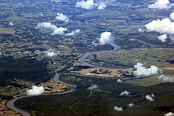
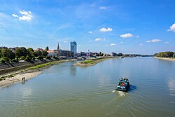
Slavonia's physical geography is dominated by the Pannonian Plain, making it one of the most productive agricultural zones in Croatia. The region is bordered by three major rivers: the Sava to the south, which forms a natural border with Bosnia and Herzegovina, the Drava to the north, and the Danube to the east.
While much of the region is flat, several mountain ranges provide topographical variety. The highest peaks include Brezovo Polje on Mount Psunj (984 m) and the peaks of Papuk (953 m), which is the second highest mountain in Slavonia.
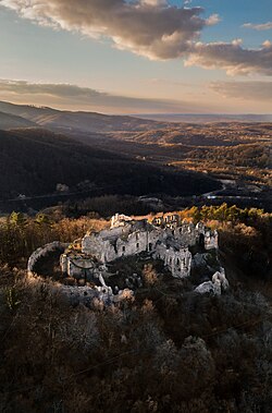
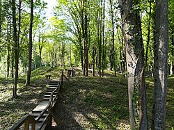
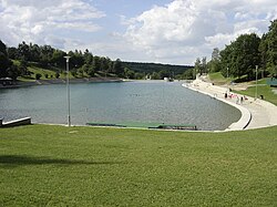
The region is also home to significant natural landmarks, such as the Spačva forest—the largest complete common oak forest in Croatia—and the serene Orahovac Lake.
Political and Administrative Structure
Administratively, Slavonia is divided into five distinct counties, each with its own seat and economic focus. The Osijek-Baranja County is the most populous, while the others contribute to the region's diverse industrial and agricultural output.
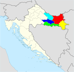
| County | Seat | Area (km²) | Population |
|---|---|---|---|
| Brod-Posavina | Slavonski Brod | 2,043 | 130,782 |
| Osijek-Baranja | Osijek | 4,152 | 259,481 |
| Požega-Slavonia | Požega | 1,845 | 64,420 |
| Virovitica-Podravina | Virovitica | 2,068 | 70,660 |
| Vukovar-Syrmia | Vukovar | 2,448 | 144,438 |
History and Cultural Heritage
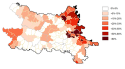
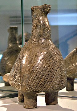
The history of Slavonia is a chronicle of migration and conquest. In prehistory, the region was home to the Vučedol culture, an advanced Copper Age civilization known for its sophisticated pottery and urban planning.
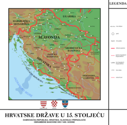
During the Middle Ages, Slavonia evolved into a significant political entity. However, the region later faced the Ottoman conquest, leading to periods of conflict and revolt, such as the uprising led by Luka Ibrišimović in Požega.
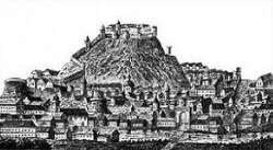
![Luka Ibrišimović led a revolt against Ottomans in Požega.[23]](/images/79/4d/794d6308e4ec40924197e64ac8ed2d271477af8a758f4a619208a5cfb7b527f6.jpg)
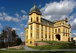
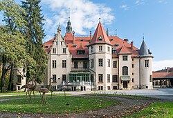
Following the retreat of the Ottomans, the region came under the influence of the Habsburg Monarchy and later Austria-Hungary. This era left a lasting architectural mark, seen in the numerous castles and manors scattered across the landscape, including the Pejačević Castle in Našice and the Mailáth Castle in Donji Miholjac.
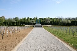
The 20th century brought significant turmoil, including the era of the Kingdom of Yugoslavia, World War II, and the subsequent Federal Yugoslavia. The region was heavily impacted during the Croatian War of Independence, with the city of Vukovar becoming a poignant symbol of the struggle, commemorated today at the Vukovar memorial cemetery.
Economy, Transport, and Infrastructure

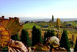
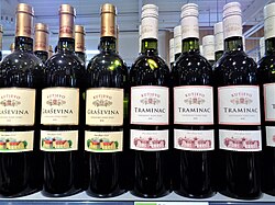
Slavonia's economy is deeply rooted in agriculture and industry. The region is world-renowned for its viticulture, particularly in Kutjevo, where dry white wines like Graševina (Welshriesling) and Gewürztraminer (Traminac) are produced.
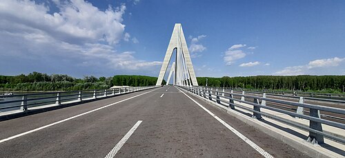
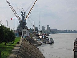
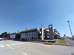
Transport infrastructure is critical for the region's connectivity. The Osijek cable-stayed Drava Highway Bridge stands as the longest bridge in Croatia, surpassing the Pelješac bridge by 81 meters. The Port of Vukovar on the Danube and the Osijek Airport further facilitate trade and travel.
Culture and Landmarks
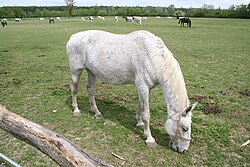
The cultural identity of Slavonia is expressed through its architecture and traditions. The Cathedral of St. Peter in Đakovo remains one of the most distinctive symbols of the region, while the State Stud Farm Đakovo preserves a long tradition of horse breeding.
![Cathedral of St. Peter in Đakovo, a distinctive symbol of Slavonia[38]](/images/b9/bc/b9bc975a4f6ebac1057252df664dc993cb5c2bbf268a775c1eff7101ed1d5618.jpg)
The region's heraldry is equally symbolic; the marten, running on a red field between two wavy white lines on a blue background with a star, represents the historical coat of arms of Slavonia.

Frequently Asked Questions
![Erdut Castle, 15th-century fortification near Erdut[167]](/images/09/6d/096dfcd5e4343f9cc1bbb19c628ed1c2b3cb9661a1ee9b752a733da4be9f2dd2.jpg)
What is the largest city in Slavonia?
Osijek is the largest city in the region, serving as its primary administrative, economic, and cultural hub.
Which rivers border the Slavonia region?
Slavonia is bordered by the Drava River to the north, the Sava River to the south, and the Danube River to the east.
What is the significance of the Vučedol culture?
The Vučedol culture was a prehistoric Copper Age civilization that established one of the most important early urban settlements in the region.
What is the heraldic symbol of Slavonia?
The marten is the heraldic symbol of Slavonia, appearing on the region's historical coat of arms.
Which mountain is the second highest in Slavonia?
Papuk is the second highest mountain in the region, with its peak reaching 953 meters.