Seoul Districts: A Comprehensive Overview of the South Korean Capital
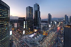
Seoul, the vibrant capital of South Korea, is a massive metropolis organized into a sophisticated administrative structure. To manage its vast population and complex urban landscape, the city is divided into 25 gu (districts). These districts function similarly to the boroughs of New York or the special wards of Tokyo, each possessing its own local government, legislative council, and mayor.
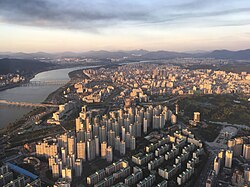
The city is geographically split by the Han River, with fourteen districts located to the north and eleven to the south. This division shapes much of the city's character, from the historic administrative cores in the north to the rapidly developed, affluent areas in the south.
![Building of the Seoul Metropolitan Council[2]](/images/76/c2/76c26563056bddcc25caf1daf332ef1cf99d1b53d4548a510493b0eac04a83eb.jpg)
Key Facts
- Total Districts: 25 gu
- Total Subdivisions: 467 dong (neighborhoods)
- Largest District by Population: Songpa-gu
- Largest District by Area: Seocho-gu
- Total Area: 605.21 km²
- Total Population (2023): 9,659,322
Administrative Structure and Governance
The governance of Seoul is split between two primary bodies: the executive and the legislative branches. The Seoul Metropolitan Government serves as the executive branch, led by the Mayor of Seoul. The Mayor holds a privileged position, reporting city affairs directly to the Prime Minister during cabinet meetings.
![Seoul City Hall serves as the headquarters for the Seoul Metropolitan Government[8]](/images/fc/45/fc4569d19ca2e834e609c12b698355d7fabc87b1911ec3524f7ac4bbf53685a4.jpg)
The Seoul Metropolitan Council
The Seoul Metropolitan Council is the legislative body responsible for overseeing the 25 districts. Council members are elected every four years through a mix of district-specific representation and proportional representation. The council holds significant power, including the ability to:
- Enact, amend, and repeal local ordinances.
- Examine and approve city budgets and final accounts.
- Manage local taxes, fees, and public property.
- Address resident petitions and public concerns.
To ensure specialized oversight, the council utilizes standing committees for areas such as public safety, housing, and transportation, alongside special committees for urgent or ethical matters.
Local Neighborhoods: The Dong
Each district is further subdivided into dong, or neighborhoods. These subdivisions provide direct services to residents. While some districts contain only a few dong, others, such as Jongno District, are composed of a very large number of distinct neighborhoods. In total, these legal-status subdivisions number 467 across the city.
A Journey Through the Districts
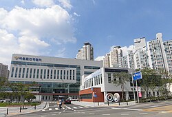
Seoul's districts offer a diverse range of experiences, from historic landmarks to modern commercial hubs.
The Historic and Cultural Core
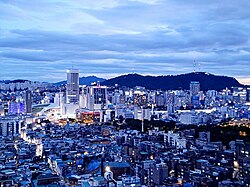
Jongno-gu and Jung-gu form the heart of the city. These districts house essential government buildings, historic palaces, and major landmarks like the N Seoul Tower. Jongno is also home to the famous fashion markets of Dongdaemun.
International and Academic Hubs
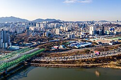
Yongsan-gu, located just south of the central area but north of the Han River, is renowned for the international atmosphere of Itaewon and serves as a major hub for foreign embassies. For students and youth culture, Seodaemun-gu and Mapo-gu are essential destinations, hosting prestigious institutions like Yonsei and Sogang Universities, as well as the vibrant nightlife of Hongdae.
Residential and Natural Landscapes
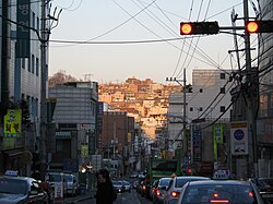
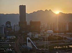
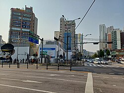
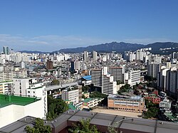
The northern reaches of the city, including Eunpyeong-gu, Dobong-gu, and Nowon-gu, are bordered by the Suraksan and Bukhansan mountains. These areas provide a blend of residential living and easy access to Bukhansan National Park. Meanwhile, districts like Seongbuk-gu and Jungnang-gu offer a unique mix of traditional neighborhoods and modern infrastructure.
Historical Evolution of Seoul's Boundaries
Seoul's administrative map has changed dramatically since the era of national independence in 1945. At that time, the city consisted of only 8 districts and 268 neighborhoods. Rapid urbanization and population growth necessitated constant expansion.
Significant milestones in Seoul's growth include:
- 1949: The city's limits expanded to roughly 268 km².
- 1963: Seoul annexed five counties and 84 ri-districts, increasing its area to 595.50 km².
- 1973: The incorporation of additional territory from Goyang-gun raised the area to 605.33 km², and Gwanak-gu and Dobong-gu were established.
- 1975: The creation of Gangnam-gu marked the pivotal expansion of the city south of the Han River.
- 1988: A major restructuring occurred to prepare for the Summer Olympics, establishing districts like Songpa-gu and Seocho-gu.
- 1995: The final major reorganization added Gangbuk-gu, Geumcheon-gu, and Gwangjin-gu, bringing the total to the current 25 districts.
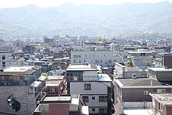
Summary of District Statistics (2014 Data)
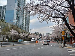
| District Name | Korean Name | Population | Area (km²) | Density (per km²) |
|---|---|---|---|---|
| Gangnam District | 강남구 | 583,446 | 39.50 | 14,771 |
| Jongno District | 종로구 | 165,344 | 23.91 | 6,915 |
| Songpa District | 송파구 | 671,794 | 33.88 | 19,829 |
| Seocho District | 서초구 | 454,288 | 47.00 | 9,666 |
| Yongsan District | 용산구 | 249,914 | 21.87 | 11,427 |
Frequently Asked Questions


What is the difference between a gu and a dong?
A gu is a large administrative district (similar to a borough), while a dong is a smaller neighborhood subdivision within that district.
Which district is the largest in Seoul?
Seocho District holds the largest land area, covering approximately 47 km².
Which district has the most people?
Songpa District is the most populous district in Seoul.
How many districts are in Seoul?
There are currently 25 districts (gu) that make up the Seoul Special Metropolitan City.
Who governs the city of Seoul?
The city is governed by the Seoul Metropolitan Government (executive branch) and the Seoul Metropolitan Council (legislative branch).