SardiniaNuragic civilizationSardinian historyCagliariMediterranean islands

Sardinia: A Journey Through Mediterranean History, Culture, and Landscapes

Sardinia: A Journey Through Mediterranean History, Culture, and Landscapes Located in the heart of the Mediterranean, Sardinia (known locally as Sardegna) is an autonomous region of Italy...

Sardinia: A Journey Through Mediterranean History, Culture, and Landscapes

Located in the heart of the Mediterranean, Sardinia (known locally as Sardegna) is an autonomous region of Italy that offers a profound connection to the ancient past. With a total area of 24,100.02 km², this island is a mosaic of rugged mountains, rolling hills, and diverse linguistic traditions. From the mysterious megalithic structures of the Nuragic civilization to the vibrant modern economy driven by tourism, Sardinia remains one of Europe's most unique cultural landscapes.
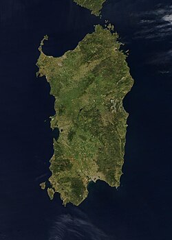
Satellite image of Sardinia, acquired on 27 April 2003 by NASA's Aqua MODIS instrument

Key Facts

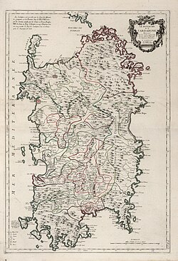
Map of Sardinia, 1779
  • Capital: Cagliari
  • Population: Approximately 1,554,490 (2026 estimate)
  • Languages: Italian and Sardinian (with minority languages including Sassarese, Gallurese, Ligurian, and Catalan)
  • GDP (2024): €43.468 billion
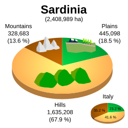
  • Topography: 67.9% hilly, 18.5% flat, and 13.6% mountainous
  • Administrative Status: Autonomous Region of Italy

A Deep Historical Tapestry
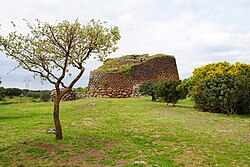
Nuraghe Losa
Nuraghe Losa

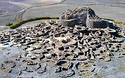
The history of Sardinia is defined by successive waves of civilization, each leaving an indelible mark on the island's identity. The Nuragic civilization, an ancient culture known for its sophisticated stone structures, laid the foundational heritage of the island.
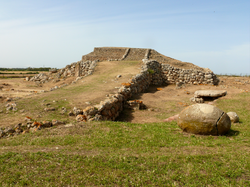
The prehistoric megalithic temple of Monte d'Accoddi

Prehistory and Ancient Civilizations

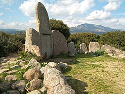
Archaeological sites such as the prehistoric megalithic temple of Monte d'Accoddi and the various Nuraghi—complex stone edifices—showcase the advanced engineering of early inhabitants. The island's landscape is dotted with menhirs, such as the 5.75-meter-high Monte Corru Tundu Menhir, and "Giants' graves," which served as significant funerary sites during the Bronze Age.
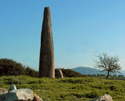
Monte Corru Tundu Menhir in Villa Sant'Antonio (5.75 meters high)
Giants' grave in Dorgali (Bronze Age)

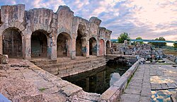
Following the prehistoric eras, Sardinia was influenced by various Mediterranean powers. The Phoenicians and Romans established significant settlements, such as the town of Tharros, while later periods saw the influence of the Vandals, Byzantines, and eventually the Aragonese and Spanish empires. These eras shaped the island's architecture, from Roman thermae (public baths) to medieval basilicas and Byzantine churches.
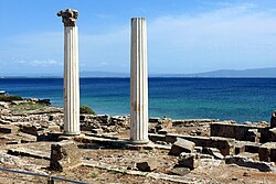
The Phoenician and subsequently Roman town of Tharros
Roman thermae of Forum Traiani, in what is now Fordongianus
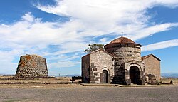
Santa Sabina Byzantine church and nuraghe in Silanus
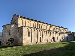
The medieval Basilica of San Gavino in Porto Torres

The Middle Ages and the Judicates

During the Byzantine era, the rise of the Judicates—independent kingdoms—marked a distinct period in Sardinian political history. This was followed by centuries of shifting allegiances involving the Republic of Sassari and various Spanish influences, which can still be seen in the coastal towers and historical monuments across the island.
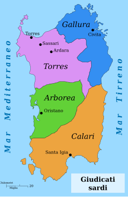
The Sardinian Judicates
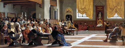
The proclamation of the Republic of Sassari. The Sassarese republic lasted from 1272 until 1323, when it sided with the new born Kingdom of Sardinia.
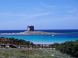
Spanish era coastal tower in Stintino called Torre della Pelosa

Geography and Natural Wonders

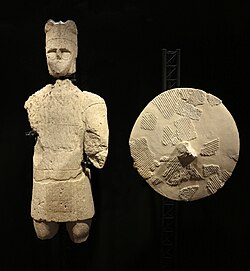
One of the so-called Giants of Mont'e Prama

Sardinia's geography is remarkably varied. While much of the island is composed of hills, the Gennargentu massif stands as the highest point, providing a dramatic contrast to the coastal regions. The island's climate varies significantly depending on elevation and location, ranging from the coastal warmth of Cagliari to the cooler, more temperate conditions of mountainous areas like Fonni.
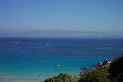
Strait of Bonifacio. The southern coast of Corsica can be seen from Santa Teresa Gallura.
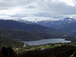
View of Gennargentu, the highest massif of Sardinia
A proportionate graph of Sardinian topography: 13.6% of the island is mountainous, 18.5% is flat, and 67.9% is hilly.

Flora, Fauna, and Protected Parks

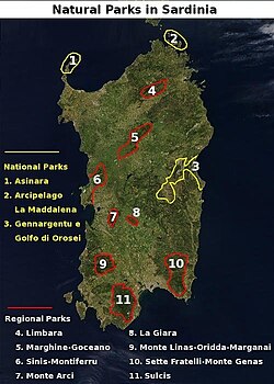
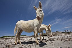
The island is home to diverse ecosystems, protected by three national parks and ten regional parks. These reserves safeguard unique species, such as the Giara horses, the Albino donkeys of Asinara, and the Sardinian feral cat. The Sulcis Regional Park, for instance, contains the largest Mediterranean evergreen forest in the Mediterranean Basin.
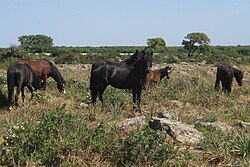
Giara horses
Giara horses
Albino donkeys in Asinara
The Sardinian feral cat, long considered a subspecies of the African wildcat, are descended from domesticated cats.[134]
National and regional parks of Sardinia
Sulcis Regional Park, the largest Mediterranean evergreen forest in the Mediterranean Basin.[144]

Modern Economy and Culture

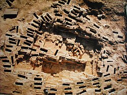
Necropolis of Tuvixeddu, Cagliari

Today, Sardinia's economy is a blend of traditional sectors and modern industries. While agriculture, fishing, and farming remain important, the tertiary sector—encompassing tourism, services, and finance—is a major driver of growth. Luxury tourism, particularly in areas like the Costa Smeralda, has been a significant source of income since the 1960s.
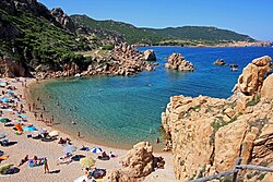
Tourism in Sardinia is one of the fastest growing sectors of the regional economy.
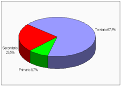
Percentage distribution of employees in different economic sectors in Sardinia: 8.7% the primary sector (fishing, agriculture, farming), 23.5% the secondary sector (industry, machinery, manufacturing), and 67.8% the tertiary sector (tourism, services, finance)
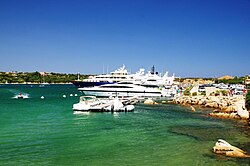
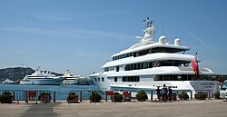
Yachts in Porto Cervo. Luxury tourism has been an important source of income in Sardinia since the 1960s.

Linguistic and Culinary Heritage

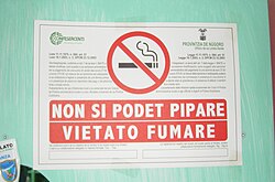
Culture in Sardinia is expressed through its unique languages and traditions. The Sardinian language remains a vital part of the identity, often appearing alongside Italian in daily life. This cultural richness extends to the cuisine, which features a wide array of traditional cakes, pastries, and local dishes that reflect the island's agricultural roots.
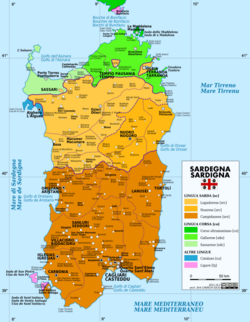
Linguistic map of Sardinia
A 'no smoking' sign in both Sardinian and Italian
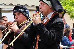
Launeddas players
Launeddas players
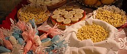
A range of different cakes, pastries, meals, dishes and sweets which are common elements of Sardinian cuisine
Summary of Sardinian Economic Sectors (2011 Data)
Economic Activity GDP (mil. €) % of Sector
Agriculture, farming, fishing 908 3%
Industry 2,828 9.4%
Constructions 1,722 5.7%
Commerce, hotels, transport, services 7,597 25.4%
Financial activity and real estate 8,011 26.7%
Other service-related activities 8,896 29.7%

Frequently Asked Questions
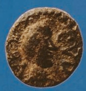
A Vandal-period coin found in Sardinia depicting Godas. Latin legend: REX CVDA.
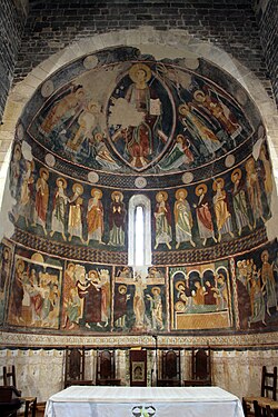
12th-century frescoes in the Basilica di Saccargia in Codrongianos
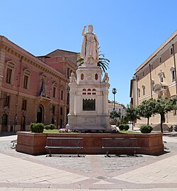
Statue of the Juighissa Eleanor of Arborea in Oristano by Ulisse Cambi
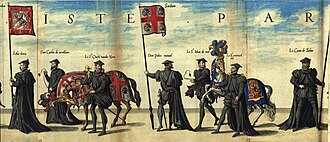
Flag of the Kingdom of Sardinia (center) at the funeral of Charles I of Spain
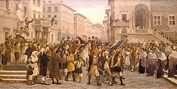
G.M. Angioy entry into Sassari
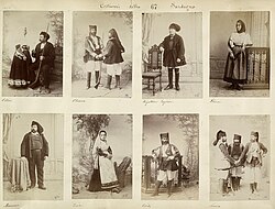
Sardinians wearing traditional ethnic garments, 1880s
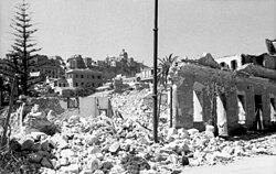
Effect of Allied bombing on Cagliari during the Second World War
Super yachts anchored at Porto Cervo port, Costa Smeralda
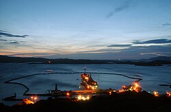
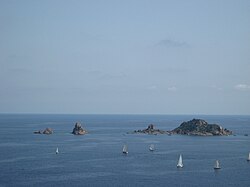
Santo Stefano's former NATO naval base
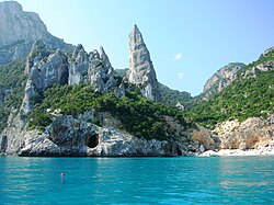
Cala Goloritzé, Baunei
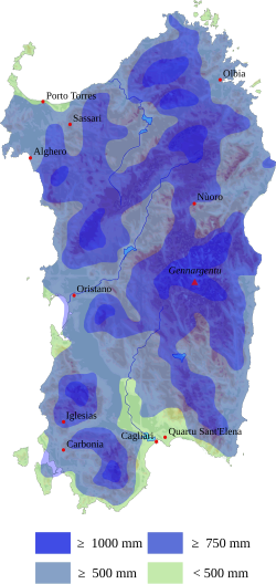
Sardinia average rainfalls
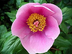
Paeonia mascula
Paeonia mascula
Main building of the University of Sassari (which started the university courses in 1562)
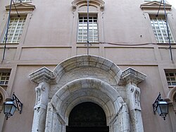
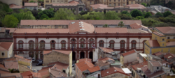
Portal of the Main Building of the University of Cagliari
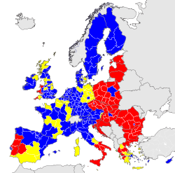
Economic classification of European regions according to Eurostat Less developed regions Transition regions More developed regions
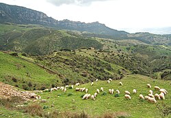
Sheep grazing around Lula, Nuoro
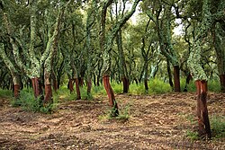
Peeled trunks of cork oaks in Tempio Pausania
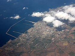
Petrochemical and Green Chemical industries in Porto Torres
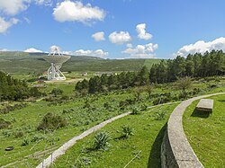
Sardinia Radio Telescope
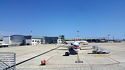
Cagliari-Elmas Airport. The 12th busiest airport in Italy in 2025
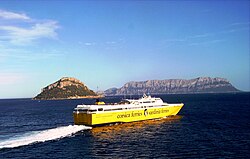
A high-speed ferry in the Gulf of Olbia
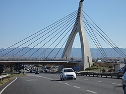
Cable-stayed bridge of the Monserrato University Campus interchange SS 554
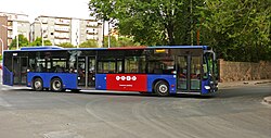
A bus of Sardinia public transport authorities (Arst) in Sassari
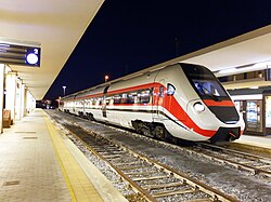
ATR 365 owned by the Autonomous Region of Sardinia in Cagliari
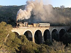
Tourist railway between Aritzo and Belvì
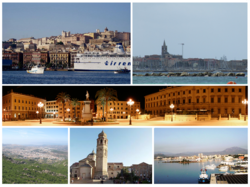
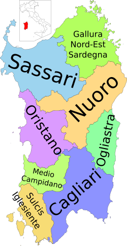
Cagliari, Alghero, Sassari, Nuoro, Oristano, Olbia
Provinces of Sardinia
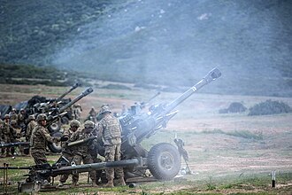
US Artillery Live Fire Exercise in Capo Teulada 2015 during NATO exercise Trident Juncture
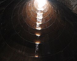
Santa Cristina holy well of Paulilatino, tholos
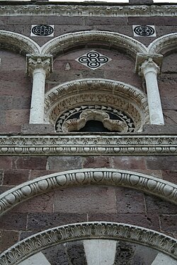
Facade of Nostra Signora di Tergu (SS)
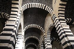
Interior of San Pietro di Sorres, Borutta (SS)
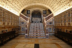
Crypt of the Cagliari Cathedral
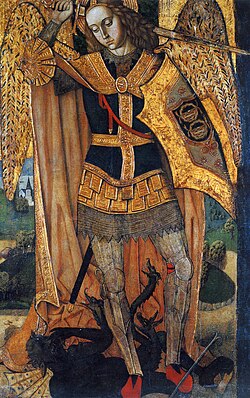
Archangel Michael by the Master of Castelsardo
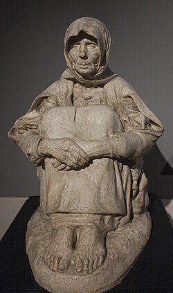
La madre dell'ucciso ("the mother of the killed") by Francesco Ciusa (1907)
Su Nuraxi, Barumini
Su Nuraxi, Barumini
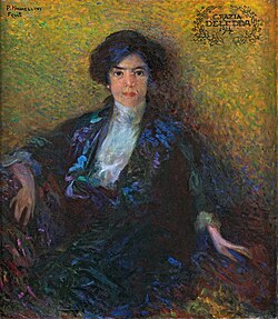
Portrait of Grazia Deledda by Plinio Nomellini, 1914
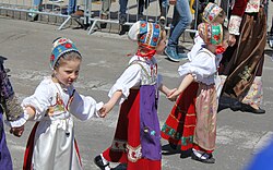
Costume from Ovodda
Costume from Ovodda
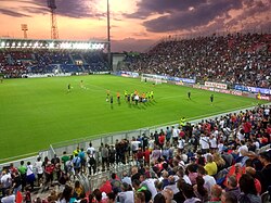
Unipol Domus in Cagliari
Regatta at Santa Maria Navarrese
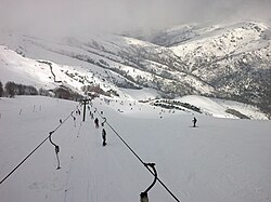
Skilifts on the Bruncu Spina

What are the main languages spoken in Sardinia?

The primary languages are Italian and Sardinian. There are also several minority languages including Sassarese, Gallurese, Ligurian (Tabarchino), and Catalan (Algherese).

What is the Nuragic civilization?

The Nuragic civilization was an ancient culture that inhabited Sardinia, famous for constructing nuraghi—complex, prehistoric stone towers and structures.

How is the Sardinian economy structured?

The economy is heavily driven by the tertiary sector (tourism and services), which accounts for a large portion of the GDP, alongside industry and the primary sector (agriculture and fishing).

What is the climate like in Sardinia?

The climate varies by location. Coastal areas like Cagliari experience warm Mediterranean temperatures, while higher elevations like Fonni are significantly cooler with higher average rainfall.
What are the main tourist attractions?

Key attractions include the archaeological sites (Nuraghi and megalithic temples), the beautiful coastline (such as Costa Smeralda), and various national and regional parks.
References

  1. "Federalism" (PDF). idea.int. In rare cases, subnational institutions may function very differently from the national level: in Italy, for example, the national government is parliamentary, but regional institutions are basically presidential in form, with directly elected regional governors.
  2. "Superficie di Comuni Province e Regioni italiane al 9 ottobre 2011" (in Italian). ISTAT.
  3. "Resident population by age, sex and marital status on 1st January 2026". demo.istat.it. ISTAT. 1 January 2026. Retrieved 1 April 2026. (On the search form, choose the statistical region of the municipality in the Area section, the Region, the Province, and the name of the Municipality)
  4. "Resident population by age, sex and marital status on 1st January 2026". demo.istat.it. ISTAT. 1 January 2026. Retrieved 1 April 2026.The file URL linking on technical dataset.
  5. "Statistiche demografiche ISTAT". Demo.istat.it. Archived from the original on 6 August 2017. Retrieved 26 July 2019.