San Francisco Bay: Geography, History, and Environmental Evolution
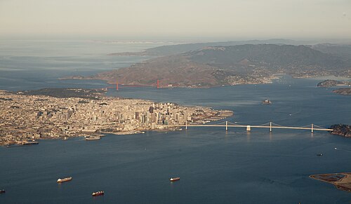
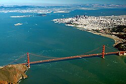
The San Francisco Bay is a massive estuary—a coastal body of water where freshwater from rivers meets the saltwater of the ocean—located along the coast of California. Serving as a critical hub for commerce, transportation, and biodiversity, the bay is defined by its unique geography and its role as the gateway to the American West.
From the towering spans of its iconic bridges to the shallow depths of its southern reaches, the bay is a complex system fed by several major river sources, including the Sacramento, San Joaquin, Petaluma, Napa, and Guadalupe rivers, all draining into the Pacific Ocean.
Key Facts
- Maximum Length: 97 km (60 mi).
- Maximum Width: 19 km (12 mi).
- Average Depth: 12–15 ft (3.7–4.6 m).
- Maximum Depth: 372 ft (113 m) at the Golden Gate.
- Ramsar Status: Designated as a Wetland of International Importance on February 2, 2013.
- Major Cities: San Francisco, San Jose, and Oakland.
Geography and Islands
The total surface area of the bay varies between 400 and 1,600 square miles, depending on whether sub-bays like San Pablo Bay and various wetlands are included. The main body of water spans roughly 48 to 60 miles from north to south.
The bay is home to five significant islands, each with a distinct history:
- Alameda: The largest island, created in 1901 to facilitate the Port of Oakland.
- Angel Island: Once known as "Ellis Island West" for its role in processing East Asian immigrants; it is now a state park.
- Yerba Buena Island: A mountainous island that houses a tunnel connecting the spans of the San Francisco–Oakland Bay Bridge.
- Treasure Island: An artificial island attached to Yerba Buena, site of the 1939 Golden Gate International Exposition.
- Alcatraz: A central islet famous for its former federal penitentiary, now a major tourist destination.
Notably, while Mare Island is often grouped with these, it is geographically a peninsula rather than an island.
Historical Development
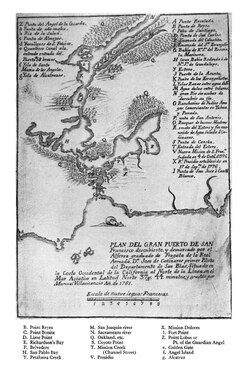
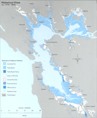
European discovery of the bay is credited to Spanish explorer Gaspar de Portolá on November 4, 1769. While Portolá initially mistook the bay for a large arm of Drakes Bay, the larger body of water eventually claimed the name San Francisco Bay.
In the early 19th century, the bay saw activity from the Russian–American Company. Between 1807 and 1811, Alaskan Native sea otter hunters led by Timofei Nikitich Tarakanov conducted raids that likely depleted the bay's sea otter population for the lucrative fur trade in China.
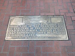
The mid-19th century marked a turning point with the California Gold Rush (1848–1855). San Francisco Bay rapidly evolved into one of the world's premier seaports. Its strategic importance grew further in 1869 when the first transcontinental railroad connected to the region, first at Alameda and later at the Oakland Long Wharf.
The Era of Bridges
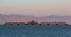
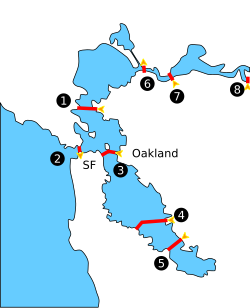
Connectivity across the bay began with the Dumbarton Rail Bridge in 1910. This was followed by a series of major automobile crossings that reshaped the region's infrastructure:
- Dumbarton Bridge: Completed January 1927.
- Carquinez Bridge: Completed May 1927.
- San Francisco–Oakland Bay Bridge: Completed 1936.
- Golden Gate Bridge: Completed 1937.
- Richmond–San Rafael Bridge: Completed 1956.
- San Mateo–Hayward Bridge: Completed 1967.
Ecology and Environmental Challenges
The bay's ecosystem is dynamic. Recent decades have seen the return of the common bottlenose dolphin (Tursiops truncatus), with sightings confirmed east of the Golden Gate Bridge by 2007. Zooarcheological evidence suggests these dolphins inhabited the bay prehistorically until at least 700 years ago.
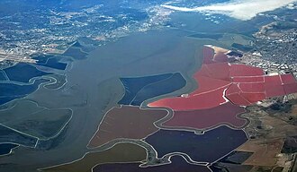
However, the bay faces significant pollution challenges. Contaminants include DDT, mercury, selenium, PCBs, dioxin, and furan compounds, as well as emerging contaminants like PFOS and fipronil.
Oil Spills and Depth Management
Environmental protection efforts were spurred by a major 1971 disaster when two Standard Oil tankers collided, spilling 800,000 gallons of oil. More recently, in 2007, the COSCO Busan collided with the Bay Bridge, spilling over 58,000 gallons of bunker fuel.
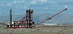
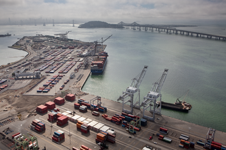
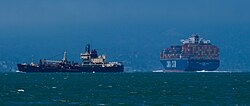
Due to the bay's shallow average depth of 12 to 15 feet, large cargo ships must utilize deep underwater channels. These channels require frequent dredging to remain navigable, particularly for the Port of Oakland.
Summary of Bay Characteristics
| Feature | Detail |
|---|---|
| River Sources | Sacramento, San Joaquin, Petaluma, Napa, Guadalupe |
| Ocean Source | Pacific Ocean |
| Max Depth | 372 ft (113 m) |
| Surface Area | 400–1,600 sq mi |
| Wetland Status | Ramsar Site (Designated 2013) |
Frequently Asked Questions
What is the deepest part of San Francisco Bay?
The deepest part of the bay is located under and just outside the Golden Gate Bridge, reaching a depth of 372 feet (113 m).
Which bridge was the first to cross the bay?
The first crossing was the Dumbarton Rail Bridge, built by the Southern Pacific railroad company in 1910.
Why is the Port of Oakland's dredging important?
Because the average depth of the bay is very shallow (12–15 feet), frequent dredging is necessary to maintain deep channels for large cargo ships to transit safely.
What is the significance of Angel Island?
Angel Island served as an entry point for immigrants from East Asia, earning it the nickname "Ellis Island West." It is currently a state park.
How did the Gold Rush affect the bay?
The California Gold Rush (1848–1855) transformed the bay into one of the world's great seaports, dominating shipping in the American West for the remainder of the 19th century.