Exploring Sakhalin: Russia's Largest Island in the North Pacific
Located in Northeast Asia, Sakhalin is a land of dramatic landscapes, complex history, and significant economic importance. As the largest island in Russia, it serves as a massive geographical bridge between the Sea of Okhotsk to the east and the Sea of Japan to the southwest. From its rugged mountain ranges to its vital role in the global energy market, Sakhalin is a unique territory shaped by both its natural environment and its shifting political boundaries.
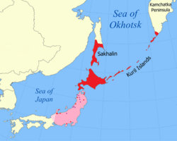
Key Facts
- Status: Largest island in Russia.
- Area: 72,492 km² (27,989 sq mi).
- Highest Point: Mount Lopatin (1,609 m).
- Administrative Center: Yuzhno-Sakhalinsk.
- Primary Economy: Oil and gas industry.
- Indigenous Groups: Nivkh, Orok, and Ainu.
Geography and Climate
Sakhalin is a long, narrow island, stretching 948 km (589 mi) from north to south. Its terrain is largely defined by its orography—the study of the formation and relief of mountains. Nearly two-thirds of the island is mountainous, featuring two parallel ranges that run north to south. The Western Sakhalin Mountains reach heights of 1,481 m at Mount Ichara, while the Eastern Sakhalin Mountains host the island's highest peak, Mount Lopatin, at 1,609 m. These ranges are separated by the Tym-Poronaiskaya Valley.
The island is separated from the Russian mainland by the Strait of Tartary, which frequently freezes during the winter months. To the south, the Soya Strait (also known as the La Pérouse Strait) separates Sakhalin from the Japanese island of Hokkaido. The island's climate is heavily influenced by the North Pacific. Strong onshore winds and frequent storms result in heavy precipitation, which can exceed 1,200 mm in the southern mountainous regions.
Flora and Fauna
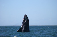
The island's diverse ecosystems support various wildlife, including the Western Gray whale, which can be found in the surrounding waters.
The vegetation is equally varied, ranging from the swampy Northern-Sakhalin plain to lush mountainous areas where species like the Anaphalis margaritacea can be found alongside various butterfly species.

A Complex History of Exploration and Sovereignty
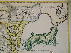
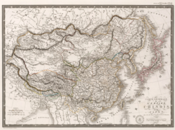
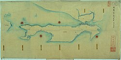
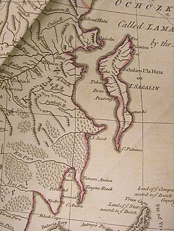
For centuries, Sakhalin was a territory of overlapping interests. Early maps often struggled to define its exact shape. For instance, 17th-century maps sometimes failed to recognize it as an island, and 18th-century cartography often only identified the northern half of the landmass.
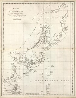
European exploration in the late 18th century helped clarify the island's coastline. In 1787, La Perouse charted much of the southwestern coast, which the local inhabitants referred to as "Tchoka."
Russo-Japanese Rivalry
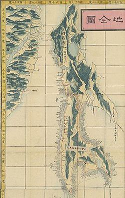
The 19th and early 20th centuries were marked by intense competition between Russia and Japan. The Treaty of Shimoda (1855) initially allowed both nations to inhabit the island, with Russians in the north and Japanese in the south. However, following various treaties and conflicts, the 1875 Treaty of Saint Petersburg saw Japan surrender its claims to Sakhalin to Russia.
The geopolitical landscape shifted again during the 20th century. Following the Siberian Intervention in 1920, Japan occupied northern Sakhalin, only returning it to the Soviet Union in 1925. After World War II, the island became fully Soviet, leading to the repatriation of many Japanese residents.
Demographics and Culture
The population of Sakhalin is approximately 490,000. While the majority of residents are ethnic Russians, the island has a rich and diverse cultural heritage. The indigenous Nivkh, Orok, and Ainu peoples have lived on the island for generations, though they now exist in much smaller numbers.
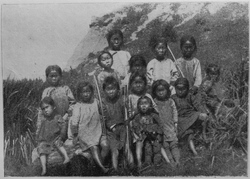
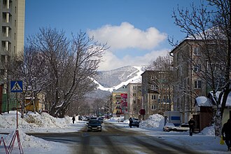
The island also has a significant Sakhalin Korean community, many of whom were brought to the island during the Japanese era to work in the coal mines. The administrative center, Yuzhno-Sakhalinsk, serves as the cultural and economic hub of the region.
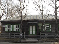
Historical figures have also left their mark on the island's legacy. The famous Russian author Anton Chekhov stayed in Alexandrovsk-Sakhalinsky in 1890, an experience that informed his literary work.
Economy and Infrastructure
Modern Sakhalin is driven by its vast natural resources. The oil and gas industry is the backbone of the economy, accounting for a massive portion of the island's industrial output. Major projects, such as Sakhalin-2, involve international partnerships and significant infrastructure development.
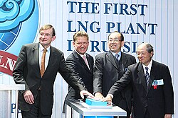
To support this industry and the growing population, infrastructure has undergone significant changes. This includes the conversion of railway gauges from the Japanese standard to the Russian standard, a process completed in 2019. There have also been long-term discussions regarding the construction of a Sakhalin Tunnel to connect the island more directly to the mainland.
Summary of Sakhalin Profile
| Feature | Details |
|---|---|
| Total Area | 72,492 km² |
| Highest Point | Mount Lopatin (1,609 m) |
| Major Industry | Oil and Natural Gas |
| Population (2019) | 489,638 |
| Largest City | Yuzhno-Sakhalinsk |
Frequently Asked Questions
What is the main industry on Sakhalin Island?
The economy of Sakhalin is heavily dominated by the oil and gas industry, which has accounted for a vast majority of the island's industrial output in recent years.
Who are the indigenous people of Sakhalin?
The primary indigenous groups of the island are the Nivkh, Orok, and Ainu peoples.
Is Sakhalin an island or part of the mainland?
Sakhalin is an island. It is separated from the Russian mainland by the Strait of Tartary and from Japan by the Soya Strait.
What is the highest point on the island?
The highest elevation on Sakhalin is Mount Lopatin, which reaches 1,609 meters (5,279 feet).
How has the railway changed on the island?
The railways were originally built using a Japanese gauge (1,067 mm) and were converted to the Russian standard gauge (1,520 mm) between 2004 and 2019.