Sabah MalaysiaKota KinabaluMount KinabaluBorneo historySabah tourism
Sabah: The Land Below the Wind
Exploring Sabah: The Land Below the Wind Known affectionately as Negeri Di Bawah Bayu or the "Land Below the Wind," Sabah is a vibrant state located on the northern part of Borneo. This r...
Exploring Sabah: The Land Below the Wind
Known affectionately as Negeri Di Bawah Bayu or the "Land Below the Wind," Sabah is a vibrant state located on the northern part of Borneo. This region is celebrated for its breathtaking landscapes, rich cultural tapestry, and diverse ecosystems. From the towering heights of Mount Kinabalu to its pristine coral reefs, Sabah offers a unique blend of natural wonder and historical depth.
Whether you are interested in its complex journey from the Sultanates of Brunei and Sulu to becoming part of Malaysia, or you are drawn to its bustling cities like Kota Kinabalu, Sabah is a destination of immense character and significance.
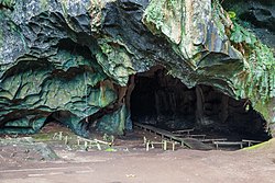
Entrance to the Madai Cave: Entrance to the Madai Cave
Key Facts
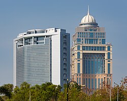
The State Administrative Building (right), behind the Wisma Innoprise (left)
Nickname: Land Below the Wind (Negeri Di Bawah Bayu)
Capital City: Kota Kinabalu
Highest Point: Mount Kinabalu (4,095 m)
Official Languages: English, Malay, Sabahan, Dusunic, Chinese, Coastal Kadazan, and Momogun/Rungus
Motto: Sabah Maju Jaya ("Let Sabah Prosper")
Total Area: 73,904 km²
A Journey Through History
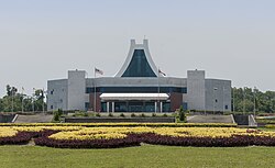
The Sabah State Legislative Assembly Building in Kota Kinabalu
The history of Sabah is a fascinating timeline of shifting influences and colonial eras. Long before modern borders were established, the region was influenced by the Bruneian Empire in the 15th century and later by the Sultanate of Sulu in 1704.
The colonial era began in earnest in 1882 with the establishment of British North Borneo. This period saw significant administrative changes, including the transition to a British crown colony on 15 July 1946. However, the mid-20th century brought the turbulence of the Second World War, during which the region experienced a Japanese occupation starting in 1942.
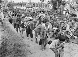
Japanese civilians and soldiers prior to their embarkation to Jesselton after their surrender to the Australian Imperial Force (AIF) in Tawau on 21 October 1945: Japanese civilians and soldiers prior to their embarkation to Jesselton after their surrender to the Australian Imperial Force (AIF) in Tawau on 21 October 1945
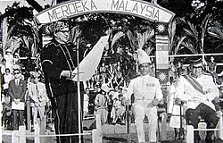
Following the war, Sabah moved toward self-governance on 31 August 1963, eventually federating into Malaysia on 16 September 1963. This historic moment marked the birth of the modern Malaysian state.
Donald Stephens (left) declaring the forming of the Federation of Malaysia at Merdeka Square, Jesselton on 16 September 1963. Together with him was the then Deputy Prime Minister of Malaysia Tun Abdul Razak (right) and Mustapha Harun (second right).: Donald Stephens (left) declaring the forming of the Federation of Malaysia at Merdeka Square, Jesselton on 16 September 1963. Together with him was the then Deputy Prime Minister of Malaysia Tun Abdul Razak (right) and Mustapha Harun (second right).
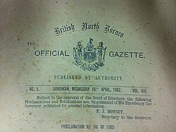
Extract from the title page of the British North Borneo Official Gazette (the British North Borneo Herald) of 16 April 1902: Extract from the title page of the British North Borneo Official Gazette (the British North Borneo Herald) of 16 April 1902
Three Came Home, a 1950 Hollywood film based on the memoir of Agnes Newton Keith life in Sandakan, North Borneo (present-day Sabah) during World War II[80]: Three Came Home, a 1950 Hollywood film based on the memoir of Agnes Newton Keith life in Sandakan, North Borneo (present-day Sabah) during World War II
Geography and Natural Wonders
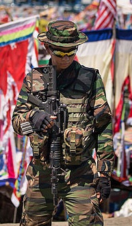
A Malaysian Army soldier armed with Colt M4 standing guard in Sabah east coast as part of the Eastern Sabah Security Command (ESSCOM)
Sabah's geography is defined by its incredible variety. The state is divided into five major administrative divisions: Interior, Kudat, Sandakan, Tawau, and West Coast. Its landscape ranges from the high-altitude peaks of Mount Kinabalu to the lush valleys and coastal plains.
One of the most notable geographical advantages is its location south of the typhoon belt. This makes Sabah largely insusceptible to the devastating effects of typhoons that frequently impact neighboring regions like the Philippines.
Sabah is located south of the typhoon belt, making it insusceptible to the devastating effects of the typhoons which frequently batter the neighbouring Philippines,[25] such as the Typhoon Haiyan in 2013.[195]: Sabah is located south of the typhoon belt, making it insusceptible to the devastating effects of the typhoons which frequently batter the neighbouring Philippines,[25] such as the Typhoon Haiyan in 2013.[195]
Biodiversity and Conservation
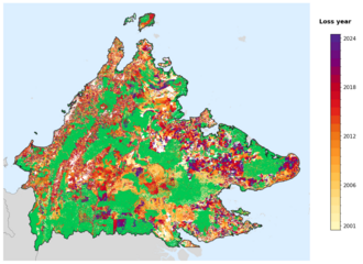
The state is a sanctuary for wildlife. From the riverine habitats of the Kinabatangan to the rehabilitation centers for primates, Sabah's biodiversity is a major draw for eco-tourism. However, this natural wealth faces challenges, including issues related to tree-cover loss and the environmental impact of industries like logging and mining.
Tree-cover loss year in Sabah, 2001-2024, from the Global Forest Change dataset.: Tree-cover loss year in Sabah, 2001-2024, from the Global Forest Change dataset.
A walkout through the Sepilok Orangutan Rehabilitation Centre: A walkout through the Sepilok Orangutan Rehabilitation Centre
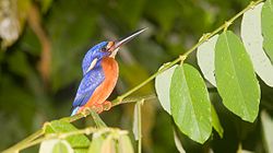
Blue-eared kingfisher in the lower Kinabatangan River area. Kingfisher is also once a state bird of Sabah and featured in one of its coat of arms.: Blue-eared kingfisher in the lower Kinabatangan River area. Kingfisher is also once a state bird of Sabah and featured in one of its coat of arms.
Marine Life
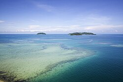
Sabah's coastline is home to world-class marine parks, including the Tunku Abdul Rahman National Park. These areas protect vibrant coral reefs and diverse marine species, serving as vital hubs for both conservation and tourism.
Coral reefs in Tunku Abdul Rahman National Park: Coral reefs in Tunku Abdul Rahman National Park
Economy and Infrastructure
Map of the British North Borneo with the yellow area covered the Philippine claim to eastern Sabah, presented by the Philippine Government to ICJ on 25 June 2001[159]
The economy of Sabah is multifaceted. As of 2016 data, the largest contributor to the GDP was the Services sector (40.8%), followed by Mining & Quarrying (29.6%) and Agriculture (19.1%). While industries like timber have historically contributed significantly to state revenue, the state continues to develop its manufacturing and construction sectors.
A lorry carrying timber in Tawau. Logging has contributed over 50% of the state revenue.[237]: A lorry carrying timber in Tawau. Logging has contributed over 50% of the state revenue.[237]
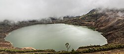
Aerial view of Mamut Mine with water that has filled the mine. Its water is reported to be dangerous for consumption due to the high presence of heavy metals.: Aerial view of Mamut Mine with water that has filled the mine. Its water is reported to be dangerous for consumption due to the high presence of heavy metals.
Modern Development
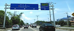
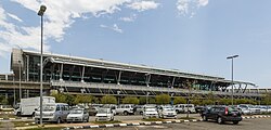
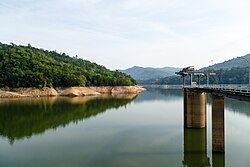
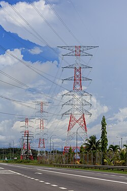
Infrastructure development is a key driver of Sabah's growth. This includes major transportation networks like the Pan-Borneo Highway, the expansion of Kota Kinabalu International Airport, and the maintenance of essential services such as the Babagon Dam for water catchment and various power plants for electricity.
Eight-lane highway in the capital city of Kota Kinabalu, part of the Pan-Borneo Highway: Eight-lane highway in the capital city of Kota Kinabalu, part of the Pan-Borneo Highway
Kota Kinabalu International Airport (Terminal 1): Kota Kinabalu International Airport (Terminal 1)
Babagon Dam, the biggest water catchment in the state: Babagon Dam, the biggest water catchment in the state
High voltage electricity pylon located near the Kimanis Power Plant: High voltage electricity pylon located near the Kimanis Power Plant
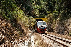
Sabah State Railway train passing through a tunnel of the Western Line in Pengalat Besar, Papar District: Sabah State Railway train passing through a tunnel of the Western Line in Pengalat Besar, Papar District
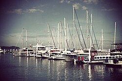
Boats and ferries at the Kota Kinabalu marina: Boats and ferries at the Kota Kinabalu marina
Culture and Society
Sabah's Desa Dairy Farm, dubbed as the little New Zealand due to the similar scenery view with the latter country[257][258]
Sabah is a melting pot of ethnicities. The population is predominantly Bumiputera (indigenous), with significant groups including the Kadazan-Dusun, Bajau, and Murut. This diversity is reflected in the state's many languages, traditional dances, and festivals.
Major celebrations like the Kaamatan harvest festival allow communities to honor their heritage through traditional music, dance, and beauty pageants. The culinary scene is equally diverse, featuring unique local dishes that showcase the state's fresh ingredients.
The Sumazau dance performance of Papar Kadazan at the Monsopiad Heritage Village: The Sumazau dance performance of Papar Kadazan at the Monsopiad Heritage Village
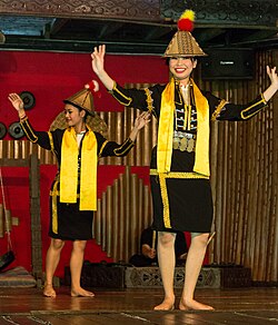
During the harvest festival of Kaamatan, there is heritage beauty pageant of Unduk Ngadau as well as the Mr. Kaamatan being held annually at the KDCA Compound in Sabah to honour of the legendary Huminodun, a maiden who sacrificed herself to save her people.[522][523]: During the harvest festival of Kaamatan, there is heritage beauty pageant of Unduk Ngadau as well as the Mr. Kaamatan being held annually at the KDCA Compound in Sabah to honour of the legendary Huminodun, a maiden who sacrificed herself to save her people.[522][523]
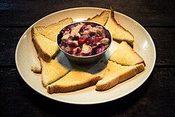
A swordfish hinava served with sandwich bread: A swordfish hinava served with sandwich bread
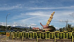
The roundabout in Tambunan with the sculpture of Sompoton, the main musical instrument of Sabah: The roundabout in Tambunan with the sculpture of Sompoton, the main musical instrument of Sabah
State Overview Summary
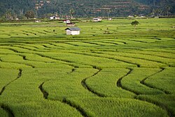
Paddy field in Tambunan District
Quick Reference Guide to Sabah
Category
Details
Capital
Kota Kinabalu
Population (2020)
3,418,785
Currency
Malaysian Ringgit (RM)
Time Zone
UTC+8 (MST)
Major Religions
Islam (69.6%), Christianity (24.7%), Buddhism (5.1%)
GDP (PPP 2022)
$77.938 billion
Frequently Asked Questions
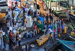
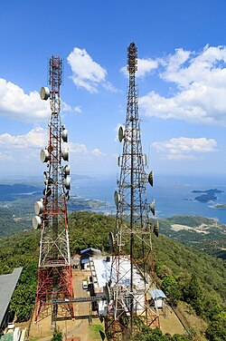
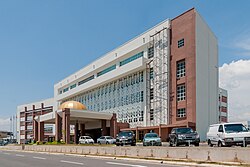
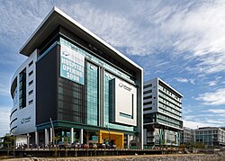
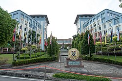
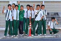
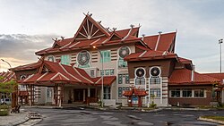
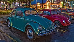
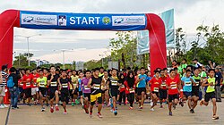
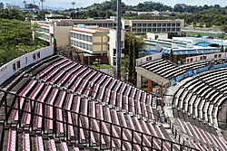
Fishery activities in the harbour of SandakanTelecommunication towers atop Mount Silam facing Darvel Bay of Lahad DatuThe building of Ministry of Communications and Multimedia Integrated Complex in Donggongon - the main office of Sabah RTMGleneagles Kota Kinabalu, one of the main private hospitals in SabahUniversiti Malaysia Sabah (UMS) chancellory buildingSabahan secondary school students in their uniformThe branch building of National Department for Culture and Arts in Kota KinabaluThe Borneo Bug Fest in 2016, featuring Volkswagen BeetleThe Borneo International Marathon in 2015Likas Stadium, which is the home stadium for Sabah F.C.
What is the meaning of the nickname "Land Below the Wind"?
The nickname refers to Sabah's geographical location, which sits south of the typhoon belt, shielding it from the intense winds and storms that frequently affect the Philippines.
What are the main ethnic groups in Sabah?
Sabah is home to a diverse population, with the largest groups being the Bumiputera (including Kadazan-Dusun, Bajau, and Murut), followed by Chinese and Malay communities.
What is the highest point in Sabah?
The highest elevation in the state is Mount Kinabalu, which reaches an altitude of 4,095 meters (13,435 feet).
How is the state of Sabah governed?
Sabah operates under a parliamentary system, featuring a Yang di-Pertua Negeri and a Chief Minister, with its own Legislative Assembly.
What are the primary industries in Sabah?
The economy is driven by services, mining and quarrying, agriculture, and manufacturing.
![Three Came Home, a 1950 Hollywood film based on the memoir of Agnes Newton Keith life in Sandakan, North Borneo (present-day Sabah) during World War II[80]](/images/69/6a/696acae08e657b60073a34c14b01cd99fe29e78f5a7aafa4fecc97b0eee2898b.jpg)
![Sabah is located south of the typhoon belt, making it insusceptible to the devastating effects of the typhoons which frequently batter the neighbouring Philippines,[25] such as the Typhoon Haiyan in 2013.[195]](/images/f7/69/f769eefebf7652dc996e9122d66329801f820112e2e1be8af034504e43117211.png)

![Map of the British North Borneo with the yellow area covered the Philippine claim to eastern Sabah, presented by the Philippine Government to ICJ on 25 June 2001[159]](/images/b2/1b/b21b312ac47bc606f1b2a71e901cb9e1a9ec51609e761658b0c28127cdfeceff.png)
![A lorry carrying timber in Tawau. Logging has contributed over 50% of the state revenue.[237]](/images/36/4f/364feca3c5915a08a1fcea99b88633c0b6833eec5de26bcd1aebf2bcf6963e5d.jpg)
![Sabah's Desa Dairy Farm, dubbed as the little New Zealand due to the similar scenery view with the latter country[257][258]](/images/cd/03/cd03203879bbb4babd652ada4a670b604bb937e45903a65d832bf09e0158f40b.jpg)
![During the harvest festival of Kaamatan, there is heritage beauty pageant of Unduk Ngadau as well as the Mr. Kaamatan being held annually at the KDCA Compound in Sabah to honour of the legendary Huminodun, a maiden who sacrificed herself to save her people.[522][523]](/images/f6/4d/f64d410c322692db7a31e042ad968ca189ef512d2294fb2b29902a070490f3fb.jpg)