Palau Geography and Administrative Structure
Palau is a serene island nation located in the North Pacific Ocean. Situated within the region of Oceania and the subregion of Micronesia, this archipelago spans both the Northern and Eastern Hemispheres. Operating on the UTC+09 time zone, Palau is characterized by its stunning maritime environment and a unique distribution of land and population.
The country covers a total land area of 459 square kilometers and possesses a coastline stretching 1,519 kilometers along the North Pacific Ocean. With a population ranging between 20,000 and 21,000 residents, it ranks as the 211th most populous country globally.
Key Facts
- Highest Point: Mount Ngerchelchuus on Babeldaob (242 m / 794 ft).
- Lowest Point: North Pacific Ocean (0 m).
- Total Area: 459 km².
- Coastline: 1,519 km.
- National Capital: Ngerulmud (moved from Koror on October 7, 2006).
- Regional Location: Micronesia, Oceania.
Natural Geographic Features
Palau's landscape is defined by its diverse islands, lakes, and rivers. The topography varies from the mountainous terrain of Babeldaob to the low-lying coral formations of the outer islands. The highest elevation in the country is found at Mount Ngerchelchuus, reaching 242 meters.
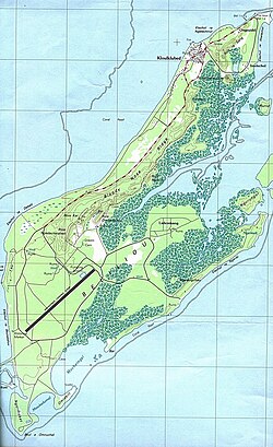
Among its most distinctive features are the Rock Islands, also known as Chelbacheb, which cover approximately 47 square kilometers. These formations contribute to the nation's unique environmental profile, alongside various other islands, lakes, and river systems.
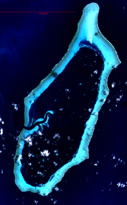
The nation's maritime boundaries extend into the North Pacific, including features such as Helen Reef.
Administrative Divisions and States
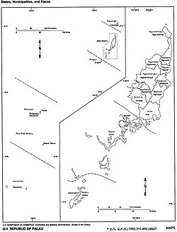
Palau is divided into 16 states, which are organized geographically across several main clusters: the North of Babeldaob, the main island of Babeldaob, the Southwest of Babeldaob, and the Southwest Islands.
The administrative center of the nation is Ngerulmud, which serves as the national capital. This capital was officially relocated from Koror on October 7, 2006. While Ngerulmud is the political center, Koror remains one of the most populous states in the archipelago.
State Distribution and Demographics
The distribution of land and people varies significantly across the states. Babeldaob contains the majority of the landmass and several states including Ngaremlengui, the largest by area at 65 square kilometers. In contrast, the Southwest Islands, such as Hatohobei and Sonsorol, are much smaller and more sparsely populated.
| State | Capital | Area (km²) | Population |
|---|---|---|---|
| Kayangel | Kayangel | 1 | 138 |
| Aimeliik | Mongami | 52 | 272 |
| Airai | Ngetkib | 44 | 2,104 |
| Melekeok | Melekeok | 28 | 239 |
| Ngaraard | Ulimang | 36 | 638 |
| Ngarchelong | Mengellang | 10 | 286 |
| Ngardmau | Urdmang | 47 | 221 |
| Ngaremlengui | Imeong | 65 | 367 |
| Ngatpang | Ngereklmadel | 47 | 280 |
| Ngchesar | Ngersuul | 41 | 267 |
| Ngiwal | Ngerkeai | 26 | 193 |
| Angaur | Ngeremasch | 8 | 188 |
| Koror | Koror | 18 | 13,303 |
| Peleliu | Kloulklubed | 13 | 571 |
| Rock Islands | - | 47 | - |
| Hatohobei | Hatohobei | 1 | 23 |
| Sonsorol | Dongosaru | 3 | 39 |
Frequently Asked Questions
What is the highest point in Palau?
The highest point in Palau is Mount Ngerchelchuus, located on the island of Babeldaob, with an elevation of 242 meters (794 feet).
When did Palau change its national capital?
The national capital of Palau was moved from Koror to Ngerulmud on October 7, 2006.
Which state in Palau has the highest population?
Based on the 2000 Census, Koror is the most populous state with 13,303 residents.
What are the Rock Islands?
The Rock Islands, also known as Chelbacheb, are a prominent natural geographic feature of Palau covering an area of 47 square kilometers.
Where is Palau located?
Palau is an island country located in the North Pacific Ocean, within the region of Oceania and the subregion of Micronesia.