Otago: The Historic and Diverse Heart of New Zealand's South Island
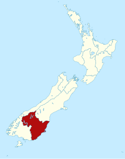
Located in the southern half of the South Island, Otago (Māori: Ōtākou) is a region of striking contrasts, where rugged coastlines meet alpine peaks and historic gold-mining towns neighbor world-class vineyards. Administered by the Otago Regional Council, it stands as New Zealand's second-largest local government region, covering approximately 31,251 square kilometers. From the academic hub of Dunedin to the adventure capital of Queenstown, Otago is a cornerstone of New Zealand's cultural and economic identity.
Key Facts
- Total Area: Approximately 31,251 km², making it the second largest region in New Zealand.
- Population: 253,900 (as of June 2025).
- Regional Seat: Dunedin, the country's sixth largest urban area.
- Economic Power: A total GDP of NZ$ 15.336 billion (2021).
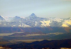
- Highest Peak: Mount Aspiring / Tititea (the highest outside the Aoraki / Mount Cook region).
- Education: Home to the University of Otago, founded in 1869.
A Legacy of Faith and Fortune
The European settlement of Otago began in March 1848, established by the Free Church of Scotland. The first immigrants arrived from Greenock on the ships John Wickliffe and Philip Laing, led by Captain William Cargill. Initially, the settlement focused on the port and the fertile Taieri Plains, but the region's trajectory changed forever in 1861.
The discovery of gold at Gabriel's Gully by Gabriel Read sparked a massive gold rush. This era brought a surge of fortune-seekers from China, Europe, and North America, diversifying the region's Scottish Presbyterian roots. This economic boom transformed Otago into the cultural and economic center of New Zealand for a time, leading to the creation of the Otago Daily Times, the nation's first daily newspaper.
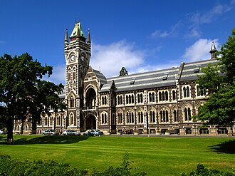
Education also flourished during this period of growth, culminating in the 1869 founding of the University of Otago in Dunedin, which remains the oldest university in New Zealand.
Geography and Climate
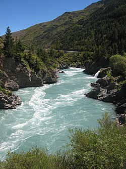
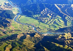
Otago's landscape is as varied as its history. In the southeast, The Catlins features rough hill country that is part of the Murihiku terrane, a geological formation linked to systems as far away as New Caledonia. To the west, the region is dominated by high mountains and the dramatic Kawarau Gorge.
The climate varies significantly between the coast and the interior. Coastal areas experience a cycle of warm, dry weather followed by cool, damp conditions, often influenced by the föhn wind (a dry wind descending the lee side of the Southern Alps). In contrast, Central Otago features a continental climate—the closest approximation to one found anywhere in New Zealand—characterized by hot, dry summers and bitterly cold winters.
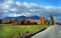
This unique inland climate is a primary driver for the region's successful viticulture, particularly for Pinot noir, which has earned Central Otago an international reputation.
Demographics and Urban Centers
As of June 2025, Otago's population reached 253,900, representing about 4.8% of New Zealand's total population. The population density is relatively low at 8.14 people per square kilometer. The majority of the population (41%) resides in Dunedin, which has maintained steady growth due to the influence of its university and medical school.
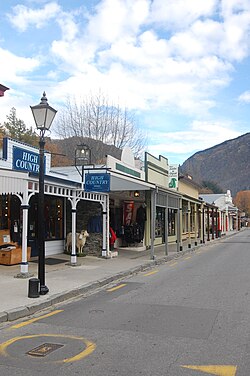
Other key urban centers include Queenstown, which saw a 60% population increase between 1996 and 2006 due to a booming tourism industry, as well as Oamaru, Wānaka, and Cromwell.
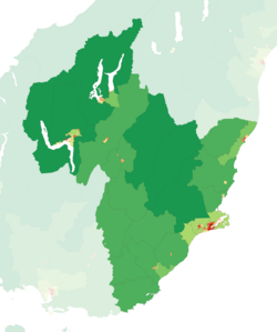
Regional Population Distribution (June 2025)
| Urban Area | Population | % of Region |
|---|---|---|
| Dunedin | 104,000 | 41.0% |
| Queenstown | 29,000 | 11.4% |
| Mosgiel | 15,100 | 5.9% |
| Oamaru | 14,300 | 5.6% |
| Wānaka | 13,200 | 5.2% |
Economy and Governance
Otago possesses a mixed economy. While Dunedin focuses on technology, publishing, and manufacturing, the rural sectors have evolved significantly. Many farms in the Clutha district have transitioned from sheep to dairy farming. Additionally, the wine industry has expanded rapidly since the mid-1990s, with Central Otago specializing in Pinot noir, Chardonnay, Sauvignon blanc, Merlot, and Riesling.
Politically, the region is managed by the Otago Regional Council and divided into five territorial authorities: Dunedin City, Queenstown-Lakes District, Central Otago District, Clutha District, and Waitaki District.
Frequently Asked Questions
What is the significance of the Otago gold rush?
The gold rush, sparked by Gabriel Read's 1861 discovery at Gabriel's Gully, led to rapid commercial expansion and a massive influx of immigrants from China, Europe, and North America, shifting the region's demographic and economic status.
Why is Dunedin's population stable compared to other southern cities?
Dunedin's population has not declined since the 1970s largely because of the University of Otago and its medical school, which attract a consistent flow of students from across New Zealand and the world.
What makes Central Otago's climate unique in New Zealand?
Central Otago has the closest approximation to a continental climate in the country, featuring very hot summers and extremely cold winters, which is ideal for specific grape varieties like Pinot noir.
Which is the highest mountain in the Otago region?
Mount Aspiring / Tititea is the highest mountain in the region and the highest in New Zealand outside of the Aoraki / Mount Cook region.
How is the Otago region governed?
The region is administered by the Otago Regional Council and is further divided into five territorial authorities: Dunedin City, Queenstown-Lakes, Central Otago, Clutha, and Waitaki districts.