North Hwanghae Province: A Detailed Overview of Geography, History, and Administration
North Hwanghae Province, known in Korean as Hwanghaebuk-to, is a significant administrative division located in North Korea. Its name literally translates to "north Yellow Sea province." Formed in 1954 following the division of the original Hwanghae Province into northern and southern sections, this region serves as a vital link between the capital, Pyongyang, and the southern borders of the country.
The province is characterized by its diverse landscape and historical depth, acting as a corridor for both transportation and ancient cultural heritage. From its provincial capital of Sariwon to its connections with the Kaesong region, North Hwanghae plays a central role in the nation's administrative and historical fabric.
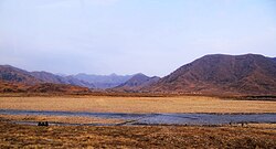
Key Facts
- Provincial Capital: Sariwon
- Total Area: 8,154 km² (3,148 sq mi)
- Population: 2,113,672 (as of 2008)
- Administrative Divisions: 2 cities and 18 counties
- Major Transport: Pyongbu Railway Line and Pyongyang-Kaesong Motorway
- Time Zone: UTC+9 (Pyongyang Time)
Geography and Administrative Structure
North Hwanghae is strategically positioned, bordering Pyongyang and South Pyongan to the north, Kangwon to the east, and South Hwanghae to the southwest. To the south, it borders the Kaesong Industrial Region and South Korea's Gyeonggi Province.
The province's administrative makeup has seen several shifts over the decades. It is currently divided into two cities (si) and 18 counties (kun). The two primary cities are the capital, Sariwon, and Songrim. The administrative boundaries were notably affected in 2003 when Kaesong became part of the province as Kaepung County, though it was later promoted to a Special City in 2019 and separated from the province.
Administrative Subdivisions
The 18 counties that comprise the province include:
- Chunghwa, Kangnam, and Sangwon (notably added in 2010, though Kangnam returned to Pyongyang in 2011)
- Hwangju, Koksan, Kumchon, and Pongsan
- Pyongsan, Rinsan, Singye, and Sinpyong
- Sohung, Suan, Sŭngho, Tosan, Unpa, Yonsan, and Yontan
Infrastructure and Education
Connectivity is a hallmark of the province. The Pyongbu Railway Line—referred to as the Kyongui Line in South Korea—runs through the region, theoretically connecting Pyongyang to Pusan, though it is currently interrupted by the Korean Demilitarized Zone. On the road, the Pyongyang-Kaesong Motorway serves as a major artery for regional travel.
Education in the province is managed through government-run higher-level institutions. These include specialized schools such as the Kye Ung Sang Sariwon University of Agriculture, the Sariwon University of Geology, and the Sariwon Teachers University.
Historical and Cultural Heritage
North Hwanghae is a repository of Korean history, particularly regarding the Koryo Dynasty. The proximity to the former Koryo capital at Kaesong means the region contains numerous significant relics and royal sites.
Ancient Fortresses and Temples
The province is home to several landmarks of immense historical value:
- Royal Tombs: The resting places of many Koryo monarchs, including the famous tombs of Kings Taejo and Kongmin.
- Taehungsan Fortress: A Koguryo-era fortification built to protect the capital at Pyongyang, which also encloses the Kwanum Temple.
- Jongbangsan Fortress: Located near Sariwon, this Koguryo satellite fortress was used for the defense of Pyongyang.
- Songbulsa Temple: Situated within the Jongbangsan Fortress, this 9th-century Buddhist temple is recognized as one of the oldest and most picturesque in the country.
Summary of Provincial Data
| Category | Details |
|---|---|
| Capital | Sariwon |
| Total Area | 8,154 km² |
| Population (2008) | 2,113,672 |
| Population Density | 259.2/km² |
| Dialect | Hwanghae |
Frequently Asked Questions
What is the capital of North Hwanghae Province?
The provincial capital is Sariwon.
How many administrative divisions are in the province?
The province is divided into 2 cities and 18 counties.
What major railway line passes through North Hwanghae?
The Pyongbu Railway Line passes through the province, connecting it to the rest of the country.
Which historical dynasty is closely associated with this region?
The Koryo Dynasty is closely associated with the region due to the presence of royal tombs and historical sites near Kaesong.
What are the main higher education institutions in the province?
Key government-run institutions include the Kye Ung Sang Sariwon University of Agriculture, the Sariwon University of Geology, and the Sariwon Teachers University.