Moray Firth: Scotland's Largest Coastal Inlet
The Moray Firth is a vast, roughly triangular inlet of the North Sea located in the north and east of Inverness. As the largest firth—a Scottish term for a coastal inlet or estuary—in Scotland, it serves as a critical geographical and ecological landmark. Its expansive reach extends from Duncansby Head near John o' Groats in the north to Fraserburgh in the east, and reaches as far west as Inverness and the Beauly Firth.
Spanning over 500 miles (800 km) of coastline, much of which consists of dramatic cliffs, the firth touches three distinct council areas: Highland to the west and north, and Highland, Moray, and Aberdeenshire to the south.
Key Facts
- Status: Largest firth in Scotland.
- Coastline: Over 500 miles (800 km), predominantly cliff-based.
- Wildlife: A premier site for observing bottlenose dolphins and harbour porpoises.
- Conservation: Includes a Ramsar Wetland (Inner Moray Firth) and one of Europe's largest marine Special Areas of Conservation (SAC).
- Economy: Key hub for scallops, Norway lobsters, oil, and offshore wind energy.
Etymology and Origins
The firth takes its name from the 10th-century Province of Moray. Linguists believe the name originates from the sea itself. The local terms Murar or Morar likely derive from the Gaelic word Muir (sea), while Murav and Morav are thought to stem from the Celtic words Mur (sea) and Tav (side), meaning "sea-side." Historical records also show variations such as the Murro Firth and Morra Firth.
Geography and Visibility
The Moray Firth is fed by several major rivers, including the River Ness, the River Findhorn, and the River Spey. It also encompasses smaller inlets such as the Cromarty Firth and the Dornoch Firth, with the Pentland Firth marking its northern boundary.
Geographically, the area is divided into two sections: the Inner Moray Firth (historically known as the Firth of Inverness), which extends from the Beauly Firth to Chanonry Point, and the Outer Moray Firth, which opens directly into the North Sea.
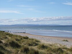
Due to its open landscape, the firth offers remarkable long-distance views. On clear days, observers in Buckie can see Wick over 80 km (50 mi) away, while those in Nairn can spot the red bands of the Tarbat Ness Lighthouse using binoculars.
The Great Channel
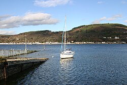
In 1917, engineers dredged the Great Channel in the Inner Moray Firth. This was intended to provide a safe passage for ships using the Caledonian Canal to avoid the perilous journey around the north of Scotland. However, the channel was not maintained and quickly filled back in with sediment.
Geological Formation
The Moray Firth is of tectonic origin, partially formed by the Helmsdale Fault. During the last ice age, the entire area was covered by a massive glacier. This glacial history left the inner part and its side-inlets, specifically the Cromarty and Dornoch Firths, as true fjords (long, narrow inlets with steep sides created by glacial erosion).
While the area experiences a mean tide range of approximately three metres (ten feet), sediment from nearby mountains has created spits at several river mouths. This accumulation of sediment has notably narrowed the fjords entered by the River Ness and River Carron.
Conservation and Economic Activity
The Moray Firth is globally recognized as a vital habitat for marine mammals. It is one of the most important locations on the British coast for spotting bottlenose dolphins, harbour porpoises, minke whales, and common dolphins. Chanonry Point is particularly famous for dolphin sightings, and the Dolphin Research Centre at Fort George Point conducts ongoing studies on breeding and hunting habits.
Economically, the region is a powerhouse for both energy and food. The fishing industry focuses heavily on Norway lobsters and scallops. In terms of energy, the area has transitioned from oil to renewables; the decommissioned Beatrice oil field is now the site of the Beatrice Wind Farm, and the region hosts the completed Moray East and the upcoming Moray West offshore wind farms (expected 2025).
To protect these resources, the Inner Moray Firth is a designated special protection area. Furthermore, a Special Area of Conservation (SAC) under the EU Habitats Directive protects the waters from a line between Lossiemouth and Helmsdale westwards.
Summary of Regional Data
| Feature | Details |
|---|---|
| Total Coastline | > 500 miles (800 km) |
| Major Rivers | Ness, Findhorn, Spey |
| Key Wildlife | Bottlenose Dolphin, Harbour Porpoise |
| Conservation Status | Ramsar Wetland, SAC (EU Habitats Directive) |
| Energy Projects | Beatrice, Moray East, Moray West Wind Farms |
Frequently Asked Questions
What is the difference between the Inner and Outer Moray Firth?
The Inner Moray Firth, formerly called the Firth of Inverness, is a more sheltered area extending from the Beauly Firth to Chanonry Point. The Outer Moray Firth is more open and consists of North Sea waters.
Which animals can be seen in the Moray Firth?
The area is most famous for bottlenose dolphins and harbour porpoises, though minke whales and common dolphins are also sighted occasionally.
How was the Moray Firth formed?
It is of tectonic origin related to the Helmsdale Fault and was shaped by a massive glacier during the last ice age, resulting in the formation of fjords in its inner sections.
What are the primary industries in the region?
The primary industries include commercial fishing (specifically scallops and Norway lobsters) and energy production, including oil and offshore wind farms.
Is the Moray Firth a protected area?
Yes, the Inner Moray Firth is a designated Ramsar Wetland and a Special Area of Conservation (SAC), making it one of the largest marine protection areas in Europe.