Mokelumne River Conservation and Restoration Efforts
The Mokelumne River is a vital waterway in California, serving as a focal point for hydroelectric power, water supply, and ecological preservation. Over the last few decades, a collaborative effort between government agencies, non-profit organizations, and utility providers has transformed the river's management, shifting the focus toward sustainability and the restoration of natural river processes.
The Project 137 Settlement
In 1999, a landmark settlement agreement was signed regarding the Federal Energy Regulatory Commission (FERC) license for PG&E's hydroelectric project, known as Project 137. This agreement brought together federal and state agencies, non-profits, and PG&E to ensure the river's health was prioritized alongside energy production.
The settlement introduced several critical mandates to mimic the river's natural state. These included requiring hydroelectric flows to follow the natural hydrograph (the seasonal pattern of river flow) and improving facilities and flows for recreational use. Additionally, the agreement established an adaptive management plan and a rigorous monitoring program to track ecological progress.
One of the most significant outcomes of this agreement was the removal of three small dams on tributary streams. In 2003, the removal of the West Panther Creek Dam marked the first time in modern history that PG&E dismantled a dam, signaling a new era of river restoration.
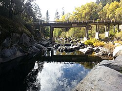
The Path to Wild and Scenic Designation
Protecting the Mokelumne River required navigating a complex legislative landscape. The U.S. Forest Service and Bureau of Land Management initially identified approximately 37 miles of the river—stretching from the Salt Springs Powerhouse to just below Highway 49—as eligible for National Wild and Scenic River designation.
Legislative Challenges and SB 1199
In 2014, Senate Bill 1199 was introduced by Senator Loni Hancock to designate the river as Wild and Scenic from Salt Springs to Pardee Reservoir. While the bill enjoyed support from the Foothill Conservancy, Friends of the River, Calaveras County, and various tribal and conservation groups, it faced opposition from Amador County and local water agencies. Although the East Bay Municipal Utility District eventually supported the bill following amendments, SB 1199 stalled in the State Assembly's Appropriations Committee.
The Compromise of AB 142
To break the deadlock, Assemblyman Frank Bigelow and Senator Tom Berryhill co-sponsored Assembly Bill 142 in 2015. This legislation mandated a formal state suitability study before any official designation could occur. Signed into law by Governor Jerry Brown, AB 142 provided interim protections for the river segment between Salt Springs Dam and Pardee Reservoir, creating a compromise supported by water agencies and conservationists alike.
Final Designation via SB 854
The process culminated in 2018. Following a draft study released by the California Natural Resources Agency in January, a final report was issued in April 2018. This report recommended adding roughly 37 miles of the main Mokelumne and its North Fork to the state system. This recommendation was codified in Senate Bill 854, signed by Governor Jerry Brown on June 27, 2018, officially making the Mokelumne the 15th river in the California Wild and Scenic Rivers System.
Key Facts
- Project 137: A 1999 settlement that aligned hydroelectric flows with the river's natural hydrograph.
- Historic Removal: The West Panther Creek Dam removal in 2003 was PG&E's first modern dam removal.
- Protected Length: Approximately 37 miles of the river are now part of the California Wild and Scenic Rivers System.
- Legal Milestone: SB 854 (2018) officially designated the river as the 15th in the state's Wild and Scenic system.
- Ongoing Work: A working group formed in 2014 continues to explore restoring salmon and steelhead populations above Camanche and Pardee reservoirs.
Summary of Legislative Milestones
| Year | Legislation/Agreement | Primary Outcome |
|---|---|---|
| 1999 | Project 137 Settlement | Natural flow requirements and adaptive management. |
| 2014 | Senate Bill 1199 | Proposed Wild and Scenic status; stalled in Assembly. |
| 2015 | Assembly Bill 142 | Mandated suitability study and provided interim protections. |
| 2018 | Senate Bill 854 | Official designation as a California Wild and Scenic River. |
Frequently Asked Questions
What was the significance of the West Panther Creek Dam removal?
The removal of the West Panther Creek Dam in 2003 was a historic milestone as it represented the first time PG&E removed a dam in modern history, fulfilling part of the Project 137 settlement.
What does it mean for a river to follow a "natural hydrograph"?
Following a natural hydrograph means that the release of water from hydroelectric projects is managed to mimic the seasonal flow patterns that would occur naturally, rather than being dictated solely by power demand.
Which agencies and groups supported the Wild and Scenic designation?
Support came from the Foothill Conservancy, Friends of the River, Calaveras County, various tribal groups, fish and conservation organizations, and eventually the East Bay Municipal Utility District.
What is the current status of fish restoration on the Mokelumne?
Since 2014, a working group comprising federal and state agencies along with conservation and fish organizations has been exploring ways to restore salmon and steelhead populations above the Pardee and Camanche reservoirs.
How many miles of the river are protected under the state system?
Approximately 37 miles of the North Fork and the main Mokelumne River are included in the California Wild and Scenic Rivers System.