Mexico City historyTenochtitlanMexico City tourismCDMX cultureMexico City geography

Mexico City: A Journey Through the Heart of a Global Megacity

Exploring Mexico City: A Journey Through History, Culture, and Modernity Mexico City, known locally as Ciudad de México (CDMX), is a sprawling megacity that serves as the beating heart of...

Exploring Mexico City: A Journey Through History, Culture, and Modernity

Mexico City, known locally as Ciudad de México (CDMX), is a sprawling megacity that serves as the beating heart of Mexico. Often referred to by its nickname, La Ciudad de los Palacios (The City of Palaces), it is a place where ancient indigenous roots meet colonial grandeur and cutting-edge modern urban life. From the ruins of the Aztec empire to its status as a global economic powerhouse, the city offers a profound look at the evolution of North American civilization.
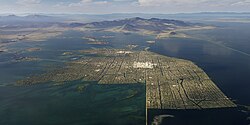
The city was the place of Mexico-Tenochtitlan, the Aztec capital.
: The city was the place of Mexico-Tenochtitlan, the Aztec capital.

Key Facts

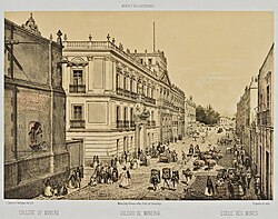
Palacio de Minería, Mexico City. The elevation of silver mining as a profession and the ennoblement of silver miners was a development of the eighteenth-century Bourbon Reforms.
  • Founded: March 13, 1325 (as Mexico-Tenochtitlan)
  • Elevation: 2,240 meters (7,350 ft)
  • Population: Over 9.2 million (Capital/Megacity); over 23 million (Urban area)
  • UNESCO World Heritage Sites: Historic center, Xochimilco, and UNAM Central University City Campus
  • Climate: Subtropical highland climate

A Deep Dive into History
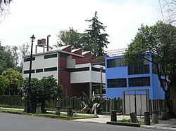
Frida Kahlo and Diego Rivera house in San Ángel designed by Juan O'Gorman

The Aztec Foundation and Spanish Conquest

The story of Mexico City begins with the Aztec Empire. In 1325, the city of Mexico-Tenochtitlan was founded by Tenoch. This massive indigenous capital was a marvel of engineering, built upon the landscape that would later become the modern metropolis.
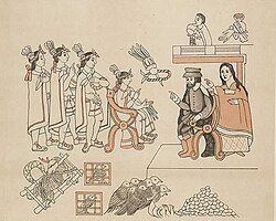
The panel dedicated to the Tenochtitlan campaign, as depicted in the 1552 Canvas of Tlaxcala. Hernando Cortés and Malintzin (right) meet Moctezuma II in Mexico-Tenochtitlan, 8 November 1519.
: The panel dedicated to the Tenochtitlan campaign, as depicted in the 1552 Canvas of Tlaxcala. Hernando Cortés and Malintzin (right) meet Moctezuma II in Mexico-Tenochtitlan, 8 November 1519.

The course of history shifted dramatically with the arrival of Spanish conquistadors. Following the conquest, the city was re-established as Ciudad de México on August 13, 1521, by Hernán Cortés. Much of the colonial architecture was constructed directly atop the ruins of the original Aztec structures.
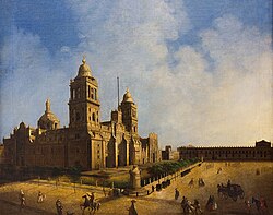
Mexico City Metropolitan Cathedral's (1571–1813) 18th century painting. The cathedral was built by the Spaniards over the ruins of the main Aztec temple.
: Mexico City Metropolitan Cathedral's (1571–1813) 18th century painting. The cathedral was built by the Spaniards over the ruins of the main Aztec temple.

Colonial Growth and Modern Conflict

As the centuries progressed, the city grew into a vital colonial hub. By the 17th and 18th centuries, it had become a center of administration and wealth. However, this growth was often marked by struggle, including the Battle of Mexico City during the U.S.–Mexican War in 1847.
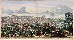
Mexico City in 1690. Atlas Van der Hagen.
: Mexico City in 1690. Atlas Van der Hagen.
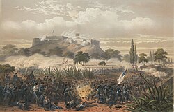
The American assault on the Chapultepec Castle, 1847 by Nebel and Bayot
: The American assault on the Chapultepec Castle, 1847 by Nebel and Bayot

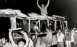
The 20th century brought further transformation through the Mexican Revolution and significant political shifts. The city has witnessed intense periods of social and political upheaval, such as the "Ten Tragic Days" in 1913 and the Tlatelolco massacre in 1968.

Corpses in front of the National Palace during the Ten Tragic Days. Photographer, Manuel Ramos.[72]
: Corpses in front of the National Palace during the Ten Tragic Days. Photographer, Manuel Ramos.[72]
Students in a burned bus during the Tlatelolco massacre 1968
: Students in a burned bus during the Tlatelolco massacre 1968

Geography and Environment

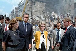
First ladies Paloma Cordero of Mexico (left) and Nancy Reagan of the United States (right) with U.S. Ambassador to Mexico, John Gavin observing the damage done by the 1985 earthquake

Topography and Climate

Situated at a high elevation of 2,240 meters, Mexico City experiences a subtropical highland climate. This means the weather is generally temperate, though it can vary significantly. The city's highest point is located at Ajusco, reaching an elevation of 3,930 meters.
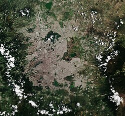
Satellite image of Mexico City
: Satellite image of Mexico City

The climate is characterized by distinct wet and dry seasons. Precipitation is highest during the summer months (June through September), while the winter months are typically drier. While the temperature remains relatively mild, air quality can become a challenge, particularly during the winter months.
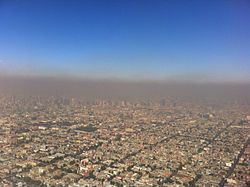
Air pollution over Mexico City. Air quality is poorest during the winter.
: Air pollution over Mexico City. Air quality is poorest during the winter.

Parks and Recreation

Despite its density, the city offers significant green spaces. Chapultepec is one of the world's largest city parks. Historically, access to this area was limited to Aztec nobility, but it was opened to the public by a decree from Charles V in 1530.

Chapultepec was an important park during the Aztec Empire, whose access had been limited to its nobility; it was declared open to the public by a decree of Charles V in 1530.[89][90] It is one of the world's largest city parks.[89]
: Chapultepec was an important park during the Aztec Empire, whose access had been limited to its nobility; it was declared open to the public by a decree of Charles V in 1530.[89][90] It is one of the world's largest city parks.[89]

Another unique ecological and cultural treasure is Xochimilco, famous for its canals and traditional trajineras (colorful boats). Both the historic center and Xochimilco are recognized as UNESCO World Heritage Sites.
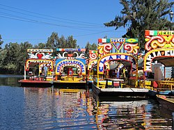
Trajineras in the canals of Xochimilco. Xochimilco and the historic center of Mexico City were declared a World Heritage Site in 1987.
: Trajineras in the canals of Xochimilco. Xochimilco and the historic center of Mexico City were declared a World Heritage Site in 1987.

Culture, Economy, and Infrastructure
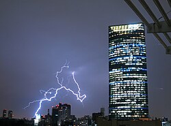
Lightning in the background of the Torre Mayor

A Global Cultural Hub

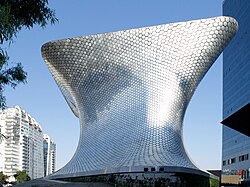
Mexico City is a powerhouse of art and education. It is home to the National Autonomous University of Mexico (UNAM), whose Central Campus is a UNESCO World Heritage Site. The city's museums, such as the Museo Soumaya and the National Museum of Anthropology, house invaluable collections ranging from pre-Hispanic artifacts to contemporary art.

Central Campus of the University City of the UNAM. Since 2007 the University City is a UNESCO World Heritage Site.[142]
: Central Campus of the University City of the UNAM. Since 2007 the University City is a UNESCO World Heritage Site.[142]
The Museo Soumaya
The Museo Soumaya
: The Museo Soumaya
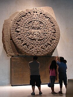
The Aztec sun stone in the National Museum of Anthropology
: The Aztec sun stone in the National Museum of Anthropology

The city's culinary scene is equally legendary, offering everything from high-end dining to world-famous street tacos.
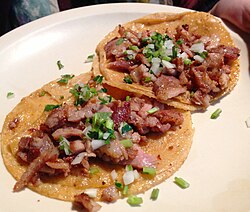
Street tacos in Mexico City
: Street tacos in Mexico City

Economic Powerhouse and Transportation

As a major economic center, the city boasts a massive GDP and serves as the financial heart of the nation. The Mexican Stock Exchange is a key component of this economic engine.
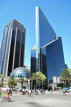
Mexican Stock Exchange
: Mexican Stock Exchange

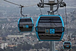
To support its massive population, the city utilizes a complex Sistema de Movilidad Integrada (Integrated Mobility System). This includes the Mexico City Metro, various bus rapid transit systems like Metrobús, and newer additions like the Cablebús. For tourists, options like the Turibus provide easy access to major landmarks.
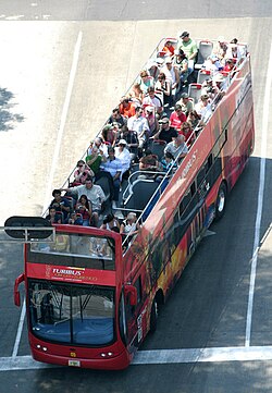
The Turibus runs through many of the most important tourist attractions in the city.
: The Turibus runs through many of the most important tourist attractions in the city.
Cablebús
Cablebús
: Cablebús

Summary of Mexico City Data

Greater Mexico City and Mexico City
Quick Reference: Mexico City Statistics
Category Details
Official Name Ciudad de México (CDMX)
Motto Capital de la transformación
Land Area (City) 1,485 km²
Land Area (Metro) 7,866 km²
HDI 0.876 (Very High)
Time Zone UTC−06:00 (CST)

Frequently Asked Questions

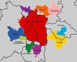
The Mexico City Megalopolis as defined prior to 2019. Since then Querétaro state is also included.
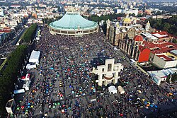
Basilica of Our Lady of Guadalupe in La Villa de Guadalupe, the main Catholic pilgrimage site in the Americas. It houses the original image of Our Lady of Guadalupe.
The XXI Century National Medical Center, managed by the Mexican Social Security Institute (IMSS)
El Colegio de México dedicated to higher education and research in the social sciences and humanities, with a particular emphasis on Mexican and Latin American studies.
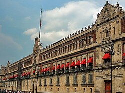
The National Palace of Mexico
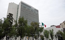
Senate of the Republic
Legislative Palace of San Lázaro
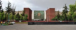
Offices of the Secretariat of Foreign Affairs
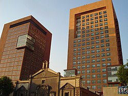
Mexico City's Legislative Assembly building
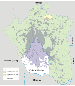
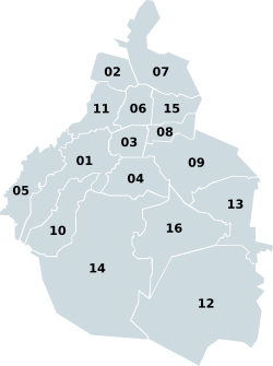
The 16 boroughs of Mexico City
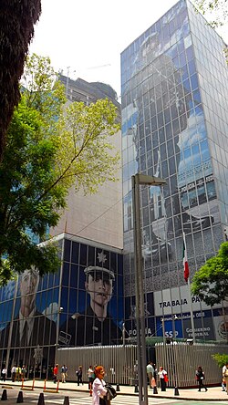
Federal Police headquarters in Mexico City
The Paseo de la Reforma is a wide avenue designed by Ferdinand von Rosenzweig in the 1860s and was modeled after the Champs-Élysées in Paris.[170]
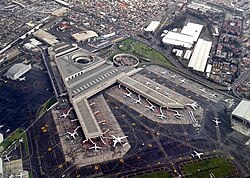
Mexico City International Airport
Buenavista railway station
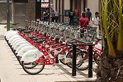
Bicycles available for rental in Zona Rosa
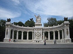
The monument "To the Meritorious Benito Juárez", Mexico City
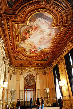
The Receptions Hall at the Museo Nacional de Arte
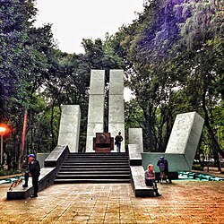
The monument to Lázaro Cárdenas (outstretched hand welcoming Spanish immigrants), Parque España
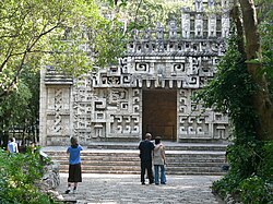
A reconstruction of the entrance to the Hochob temple in the National Museum of Anthropology
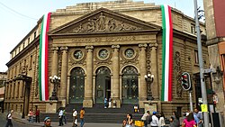
The City Theatre, built in 1918
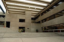
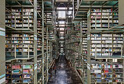
The Biblioteca Vasconcelos
The Televisa headquarters in Mexico City
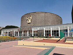
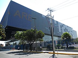
Mexico City Arena
Mexico City Arena
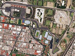
The Autódromo Hermanos Rodríguez

What are the common nicknames for Mexico City?

The most common nickname is La Ciudad de los Palacios (The City of Palaces). Colloquially, residents are often referred to as Chilangos.

Is Mexico City a UNESCO World Heritage Site?

Yes. Several parts of the city hold this distinction, including the Historic Center, Xochimilco, and the Central University City Campus of the UNAM.

What is the climate like in Mexico City?

The city has a subtropical highland climate. It is generally temperate, with a rainy season during the summer and a drier, cooler season during the winter.

How does the city manage its large population?

The city uses an Integrated Mobility System (Sistema de Movilidad Integrada) which includes the Metro, Tren Ligero, Metrobús, and Cablebús to facilitate movement across its vast urban and metropolitan areas.

What is the elevation of Mexico City?

The average elevation of the city is 2,240 meters (7,350 feet), though certain areas like Ajusco reach much higher at 3,930 meters.