Meanders: The Science of Sinuous River Channels
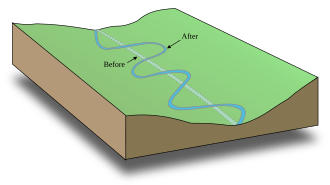
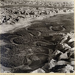
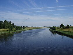
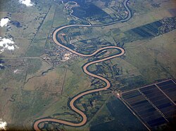
A meander is a series of regular, sinuous curves found in the channel of a stream or river. These winding paths are not random; they are the result of a continuous cycle of erosion and deposition. As water flows, it erodes the outer bank and deposits sediment on the inner bank, causing the channel to migrate across its floodplain over time.
This dynamic process creates a shifting landscape known as a meander belt—the zone within which a stream periodically moves. Typically, this belt ranges from 15 to 18 times the width of the channel. Because meanders can migrate downstream relatively quickly, they often present significant civil engineering challenges for municipalities trying to maintain stable bridges and roads.
Key Facts
- Sinuosity: A river is officially classified as "meandering" if its sinuosity index (channel length divided by valley length) is 1.5 or higher.
- Erosion vs. Deposition: Erosion occurs at the outer concave bank, while deposition occurs at the inner convex bank.
- Meander Geometry: On average, a meander's length is 11 times the channel width.
- Helicoidal Flow: The corkscrew-like water movement that drives the migration of the river bend.
- Meander Belt: The area of the floodplain where the river channel shifts, usually 15–18 times the channel width.
The Physics of Meandering

Helicoidal Flow
The primary driver of a meander is helicoidal flow. This is a corkscrew-like motion where water moves from the outer bank toward the inner bank along the stream bed, then circles back toward the outer bank near the surface. This flow pattern increases the water's capacity to carry sediment on the outer bank (leading to erosion) and reduces it on the inner bank (leading to deposition).
Fluid Dynamics and Pressure
When water enters a bend in a channel, the sidewalls create a pressure gradient that forces the fluid to follow the curve. For a stream to develop meanders, secondary flow (the movement perpendicular to the main current) must dominate over irrotational flow. While Albert Einstein once suggested that the Earth's Coriolis force might trigger this imbalance, modern science suggests that other physical forces are far more significant in producing meanders.
Geometry and Measurement
To analyze a meandering stream, geologists use a down-valley axis—a hypothetical straight line that represents the overall direction of the stream. The degree of winding is quantified by the sinuosity index, calculated as the ratio of the actual channel length to the straight-line distance of the valley.
| Metric/Category | Value/Range | Description |
|---|---|---|
| Sinuous River | 1.0 < Index < 1.5 | Slightly curved path |
| Meandering River | Index ≥ 1.5 | Distinctly winding path |
| Average Meander Length | 11 × Channel Width | Typical length of a single loop |
| Radius of Curvature | 2–3 × Channel Width | Radius at the apex of the bend |
The behavior of these curves also depends on the environment. If a river has a floodplain, the meanders are considered free and can move anywhere within that plain. Without a floodplain, the meanders are fixed.
Associated Landforms
Cut Banks and Point Bars
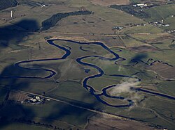
The outer curve of a meander is called the cut bank (or river cliff). Because helicoidal flow keeps this area clear of loose sediment, the bank is subjected to constant erosion, often becoming a vertical cliff. Conversely, the inner curve forms a point bar, where slower water deposits sand and silt.
Scroll-Bars and Slip-off Slopes
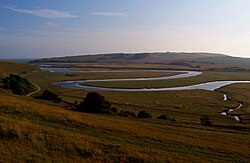
As a meander migrates laterally, it creates scroll-bars—asymmetrical ridges and swales on the inside of the bend. This process, called lateral accretion, results in sediment patterns that fine upward, as larger grains are deposited during high-energy floods and smaller grains follow as the water recedes.
The slip-off slope is the gently sloping inner bank. In freely meandering rivers, this is where point bars accumulate; in entrenched rivers, it refers to the sloping bank of the loop.

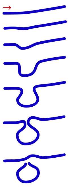
Cutoffs and Oxbow Lakes
Over time, the neck of a meander may become so narrow that the river breaches it, creating a meander cutoff. The abandoned loop is then isolated from the main channel, forming a crescent-shaped oxbow lake. Eventually, these may dry up to become meander scars.
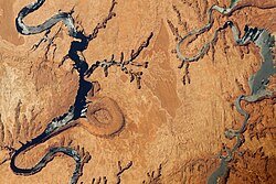
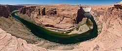
Incised Meanders
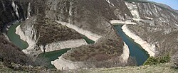
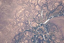
In some cases, meanders are carved deeply into bedrock rather than shifting across a soft floodplain. These are known as incised meanders, often seen in canyons where the river has cut vertically into the earth while maintaining its winding path.
Frequently Asked Questions
What is the difference between a sinuous river and a meandering river?
The difference is based on the sinuosity index. A river is considered sinuous if its index is between 1 and 1.5, while it is classified as meandering if the index is 1.5 or higher.
How does a point bar form?
A point bar forms on the inner, convex bank of a meander. Because the water velocity is lower on the inside of the curve, the river loses the energy required to carry sediment, causing it to be deposited there.
What causes a river to form an oxbow lake?
An oxbow lake forms when a meander loop becomes so extreme that the river cuts through the narrow neck of the bend to take a shorter, straighter path. The old loop is cut off from the main flow and becomes a stagnant lake.
What is helicoidal flow?
Helicoidal flow is a corkscrew-like water movement in a river bend. Water moves toward the inner bank along the bottom and returns to the outer bank near the surface, driving the erosion of the cut bank and the growth of the point bar.
Are all meanders free to move?
No. Meanders are "free" if they exist within a broad floodplain. However, if the river is entrenched in bedrock or lacks a floodplain, the meanders are "fixed" and cannot migrate laterally.