Maryland historyChesapeake BayBaltimoreAnnapolisMaryland geography

Maryland: A Comprehensive Overview of the Old Line State

Discovering Maryland: The Old Line State Often referred to by its many nicknames—including the "Old Line State," "Free State," and "America in Miniature"—Maryland is a state of profound h...

Discovering Maryland: The Old Line State

Often referred to by its many nicknames—including the "Old Line State," "Free State," and "America in Miniature"—Maryland is a state of profound historical significance and diverse natural beauty. From the bustling urban corridors of the Washington–Baltimore metropolitan area to the serene tidal wetlands of the Chesapeake Bay, Maryland offers a unique blend of coastal charm and mountainous landscapes.

Admitted to the Union on April 28, 1788, as the 7th state, Maryland has played a central role in the American story. Today, it remains a vital hub of commerce, culture, and governance, boasting a median household income of $98,700 (as of 2023), ranking it 3rd in the nation.

A 1732 map of Maryland[28]
: A 1732 map of Maryland[28]

Key Facts

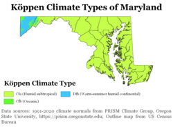
Köppen climate types of Maryland, using 1991–2020 climate normals
  • Capital: Annapolis
  • Largest City: Baltimore
  • State Motto: "Fatti maschii, parole femine" (Strong Deeds, Gentle Words)
  • Total Area: 12,407 sq mi (including 2,633 sq mi of water)
  • Population: Approximately 6,265,347 (2025 estimate)
  • State Flower: Black-eyed Susan
  • State Bird: Baltimore Oriole

Geography and Natural Regions
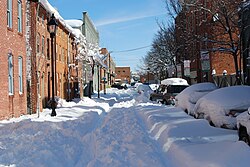
Winter on Lancaster Street in Baltimore's Fells Point

Maryland's geography is remarkably varied, earning it the title "America in Miniature." The state's terrain transitions from the Atlantic coastal plain to the rolling hills of the Piedmont and finally to the rugged Appalachian Mountains in the west.
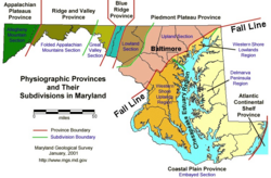
Physical regions of Maryland
: Physical regions of Maryland

The Coastal Plain and Chesapeake Bay

A defining feature of the state is the Chesapeake Bay, the largest estuary in the United States and the largest water feature in Maryland. The bay's tidal wetlands provide critical habitats for diverse flora and fauna.
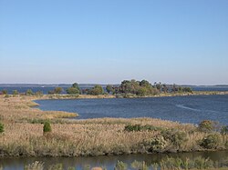
Tidal wetlands of the Chesapeake Bay, the largest estuary in the nation and the largest water feature in Maryland
: Tidal wetlands of the Chesapeake Bay, the largest estuary in the nation and the largest water feature in Maryland

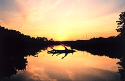
The coastline includes popular destinations like Ocean City, a renowned beach resort along the Atlantic Ocean. Further inland, the Patuxent River offers scenic views of marshlands at locations such as Cardinal Cove.
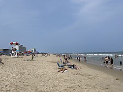
Ocean City, a beach resort along the Atlantic Ocean and a popular tourist destination in Maryland
: Ocean City, a beach resort along the Atlantic Ocean and a popular tourist destination in Maryland
Sunset over a marsh at Cardinal Cove on the Patuxent River
: Sunset over a marsh at Cardinal Cove on the Patuxent River

Mountains and Rivers

In Western Maryland, the landscape shifts to heavily forested mountains. Deep Creek Lake serves as a centerpiece for the Appalachian region in Garrett County.
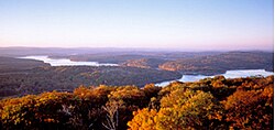
Western Maryland is known for its heavily forested mountains. A panoramic view of Deep Creek Lake and the surrounding Appalachian Mountains in Garrett County.
: Western Maryland is known for its heavily forested mountains. A panoramic view of Deep Creek Lake and the surrounding Appalachian Mountains in Garrett County.

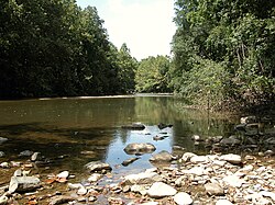
Waterways also play a vital role in the state's character. The Potomac River features the dramatic Great Falls, while the Patapsco River flows through the Patapsco Valley State Park and forms Baltimore's Inner Harbor.
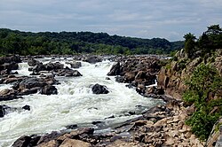
Great Falls on the Potomac River
: Great Falls on the Potomac River
Patapsco River includes the Thomas Viaduct and is part of the Patapsco Valley State Park; the river forms Baltimore's Inner Harbor as it empties into the Chesapeake Bay.
: Patapsco River includes the Thomas Viaduct and is part of the Patapsco Valley State Park; the river forms Baltimore's Inner Harbor as it empties into the Chesapeake Bay.

History and Heritage

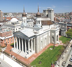
Baltimore Basilica, the first Catholic cathedral built in the U.S.

Maryland's history is deeply intertwined with the development of the United States. From its early colonial settlements and religious history to its pivotal role in the American Civil War, the state has witnessed transformative events.
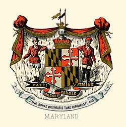
The historical coat of arms of Maryland in 1876
: The historical coat of arms of Maryland in 1876

During the Civil War, Maryland was a site of intense conflict. The Battle of Antietam in 1862 remains one of the bloodiest battles in American history, resulting in nearly 23,000 casualties.
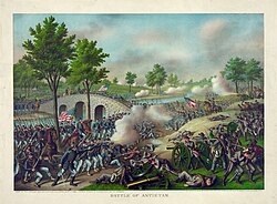
The Battle of Antietam in 1862, one of the bloodiest battles of the American Civil War, with nearly 23,000 casualties
: The Battle of Antietam in 1862, one of the bloodiest battles of the American Civil War, with nearly 23,000 casualties

The state also holds significant military history, such as the bombardment of Fort McHenry during the Battle of Baltimore, an event that inspired "The Star-Spangled Banner."
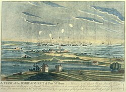
The bombardment of Fort McHenry in the Battle of Baltimore, which inspired "The Star-Spangled Banner"
: The bombardment of Fort McHenry in the Battle of Baltimore, which inspired "The Star-Spangled Banner"

Urban Evolution

Baltimore, the state's largest city, has undergone significant changes over the centuries. While it serves as a major economic engine, it has also faced challenges, such as the devastating Great Baltimore Fire of 1904.
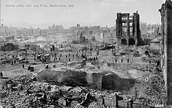
The ruins left by the Great Baltimore Fire of 1904
: The ruins left by the Great Baltimore Fire of 1904

Demographics and Society

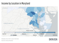
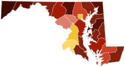
A map showing Maryland's median income by county. Data is sourced from the 2014 ACS five-year estimate report, published by the U.S. Census Bureau

Maryland is a diverse state with a population concentrated largely in the Washington–Baltimore combined statistical area. As of 2020, the population was approximately 6.17 million, with significant ethnic and racial variety.
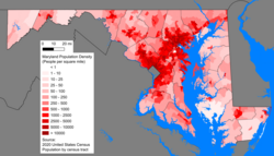
Maryland population distribution map; Maryland's population is concentrated mostly in the Washington–Baltimore combined statistical area.
: Maryland population distribution map; Maryland's population is concentrated mostly in the Washington–Baltimore combined statistical area.
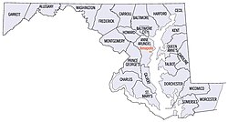
Maryland's counties
Maryland's counties
: Maryland's counties
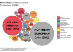
Ethnic origins in Maryland
: Ethnic origins in Maryland
Largest alone or in any combination ethnic origin by county in Maryland, per the 2020 census [126]
: Largest alone or in any combination ethnic origin by county in Maryland, per the 2020 census [126]
Map of counties in Maryland by racial plurality, according to 2020 U.S. census findings Non-Hispanic White 40–50% 50–60% 60–70% 70–80% 80–90% 90%+ Black or African American 50–60% 60–70%
: Map of counties in Maryland by racial plurality, according to 2020 U.S. census findings

Culture and Religion

The cultural fabric of Maryland is woven from various religious and ethnic threads. While Protestantism is the largest religious group at 52%, Catholicism (15%) and those identifying with no religion (23%) also represent significant portions of the population.

The state's identity is further expressed through its unique symbols, including the Blue Crab (crustacean), the Smith Island cake (food), and the Skipjack (ship).

Black-eyed susans, the state flower, grow throughout much of the state.[59]
: Black-eyed susans, the state flower, grow throughout much of the state.[59]
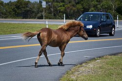
A feral Chincoteague Pony on Assateague Island on Maryland's Atlantic coastal islands
: A feral Chincoteague Pony on Assateague Island on Maryland's Atlantic coastal islands

Economy and Infrastructure

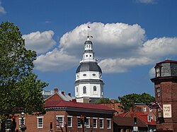
The Maryland State House in Annapolis dates to 1772, and houses the Maryland General Assembly and offices of the governor.

Maryland's economy is multifaceted, supported by sectors such as agriculture, biotechnology, healthcare, and tourism. Agriculture remains a vital component of the state's economic landscape.
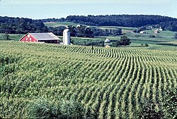
Agriculture is an important part of Maryland's economy.
: Agriculture is an important part of Maryland's economy.

Transportation is a cornerstone of the state's connectivity. The Port of Baltimore is a major maritime hub, and the state is well-served by rail, including the historic Baltimore and Ohio Railroad line and the Northeast Corridor.
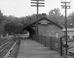
Ellicott City Station, on the original Baltimore and Ohio Railroad line, the oldest remaining passenger station in the nation. The rail line is still used by CSX Transportation for freight trains, and the station is now a museum.
: Ellicott City Station, on the original Baltimore and Ohio Railroad line, the oldest remaining passenger station in the nation. The rail line is still used by CSX Transportation for freight trains, and the station is now a museum.

The Chesapeake Bay Bridge serves as a critical link, connecting Maryland's Eastern and Western Shores.
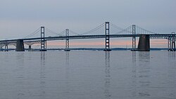
The Chesapeake Bay Bridge, which connects Maryland's Eastern and Western Shores
: The Chesapeake Bay Bridge, which connects Maryland's Eastern and Western Shores

Sports and Entertainment

Sports enthusiasts flock to Maryland to visit professional venues, including Oriole Park at Camden Yards and M&T Bank Stadium, home to the Baltimore Orioles and Baltimore Ravens, respectively.
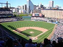
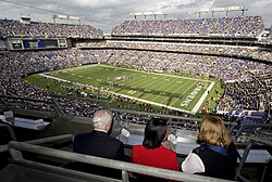
Oriole Park at Camden Yards, home of the Baltimore Orioles
: Oriole Park at Camden Yards, home of the Baltimore Orioles
M&T Bank Stadium, home of the Baltimore Ravens
: M&T Bank Stadium, home of the Baltimore Ravens

Summary of Maryland State Data

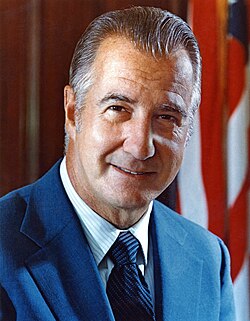
Spiro Agnew, the 39th Vice President of the United States during the Nixon administration, the highest-ranking political leader from Maryland since the nation's founding
Quick Reference: Maryland State Statistics
Category Details
Capital City Annapolis
Largest City Baltimore
Total Area 12,407 sq mi
Water Percentage 21%
Median Household Income $98,700 (2023)
Highest Elevation 3,360 ft (Hoye-Crest)

Frequently Asked Questions

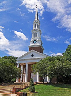
Memorial Chapel at the University of Maryland, Maryland's flagship university
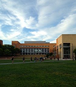
University of Maryland, Baltimore County

What are the nicknames for Maryland?

Maryland is known by several nicknames, most notably the "Old Line State," "Free State," "Little America," and "America in Miniature."

What is the state capital of Maryland?

The capital of Maryland is Annapolis, which also houses the Maryland State House.

What is the largest city in Maryland?

Baltimore is the largest city in the state.

What are some of Maryland's official state symbols?

Maryland has many symbols, including the Baltimore Oriole (bird), the Black-eyed Susan (flower), and the Blue Crab (crustacean).

How diverse is the population of Maryland?

Maryland is a diverse state. According to 2020 census data, the population includes significant White, Black or African American, Asian, and Hispanic communities, with a growing number of residents from various international birthplaces.