Kuala Lumpur: The Dynamic Heart of Malaysia

Kuala Lumpur: The Dynamic Heart of Malaysia

Kuala Lumpur, the federal capital of Malaysia, is a sprawling metropolis where colonial history meets futuristic ambition. Located at the confluence of the Gombak and Klang rivers, the city has evolved from a modest settlement established in 1857 into a global hub of commerce, culture, and architecture. Today, it serves as the center of the Klang Valley, a vast urban area that blends high-density city living with lush tropical landscapes.
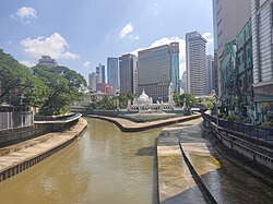
Jamek Mosque at the confluence of the Gombak (left) and Klang rivers. The earliest settlement of Kuala Lumpur developed on the eastern side of the river bank (to the right in this picture).

Key Facts

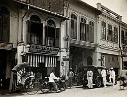
An arcade of shophouses with a road sweeper at work in the street of Kuala Lumpur, c. 1915–1925.
  • Status: Federal capital city and Federal Territory.
  • Population: Approximately 2,075,600 in the city center and over 8.8 million in the metro area (2024).
  • Economy: Metro GDP of RM 697 billion (US$ 152.643 billion) with a very high Human Development Index (HDI) of 0.899.
  • Landmarks: Home to the Merdeka 118 (second-tallest building globally) and the iconic Petronas Twin Towers.
  • Climate: Tropical rainforest climate characterized by high humidity and significant annual rainfall.

The Evolution of a Capital
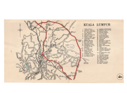
Map of Kuala Lumpur in 1951

The early years of Kuala Lumpur were marked by rapid growth driven by trade and resource extraction. In the late 19th century, the city's landscape was dominated by wooden structures and atap roofs. This changed in 1884 when regulations enacted by Swettenham mandated the use of bricks and tiles, fundamentally transforming the city's aesthetic and durability.
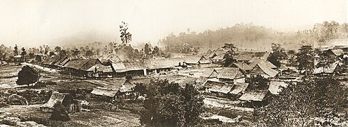
Part of a panoramic view of Kuala Lumpur c. 1884. To the left is the Padang. The buildings were mostly constructed of wood and atap before regulations enacted by Swettenham in 1884 required buildings to use bricks and tiles. The appearance of Kuala Lumpur transformed rapidly in the following years due to the building regulations.

The 20th century brought further modernization. The construction of the railway was a pivotal catalyst for growth, facilitating the movement of goods and people. This era saw the rise of grand administrative buildings, such as the Sultan Abdul Samad Building, designed in the Moorish style to house the government offices of the Federated Malay States.
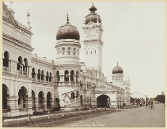
The Government Offices of the Federated Malay States (Now the Sultan Abdul Samad Building) facing the Padang, c. 1900

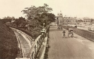
The construction of railway spurred the growth of the city. The first headquarters of the Federated Malay States Railways (now the National Textile Museum) near the F.M.S. Government Offices in the distance, c. 1910.

As the city expanded, it weathered the turmoil of World War II, including the Japanese advance in December 1941, before eventually transitioning into the administrative heart of an independent Malaysia. By 1972, it officially attained city status, and in 1974, it was transferred to federal jurisdiction as a Federal Territory.
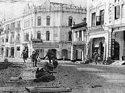
Japanese troops advancing up High Street (now Jalan Tun H S Lee) in Kuala Lumpur in December 1941 during World War II.

Geography and Climate

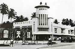
The Majestic Theatre on Pudu Road was an early pioneer in Kuala Lumpur's cinema scene. It was converted into an amusement park in the 1990s and demolished in 2009.

Kuala Lumpur is situated in a tropical rainforest climate (Af), meaning it experiences warm temperatures and rainfall throughout the year. The city's elevation averages 63 meters, though its highest point, Bukit Dinding, reaches 302 meters.

The weather is characterized by consistent daily means around 27-28°C. Rainfall is heaviest in November, often exceeding 350mm, while the driest periods typically occur around June and July.
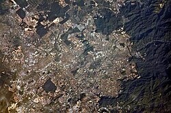
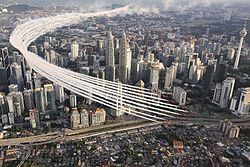
A satellite view of Klang Valley or Greater Kuala Lumpur

Governance and Urban Structure

Kuala Lumpur cityscape in 1987 before KLCC was created. The race track in the foreground was replaced by the Petronas Towers and KLCC Park in 1998.[76]

The city is managed by the Kuala Lumpur City Hall (Dewan Bandaraya Kuala Lumpur), with the Mayor serving as the primary local authority. Politically, the city is divided into several parliamentary seats, including Kepong, Batu, and Bukit Bintang, ensuring representation in the Malaysian Parliament.

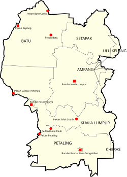
Administratively, the city is organized into various districts and mukims (sub-districts). These include areas such as Mukim Batu, Mukim Petaling, and Mukim Ampang, which help manage the dense urban population across the 243 square kilometers of the federal capital.
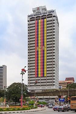
Kuala Lumpur City Hall

Mukims of the Federal Territory of Kuala Lumpur

Demographics and Culture

The British Red Arrows flying over the city in 2016

Kuala Lumpur is a melting pot of ethnicities and religions, reflecting Malaysia's multicultural identity. The population is primarily composed of Bumiputras (47.7%), Chinese (41.6%), and Indians (10.0%). This diversity is mirrored in the city's spiritual landscape, where Islam is the predominant religion (45.3%), followed by Buddhism (32.3%) and Hinduism (8.2%).
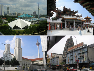
Clockwise from top left: Masjid Negara, Thean Hou Temple, Sri Mahamariamman Temple, St. John's Cathedral

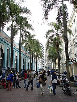
This cultural richness is evident in the city's architecture and public spaces, from the historic Jamek Mosque, built in 1909, to the modern pedestrian malls near the Central Market.
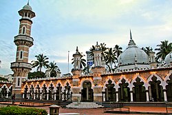
Jamek Mosque (Masjid Jamek) is one of the oldest mosques still standing in Kuala Lumpur, built in 1909.

A pedestrian mall by the Central Market

Modern Architecture and Infrastructure
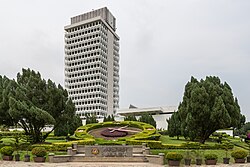
The Malaysia Parliament House (Bangunan Parlimen Malaysia), located at the end of Jalan Parlimen.

The skyline of Kuala Lumpur is one of the most recognizable in the world. The Kuala Lumpur City Centre (KLCC) area is the crown jewel of this development, featuring the 50-acre KLCC Park and the Petronas Towers. More recently, the city has reached new heights with the Merdeka 118, the tallest building in Southeast Asia.
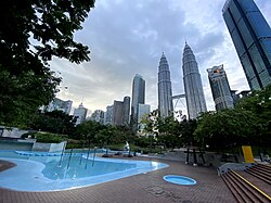
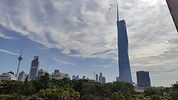
The Kuala Lumpur City Centre (KLCC) in 2020

The Merdeka 118 is the tallest building in Southeast Asia; it is also the second-tallest building in the world, after the Burj Khalifa.

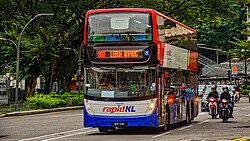
To support its massive population, the city has invested heavily in transportation. This includes an extensive urban rail network, double-deck buses, and the development of new financial districts like the Tun Razak Exchange (TRX), which features business-friendly MRT stations.
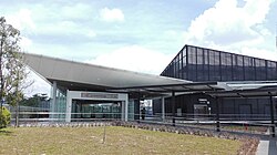
Entrance A of the Tun Razak Exchange MRT station. The station is designed to look more business-friendly, located in and named after a new financial district under development, TRX.

Double-deck buses crossing at Jalan Ampang

City Overview Summary

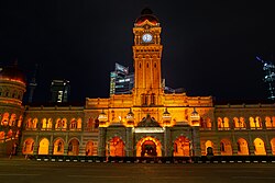
Sultan Abdul Samad Building, a historic building designed in the Moorish style and formerly housed various government offices.
Kuala Lumpur Quick Reference Guide
Category Detail
Established 1857
City Status 1 February 1972
Official Languages Malay, English
Metro Population 8,815,630 (2024)
Metro GDP RM 697 Billion
Highest Point Bukit Dinding (302m)

Frequently Asked Questions

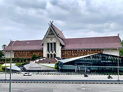
The National Museum of Malaysia, located along Jalan Damansara.
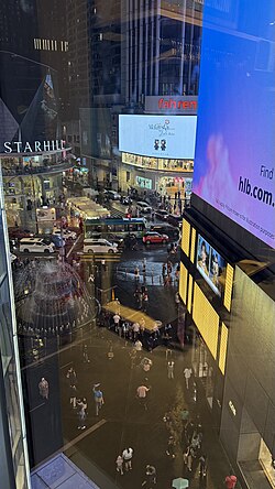
Bukit Bintang 26
Bukit Bintang area taken from the Pavillion complex 9 May 2026
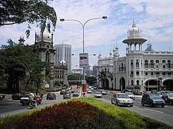
The Kuala Lumpur Railway Station (right) contrasts with Keretapi Tanah Melayu (left) Administration Building, a darker, similarly Mughal-styled building. Both were designed by A. B. Hubback
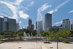
KLCC Park is a 50-acre urban park located in the city centre.
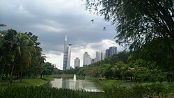
University of Malaya City View.
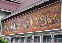
Frieze depicting Malaysian history at the National Museum.
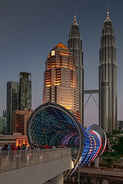
The Saloma Link seen at dusk, with the Petronas Tower behind it.
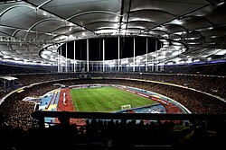
Bukit Jalil National Stadium is an all-seater multi-purpose stadium that was built in January 1995.
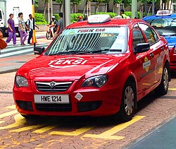
Typical public cab in Kuala Lumpur
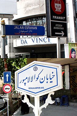
Esfahan Street (formerly Jalan Selat, Straits Road) in Kuala Lumpur (above) and Kuala Lumpur Avenue in Isfahan (below)

What is the significance of the Merdeka 118 building?

The Merdeka 118 is a landmark of modern engineering, holding the title of the tallest building in Southeast Asia and the second-tallest building in the world, surpassed only by the Burj Khalifa.

How has the city's architecture changed over time?

Kuala Lumpur transitioned from early wooden and atap structures to brick and tile buildings after 1884. It later embraced Moorish styles for government buildings and eventually shifted toward the futuristic steel and glass skyscrapers seen in the KLCC area.

What are the primary ethnic groups in Kuala Lumpur?

The city is multicultural, with the population consisting mainly of Bumiputras (47.7%), Chinese (41.6%), and Indians (10.0%).

What is the climate like in Kuala Lumpur?

The city has a tropical rainforest climate, meaning it is generally hot and humid year-round with significant rainfall, particularly peaking in November.

Which government body manages the city?

Kuala Lumpur is managed by the Kuala Lumpur City Hall (Dewan Bandaraya Kuala Lumpur), which oversees local government administration.

References

  1. UK: /ˌkwɑːlə ˈlʊmpʊər, -pər/ KWAH-lə LUUM-poor, -⁠pər, also US: /- lʊmˈpʊər/ -⁠ luum-POOR; Malaysian: [ˈkualə, ˈkwa-, ˈlumpo(r), -la -, -pʊ(r),-puɾ,-poɾ]
  2. Malay: Wilayah Persekutuan Kuala Lumpur
  3. "Malaya Celebrates, 1959". British Pathé. Archived from the original on 7 September 2013. Retrieved 2 August 2013.
  4. City of Kuala Lumpur Act 1971 (PDF). Malaysian Government. 1 February 1972.
  5. "Laporan Kiraan Permulaan 2010". Jabatan Perangkaan Malaysia. p. 27. Archived from the original on 8 July 2011. Retrieved 24 January 2011.