Kent: A Comprehensive Overview of England's Historic County
Located in the South East of England, Kent is a non-metropolitan and ceremonial county with a rich tapestry of history, diverse geography, and significant economic importance. Known for its iconic landscapes and ancient roots, Kent serves as a vital gateway to the United Kingdom.

From the ancient descriptions found in classical texts to its modern role as a major transport hub, Kent remains one of the most recognizable regions in the British Isles. Whether through its historic cathedral cities or its bustling coastal towns, the county offers a unique blend of tradition and contemporary life.
Key Facts

- County Town: Maidstone
- Area: 3,738 km² (1,443 sq mi)
- Population: Approximately 1,931,684 (2024 estimate)
- Ceremonial County: Kent
- Non-metropolitan County: Kent
- Major Landmark: The White Cliffs of Dover
Geography and Climate
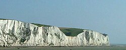
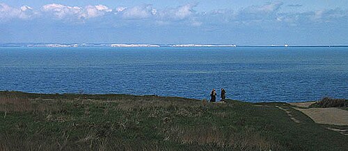
Kent's landscape is varied, ranging from the coastal heights of the English Channel to the marshlands and valleys that define its interior. One of its most famous geographical features is the White Cliffs of Dover, which provide a striking natural boundary between England and France.
The county also features unique areas such as Romney Marsh, a coastal plain that has undergone significant historical changes through drainage and embanking processes.
The climate in Kent, specifically observed in areas like Wye, is characterized by moderate temperatures. Summer months typically see mean daily maximums around 21.9°C (71.4°F), while winter temperatures average a daily mean of approximately 4.5°C (40.1°F). Precipitation is distributed throughout the year, with October often seeing the highest average rainfall.
History and Etymology
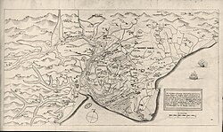
The history of Kent is documented through various eras, from ancient manuscripts to the detailed historical descriptions of the 16th century. Early records, such as those in Strabo's Geographica, provide a glimpse into how the region was perceived in antiquity.
: Kent in Strabo's Geographica (1.4.3) from a 10th-century manuscript.

In the 16th century, William Lambarde produced Perambulation of Kent, which stands as the first published county history. This work helped formalize the historical understanding of the region's boundaries and heritage.


Governance and Administration
Kent is managed through several administrative layers. The Kent County Council oversees the non-metropolitan area, while the ceremonial county includes various districts. The county town and administrative headquarters is located in Maidstone.
The county is divided into several districts, including:
- Sevenoaks
- Dartford
- Gravesham
- Tonbridge and Malling
- Medway
- Maidstone
- Tunbridge Wells
- Swale
- Ashford
- Canterbury
- Folkestone and Hythe
- Thanet
- Dover

Economy and Infrastructure
The economy of Kent is diverse, with significant contributions from the service sector, industry, and agriculture. As of recent historical data, the service sector has consistently represented the largest portion of the regional Gross Value Added (GVA).
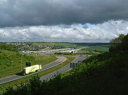
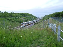
Transport infrastructure is a cornerstone of the Kentish economy. The county is a critical node for both road and rail travel, connecting the UK to mainland Europe via high-speed links.
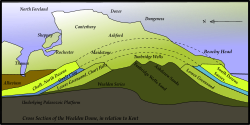
The geological makeup of the region also influences local development and industry, as seen in the various cross-sections of the county's terrain.
Culture and Landmarks
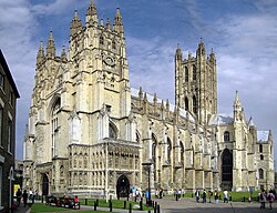
Kent is home to several world-renowned landmarks and cultural sites. Canterbury Cathedral is a primary spiritual and architectural center, famous for its historical significance and stunning stained glass.
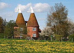
The county's architectural heritage is further enriched by structures like Rochester Castle and the traditional oast houses, which were historically used for drying hops.
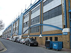
Sports also play a vital role in local culture, with Priestfield Stadium serving as the home for Gillingham FC, the county's only Football League team.
Summary of County Data
| Category | Ceremonial County Value | Non-Metropolitan County Value |
|---|---|---|
| Area | 3,738 km² | 3,544 km² |
| Population (2024) | 1,931,684 | 1,639,029 |
| Density | 517/km² | 462/km² |
Frequently Asked Questions
What is the largest town in Kent?
Maidstone serves as the county town and is the largest town in Kent.
Which county is Kent part of?
Kent is located within the South East region of England in the United Kingdom.
What are the White Cliffs of Dover?
The White Cliffs of Dover are a famous natural landmark located on the coast of Kent, overlooking the English Channel.
How is Kent governed?
Kent is governed by the Kent County Council for non-metropolitan areas, and it is also a ceremonial county with a Lord Lieutenant.
What is the main economic driver in Kent?
While diverse, the service sector has historically been a major component of Kent's regional Gross Value Added (GVA).