Interstate 95 in Florida
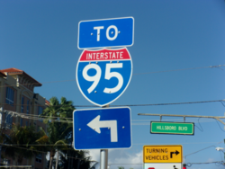
Interstate 95 (I-95) serves as the primary transportation artery for Florida's Atlantic Coast. Stretching from the bustling urban center of Miami to the Georgia state line at the St. Marys River near Becker, this highway is a critical link for commerce, tourism, and daily commuting. Spanning 382.15 miles, Florida's segment of I-95 is the longest portion of the interstate within any single state.
The route connects several of Florida's most prominent cities, including Fort Lauderdale, West Palm Beach, Port St. Lucie, Titusville, and Daytona Beach, before terminating its Florida journey in Jacksonville.
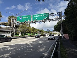
Key Facts
- Total Length: 382.15 miles (615.01 km).
- Maintenance: Managed by the Florida Department of Transportation (FDOT).
- Southern Terminus: US 1 / SR 913 in Miami.
- Northern Terminus: Georgia state line in Kingsland.
- Completion Date: Fully completed on December 19, 1987.
- Designations: Unsigned as State Road 9A for the first 12.848 miles and State Road 9 for the remainder.
Route Description and Major Hubs
Miami and the South Florida Corridor
I-95 begins at a partial interchange with US 1 near 32nd Road in southern Miami. As it moves north through downtown, it utilizes the SR 970 freeway to distribute traffic. Key junctions in this region include the Midtown Interchange, where I-395 leads to the MacArthur Causeway and SR 836 provides access to Miami International Airport.
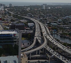
Further north, the highway crosses I-195 and SR 112. A significant landmark is the Golden Glades Interchange, a complex junction providing access to Florida's Turnpike (SR 91) and the Palmetto Expressway (SR 826). In this region, I-95 runs parallel to the Seaboard–All Florida Railway, supporting CSX, Tri-Rail, and Amtrak services.

Fort Lauderdale to the Space Coast
In Fort Lauderdale, I-95 interchanges with I-595, linking travelers to the Fort Lauderdale–Hollywood International Airport and Port Everglades. As the route progresses through West Palm Beach, it provides access to President Donald J. Trump International Airport via SR 704.
A unique characteristic of the route occurs between Jupiter and Palm City, where I-95 and Florida's Turnpike run immediately adjacent to one another for 17 miles. After navigating through Martin and St. Lucie counties, the highway enters the Space Coast region in Brevard County, passing through Melbourne, Viera, and Cocoa, with SR 528 providing a vital link to Cocoa Beach and Cape Canaveral.
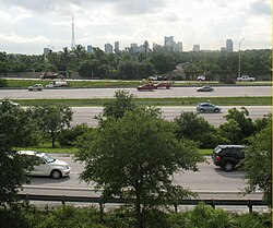
Daytona Beach and Jacksonville
Upon entering Volusia County, I-95 meets the eastern terminus of I-4 in Daytona Beach. The highway then continues through Flagler and St. Johns counties into Duval County. In Jacksonville, the route crosses the St. Johns River via the Fuller Warren Bridge, which was rebuilt in 2002.
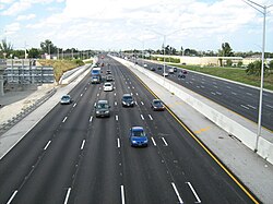
The highway intersects the I-295 beltway twice—once south of central Jacksonville and again north of downtown. It also meets the national eastern terminus of I-10. This urban stretch is known for significant congestion, with daily traffic often exceeding 100,000 vehicles.
Express Lanes and Traffic Management
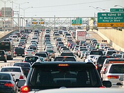
To combat congestion, High-Occupancy Toll (HOT) lanes have been implemented between I-395 in Miami and Broward Boulevard in Fort Lauderdale. These lanes utilize electronic tolling with variable pricing based on peak hours. However, registered hybrid vehicles and travelers with three or more passengers may use these lanes for free.
Historical Development
First signed in 1959, I-95 was developed in stages. The first section opened in Jacksonville in 1960, followed by a segment in Miami in 1961. By 1970, the stretch from Miami to Fort Lauderdale was complete. In 2002, the state transitioned from sequential exit numbering to a mileage-based system to improve navigation.
The Treasure Coast Missing Link
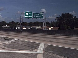
For years, a gap existed in the I-95 alignment through the Treasure Coast. Originally, the Bureau of Public Roads planned to use a portion of Florida's Turnpike. However, in 1973, a separate alignment was authorized. Environmental concerns and resistance from Martin County officials delayed the completion of this independent route for 15 years. The "missing link" finally opened on December 19, 1987, allowing uninterrupted travel from Miami to Georgia.
Route Summary Table
| Feature | Details |
|---|---|
| Total Length | 382.15 miles |
| Major Cities Served | Miami, Fort Lauderdale, West Palm Beach, Daytona Beach, Jacksonville |
| Key Interchanges | Golden Glades, I-10 (Jacksonville), I-4 (Daytona Beach) |
| Special Lanes | HOT lanes (Miami to Fort Lauderdale) |
| State Designations | SR 9A (partial), SR 9 (partial) |
Frequently Asked Questions
What are the HOT lanes on I-95?
High-Occupancy Toll (HOT) lanes are express lanes between Miami and Fort Lauderdale that charge a variable electronic toll based on traffic levels, though they remain free for hybrid vehicles and carpools with three or more people.
Why was there a "missing link" in the Treasure Coast?
The gap was caused by resistance from Martin County officials regarding environmental impact and urban growth, which delayed the construction of a separate alignment from Florida's Turnpike until 1987.
How did the exit numbering system change?
In 2002, I-95 switched from a sequential numbering system (where exits are numbered 1, 2, 3, etc.) to a mileage-based system, where the exit number corresponds to the mile marker.
Where does I-95 end in Florida?
The Florida portion of I-95 ends at the Georgia state line at the St. Marys River, just north of milemarker 380 in Nassau County.