Interstate 35: A Comprehensive Overview of America's Major North-South Corridor
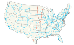
Interstate 35, commonly known as I-35, serves as a vital artery in the central United States. As a primary north-south route within the Interstate Highway System, it facilitates massive amounts of commerce and travel across six different states. Stretching from the Mexican border in Texas to the shores of Lake Superior in Minnesota, this highway is a cornerstone of American infrastructure.
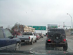
While often described as a border-to-border highway, I-35 does not touch an international border directly. Its southern terminus is located at a traffic signal in Laredo, Texas, just north of the Rio Grande. To the north, the highway concludes in Duluth, Minnesota, providing connections toward Canada via Minnesota State Highway 61 or U.S. Route 53.
Key Facts
- Total Length: Approximately 1,569.06 miles (2,525.16 km).
- States Traversed: Texas, Oklahoma, Kansas, Missouri, Iowa, and Minnesota.
- Rank: The 9th longest Interstate and the 3rd longest north-south Interstate in the U.S.
- Major Splits: The route divides into I-35E and I-35W in both the Dallas–Fort Worth metroplex and the Minneapolis–Saint Paul area.
- Completion: The full route was completed in 1982.
Route Breakdown by State
Texas: From the Rio Grande to the Red River
The journey begins in Laredo, where I-35 shares a 17-mile concurrency with US 83. As it moves north through Webb, La Salle, and Frio counties, it enters San Antonio, where it is known as the Pan Am Expressway. In San Antonio, it intersects with major routes including I-10 and I-37.
Continuing northeast, the highway reaches Austin, known locally as the Interregional Highway. This section is notable for having previously included an unusual at-grade railroad crossing before modern expansions. After passing through Waco—where it is called the Jack Kultgen Freeway—the highway reaches Hillsboro. At this point, the route splits into two distinct branches: I-35E and I-35W, which serve the Dallas–Fort Worth metroplex.
Oklahoma and Kansas: The Central Stretch
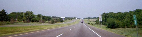
In Oklahoma, I-35 connects several major urban centers, including Norman, Oklahoma City, and Edmond. In downtown Oklahoma City, the highway features a major junction with I-40 and spurs into I-235. Historically, the route in Oklahoma was kept close to US 77 due to local legislative and community efforts.
As the highway enters Kansas, the segment between the Oklahoma state line and Emporia is part of the Kansas Turnpike. This section passes through the scenic Flint Hills and serves the city of Wichita. After Emporia, the highway becomes a free section, eventually entering the Kansas City Metropolitan Area.
Missouri and Iowa: Crossing the Heartland
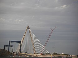
I-35 enters Missouri near Kansas City, where it joins I-70 and I-29. A notable landmark in this region is the Bond Bridge, which carries both I-29 and I-35 across the Missouri River.
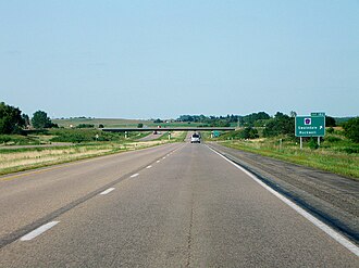
Moving into Iowa, the highway runs parallel to US 69 for much of its course. In Des Moines, I-35 shares a 12-mile overlap with I-80. A portion of the highway in Iowa is also recognized as part of the Avenue of the Saints, a corridor connecting Clear Lake, Iowa, to St. Paul, Minnesota.
Minnesota: The Northern Terminus
In the Twin Cities area of Minneapolis and Saint Paul, the highway splits once more into I-35E and I-35W. The I-35E segment includes a specific section between MN 5 and I-94 where trucks weighing over 9,000 pounds are prohibited, a design compromise intended to protect the historic Crocus Hill neighborhood.
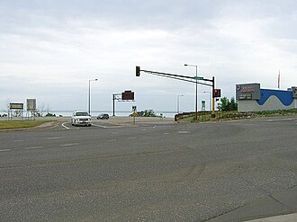
The highway reaches its final destination in Duluth. Travelers navigating the "Can of Worms" interchange (I-35 and I-535/US 53) must be cautious of complex lane drops and signals. The route officially ends at an intersection with London Road (MN 61).
Summary of Interstate 35 Route Data
| Feature | Details |
|---|---|
| Total Distance | 1,569.06 miles |
| Southern Terminus | Laredo, TX (US 83 / I-69W) |
| Northern Terminus | Duluth, MN (MN 61) |
| States Covered | TX, OK, KS, MO, IA, MN |
| Major Splits | Dallas/Fort Worth & Minneapolis/St. Paul |
Frequently Asked Questions
Does I-35 connect to the Mexican border?
While it begins in Laredo, Texas, very close to the border, the highway terminates at a traffic signal in Laredo rather than directly at the international boundary.
What is the "NAFTA Superhighway" controversy?
This refers to a proposed project called the Trans-Texas Corridor, which included a plan (TTC-35) to build a massive parallel route to I-35. The project faced significant opposition regarding its impact on commerce and security, and the Texas Legislature eventually repealed the authority to establish it in 2011.
Why does I-35 split into two different routes?
I-35 splits into I-35E and I-35W in the Dallas–Fort Worth area and again in the Minneapolis–Saint Paul area to serve both sides of these major metropolitan centers.
Is any part of I-35 a toll road?
Yes, the section of I-35 between the Oklahoma state line and Emporia, Kansas, is part of the Kansas Turnpike.
What is the "Can of Worms" in Duluth?
The "Can of Worms" is a local nickname for the complex interchange where I-35 meets I-535 and US 53 in Duluth, Minnesota.