Articles/Illinois: A Comprehensive Overview of the Land of Lincoln
Illinois historyChicago economyIllinois demographicsIllinois geographyLand of Lincoln
Illinois: A Comprehensive Overview of the Land of Lincoln
Illinois: A Comprehensive Overview of the Land of Lincoln Known affectionately as the Land of Lincoln and the Prairie State, Illinois stands as a cornerstone of the American Midwest. From...
Illinois: A Comprehensive Overview of the Land of Lincoln
Known affectionately as the Land of Lincoln and the Prairie State, Illinois stands as a cornerstone of the American Midwest. From the bustling, global metropolis of Chicago to the fertile agricultural heartlands, the state offers a diverse tapestry of economic power, rich history, and varied landscapes. Whether you are interested in its political significance, its complex demographic makeup, or its vital role in national industry, Illinois provides a profound look into the American experience.
Mississippian copper plate found at the Saddle Site in Union County, Illinois: Mississippian copper plate found at the Saddle Site in Union County, Illinois
Key Facts
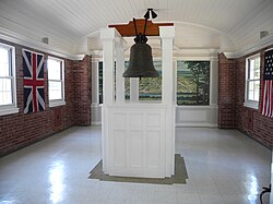
The bell donated by King Louis XV in 1741 to the French mission at Kaskaskia. It was later called the "Liberty Bell of the West", after it was rung to celebrate U.S. victory in the Revolution
Capital: Springfield
Largest City: Chicago
Statehood: Admitted to the Union on December 3, 1818 (21st state)
Motto: State Sovereignty, National Union
Population: Approximately 12.7 million (2025 estimate)
Total Area: 57,914 sq mi
History and Statehood
In 1818, Illinois became the 21st U.S. state. The southern portion of Illinois Territory was admitted as the state of Illinois, and the rest was joined to Michigan Territory.
The history of Illinois stretches back long before European arrival, evidenced by archaeological finds such as the Mississippian copper plates. Following European exploration and settlement, the region transitioned through various territories before officially becoming the 21st U.S. state in 1818.
Illinois in 1718, approximate modern state area highlighted, from Carte de la Louisiane et du cours du Mississipi by Guillaume de L'Isle[26]: Illinois in 1718, approximate modern state area highlighted, from Carte de la Louisiane et du cours du Mississipi by Guillaume de L'Isle[26]
The 19th century was a transformative era for the state. During the Civil War, Illinois played a pivotal role, with troops mobilizing from key locations like Cairo. The state also saw significant social shifts; for instance, Edward Coles, the second Governor of Illinois, famously brought his slaves from Virginia to grant them their freedom upon arrival in the state.
The second Governor of Illinois, Edward Coles brought his slaves from his home state of Virginia to give them their freedom when they arrived in Illinois.: The second Governor of Illinois, Edward Coles brought his slaves from his home state of Virginia to give them their freedom when they arrived in Illinois.
Union troops embarking at Cairo on January 10, 1862: Union troops embarking at Cairo on January 10, 1862
As the state grew, so did its political infrastructure. The movement of the state capital to the centrally located Springfield in 1839 marked a significant milestone in the state's administrative development.
Old State Capitol: Abraham Lincoln and other area legislators were instrumental in moving the state capitol to centrally located Springfield in 1839.: Old State Capitol: Abraham Lincoln and other area legislators were instrumental in moving the state capitol to centrally located Springfield in 1839.
The Illinois State Capitol in Springfield: The Illinois State Capitol in Springfield
Geography and Climate
Police and protesters at the 1968 Democratic National Convention in Chicago.
Illinois features a varied topography. The state's elevation ranges from its highest natural point, Charles Mound, at 1,235 feet in the northwestern Driftless Area, to its lowest point at 279 feet near the confluence of the Ohio and Mississippi Rivers near Cairo.
Charles Mound, the highest natural point in Illinois at 1,235 feet (376 m) above sea level, is located in the Driftless Area in the northwestern part of the state.: Charles Mound, the highest natural point in Illinois at 1,235 feet (376 m) above sea level, is located in the Driftless Area in the northwestern part of the state.
At 279 feet (85 m) above sea level,[65] the lowest elevation point in the state is located near Cairo and the confluence of the Ohio and Mississippi Rivers.: At 279 feet (85 m) above sea level,[65] the lowest elevation point in the state is located near Cairo and the confluence of the Ohio and Mississippi Rivers.
Sunset on the Garden of the Gods Wilderness, part of the Shawnee National Forest in southern Illinois.: Sunset on the Garden of the Gods Wilderness, part of the Shawnee National Forest in southern Illinois.
The climate of Illinois is categorized by various Köppen climate types, influencing the state's vast agricultural productivity and seasonal weather patterns.
Köppen climate types of Illinois: Köppen climate types of Illinois
Demographics and Society
Rising waters in Alton in 1993.
Illinois is home to a diverse population, with a 2025 estimate of 12,719,141 residents. The state's ethnic makeup is multifaceted, with significant populations of White (non-Hispanic), Hispanic or Latino, Black or African American, and Asian residents. Language diversity is also notable, with English being the primary language, followed by Spanish.
Illinois 2020 Population Density Map: Illinois 2020 Population Density Map
Ethnic origins in IllinoisLargest alone or in any combination ethnic origin by county in Illinois, per the 2020 census: Ethnic origins in IllinoisLargest alone or in any combination ethnic origin by county in Illinois, per the 2020 census
Map of counties in Illinois by racial plurality, per the 2020 U.S. census Non-Hispanic White 40–50% 50–60% 60–70% 70–80% 80–90% 90%+: Map of counties in Illinois by racial plurality, per the 2020 U.S. census Non-Hispanic White 40–50% 50–60% 60–70% 70–80% 80–90% 90%+
Little Village neighborhood in Chicago: Little Village neighborhood in Chicago
Illinois population pyramid: Illinois population pyramid
The state's urban centers, particularly the Chicagoland area, serve as cultural hubs, hosting diverse religious and community landmarks, such as the Baháʼí House of Worship in Wilmette.
The Baháʼí House of Worship in Wilmette, Illinois: The Baháʼí House of Worship in Wilmette, Illinois
Economy and Industry
A COVID-19 safety message in the Chicago Loop
The Illinois economy is a powerhouse driven by several key sectors:
Agriculture: A major producer of crops, supported by advanced machinery from companies like John Deere.
Manufacturing: Including automotive production, such as the Rivian plant in Normal.
Finance: Chicago serves as a global financial center, housing the Federal Reserve Bank of Chicago and the Chicago Board of Trade.
Energy: A mix of nuclear power, wind power, and traditional resources.
A John Deere combine harvester on an Illinois farm; the company is headquartered in Moline, Illinois.: A John Deere combine harvester on an Illinois farm; the company is headquartered in Moline, Illinois.
Rivian Automotive Plant in Normal.: Rivian Automotive Plant in Normal.
The Federal Reserve Bank of Chicago, one of twelve Federal Reserve Banks, at the heart of Chicago's financial center.: The Federal Reserve Bank of Chicago, one of twelve Federal Reserve Banks, at the heart of Chicago's financial center.
Trading floor in the Chicago Board of Trade Building: Trading floor in the Chicago Board of Trade Building
Byron Nuclear Generating Station in Ogle County: Byron Nuclear Generating Station in Ogle County
Average annual wind power distribution for Illinois, 50 m (160 ft) height above ground (2009): Average annual wind power distribution for Illinois, 50 m (160 ft) height above ground (2009)
Transportation and Infrastructure
Illinois municipalities
Illinois boasts a sophisticated transportation network. This includes major international hubs like O'Hare International Airport, extensive highway systems, and a robust public transit network featuring the CTA in Chicago and various regional commuter services like Metra.
Concourse B inside O'Hare International Airport, one of the world's busiest airports: Concourse B inside O'Hare International Airport, one of the world's busiest airports
Two IDOT-owned Amtrak locomotives at Chicago Union Station: Two IDOT-owned Amtrak locomotives at Chicago Union Station
Metra commuter train in Chicago: Metra commuter train in Chicago
CTA Blue Line train in Chicago: CTA Blue Line train in Chicago
A boat on the South Branch of the Chicago River: A boat on the South Branch of the Chicago River
Summary of State Profile
Illinois counties by GDP (2021)
Quick Reference: Illinois State Statistics
Category
Details
Total Area
57,914 sq mi
Highest Point
Charles Mound (1,235 ft)
Lowest Point
Confluence of Ohio/Mississippi Rivers (279 ft)
Median Household Income (2023)
$80,300
Primary Time Zone
Central Time (UTC−06:00)
Frequently Asked Questions
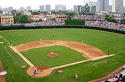
Location of the Illinois BasinSoldier Field is home to the National Football League's Chicago BearsWrigley Field is home to Major League Baseball's Chicago CubsGies Memorial Stadium and State Farm Center at the University of Illinois Urbana-ChampaignChicagoland SpeedwayIllinois House of Representatives2024 U.S presidential election results by county in IllinoisAn Illinois welcome sign along U.S. Route 67 in Rock IslandStandard license plate introduced in 2017Hydrogen-powered MTD bus in Champaign–UrbanaUnion Pacific freight train in Elmhurst
What is the capital of Illinois?
The capital of Illinois is Springfield.
What are the nicknames for Illinois?
Illinois is commonly known as the Land of Lincoln, the Prairie State, and the Inland Empire State.
What is the largest city in Illinois?
Chicago is the largest city in the state.
When did Illinois become a state?
Illinois was admitted to the Union on December 3, 1818, as the 21st state.
What is the highest point in Illinois?
The highest natural point is Charles Mound, which reaches an elevation of 1,235 feet.


![Illinois in 1718, approximate modern state area highlighted, from Carte de la Louisiane et du cours du Mississipi by Guillaume de L'Isle[26]](/images/df/c8/dfc84b6425e3d1c19e7710ff5fa384f85a5ecad69c13235487a419eeaa836016.jpg)


![At 279 feet (85 m) above sea level,[65] the lowest elevation point in the state is located near Cairo and the confluence of the Ohio and Mississippi Rivers.](/images/cc/81/cc81940352f0644124293b395f58a45ddc075a3562f8ecfc2808ace80750657e.jpg)