The Gyeongbu Expressway: South Korea's Vital Arterial Route
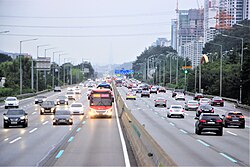
The Gyeongbu Expressway is the most significant and heavily traveled expressway in South Korea. Serving as a primary artery for the nation, it connects the capital city of Seoul to the major port city of Busan, passing through several key urban centers along the way. Designated as Route 1, its numbering reflects its status as the most important road in the country's highway network. It is also a vital component of the Asian Highway Network (AH 1).
Spanning a total length of 416 kilometers (258 miles), the expressway facilitates the movement of people and goods between major cities including Suwon, Daejeon, Gumi, Daegu, Gyeongju, Ulsan, and Busan. Most of the route maintains a posted speed limit of 110 km/h (68 mph), which is strictly monitored by speed cameras.
Key Facts
- Total Length: 416 km (258 mi)
- Route Number: 1 (Asian Highway AH 1)
- Termini: Seoul (North) to Busan (South)
- Established: 1968
- Primary Speed Limit: 110 km/h (68 mph)
- Major Cities Served: Seoul, Daejeon, Daegu, Ulsan, and Busan
A History of Rapid Development
The origins of the Gyeongbu Expressway can be traced back to 1967, when South Korean President Park Chung Hee proposed its construction as an election pledge. Inspired by the German Autobahn (a high-speed divided highway system), the project was intended to modernize the nation's infrastructure.
Construction officially began in February 1968 under the direction of Park Myung-keun. The project was completed in stages throughout the late 1960s:
- December 1968: The Seoul-Suwon and Suwon-Osan segments opened.
- September 1969: The Anseong-Cheonan segment opened.
- December 1969: The Cheonan-Daejeon and Busan-Daegu (via Gyeongju) segments opened.
- July 1970: The final, mountainous Daejeon-Daegu segment opened, completing South Korea's first long-distance limited-access expressway.
As the nation grew, so did the need for more capacity. Starting in December 1987, work began to widen the road to six lanes, with some sections expanding to 8 or 10 lanes by 1996. In 2001, South Korea reorganized its highway system to model it after the United States' Interstate Highway System. While the Gyeongbu Expressway retained its "Route 1" designation, its kilometer markers were updated to progress from south to north.
Infrastructure and Traffic Management
To manage the massive volume of traffic, several specialized facilities and systems have been implemented over the decades.
Bus-Only Lanes
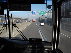
To improve transit efficiency, bus-only lanes (similar to High-Occupancy Vehicle or HOV lanes) were introduced. Initially established in 1995 for holiday periods between the northern terminus and Sintanjin, the system evolved. By 2008, enforcement became a daily occurrence between 6 AM and 10 PM, with specific weekday and weekend hours adjusted to manage commuter flow.
Interchanges and Service Areas
The expressway is supported by a vast network of Interchanges (IC), Junctions (JC), Tollgates (TG), and Service Areas (SA). These facilities allow drivers to transition between different highways and access essential services like fuel and rest stops.
| Location | Major Facility Type | Key Connections / Notes |
|---|---|---|
| Seoul (North End) | Interchange (IC) | Yangjae IC (Connects to National Route 47) |
| Seongnam | Junction (JC) | Pangyo JC (Connects to Seoul Ring Expressway) |
| Yongin | Interchange (IC) | Giheung IC |
| Cheonan | Junction (JC) | Cheonan JC (Connects to Nonsan-Cheonan Expressway) |
| Daejeon | Junction (JC) | Biryong JC (Connects to Tongyeong-Daejeon Expressway) |
| Daegu | Junction (JC) | Dongdaegu JC (Connects to Jungang Expressway) |
| Busan (South End) | Interchange (IC) | Geumjeong IC (Connects to National Route 7) |
The Seoul Urban Segment
A unique aspect of the Gyeongbu Expressway is its northernmost stretch. In December 2002, the Korea National Expressway Corporation transferred control of the 9 km segment between Yangjae and Hannam Bridge to the City of Seoul. This section is officially designated as Seoul Special Metropolitan Route 06 (Gyeongbu Urban Expressway), though it is still widely referred to as the Gyeongbu Expressway on traffic broadcasts.
Because this segment passes through dense urban areas, the speed limits are lower than the rest of the highway, ranging from a minimum of 50 km/h to a maximum of 80 km/h.
Frequently Asked Questions
What is the total length of the Gyeongbu Expressway?
The entire length of the expressway from Seoul to Busan is 416 kilometers (258 miles).
How fast can you drive on the Gyeongbu Expressway?
The posted speed limit is typically 110 km/h (68 mph) for most of the route, though it is lower in certain sections (100 km/h) and in the Seoul urban segment (maximum 80 km/h).
Is the Gyeongbu Expressway part of an international network?
Yes, it is designated as part of the Asian Highway Network, specifically AH 1.
What happened to the northernmost 9 km of the expressway?
In 2002, control of the stretch between Yangjae and Hannam Bridge was transferred from the Korea Expressway Corporation to the City of Seoul, where it is now managed as Seoul Special Metropolitan Route 06.
Are there special lanes for buses?
Yes, bus-only lanes are utilized to manage traffic, with specific enforcement hours in place to assist commuters and holiday travelers.