Georgetown, Guyana: The Garden City of the Caribbean
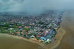
Perched on the Atlantic coast at the mouth of the Demerara River, Georgetown serves as the vibrant capital and largest city of Guyana. Known affectionately as the "Garden City of the Caribbean," it is the nation's primary hub for retail, administration, and financial services, contributing a significant portion of Guyana's GDP. With a population of 125,683 as of the 2022 census, the city blends colonial charm with its role as a modern political powerhouse.
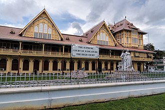
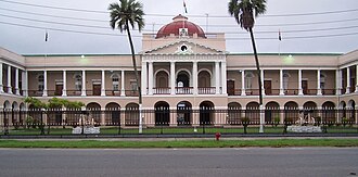
As the administrative heart of the country, Georgetown houses all executive government departments. This includes the Parliament Building, the Legislative Building, and the Court of Appeals—the highest judicial court in Guyana. It is also home to the State House, the official residence of the head of state, and the offices of the head of government. Beyond national borders, the city hosts the Secretariat of the Caribbean Community (CARICOM), an international organization comprising 15 member-states and five associate partners.
Key Facts
- Established: 1781
- Nickname: Garden City of the Caribbean
- Population: 125,683 (2022 Census)
- Elevation: 0 meters (at sea level)
- Key Role: Administrative, financial, and retail center of Guyana
- International Hub: Headquarters of CARICOM
A Journey Through History
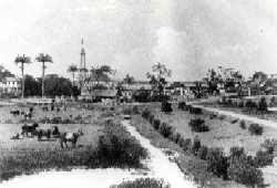
The origins of Georgetown date back to 1748, when Governor Laurens Storm van 's Gravesande established a guard post at the mouth of the Demerara River. English planters soon settled around this post, evolving the area into a small village. The town was formally established in 1782 during a brief French occupation of the Dutch colony of Demerara.
The settlement's name has evolved alongside its colonial rulers. Originally called Longchamps, it was renamed Stabroek in 1784 after Nicholaas Geelvinck, the Lord of Stabroek and President of the Dutch West India Company. By 1807, the population had grown rapidly to approximately 8,500 people, aided by American traders who built a wharf known as American Stelling.
![Wesleyan Mission Premises, George-Town, Demerara (1850)[3]](/images/a0/9f/a09fbe1b66391457f29a9ad8dbd9636d59e105a679907dff21c2f4b1a5902d7a.jpg)
In 1812, under British rule, the town was renamed Georgetown in honor of King George III. It officially achieved city status on August 24, 1842, during the reign of Queen Victoria. While the city has flourished, it has also faced adversity, most notably "The Great Fire" of 1945, which caused widespread destruction across the urban landscape.
Geography and Climate
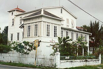
Georgetown is situated on the east bank of the Demerara River estuary on flat coastal plains. The surrounding landscape consists of marshy swamps, savannah lands, and expansive cane fields. Because the land is exceptionally low—reaching as far as 2 meters (6 ft) below high tide level—the city relies on a sophisticated engineering system for survival.
To prevent flooding, the city is protected by a massive seawall and an intricate network of canals equipped with kokers (sluices) that drain excess water. The city layout follows a north-south and east-west grid, interlaced with these drainage canals.
Tropical Weather Patterns
The city experiences a tropical climate (Af) without a true dry season; precipitation exceeds 60 mm (2.4 in) every month. Temperatures are moderated by North-East trade winds from the North Atlantic, meaning temperatures rarely exceed 31 degrees Celsius. Annual precipitation is high, with data from the Botanical Gardens showing an average of 2,281.1 mm (89.81 in) per year.
Infrastructure and Transportation
Georgetown is connected to the world through a variety of transport modes. Air travel is primarily handled by the Cheddi Jagan International Airport, located 41 kilometers south of the city. For regional and CARICOM flights, the Eugene F. Correia International Airport provides a closer alternative and supports offshore oil and gas exploration via helicopter services.
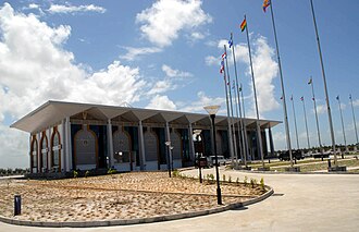
On land, the city has seen significant modernization. The first four-lane East Coast Highway was completed in 2005, and the Heroes Highway was commissioned in 2022 to reduce congestion on the East Bank of Demerara. For river crossings, the Demerara Harbour Bridge has long been the primary link to Region 3, supplemented by the Bharrat Jagdeo Demerara River Bridge commissioned on October 5, 2025.
Water transport remains vital, as Georgetown is a seaport and the Demerara River is navigable by oceangoing vessels for approximately 100 km upriver.
City Landmarks and Points of Interest
The city is renowned for its wooden colonial architecture and historic markets. The western-central area is the heart of the city's heritage, featuring Independence Square, Promenade Gardens, and the State House (built in 1852). Other notable sites include the National Library, the Bank of Guyana, and the Walter Roth Museum of Anthropology.
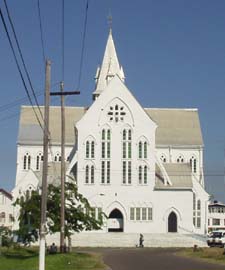
Further south, visitors can find the neo-Gothic City Hall (1889), the Victoria Law Courts (1887), and the Parliament Building. The Stabroek Market (1792), with its iconic cast-iron clock tower, remains a dominant feature of the skyline. In the northern coastal area, the Umana Yana—a traditional conical thatched building built by Wai-Wai Amerindians—stands as a symbol of indigenous craftsmanship.
Cultural and Sporting Hubs
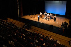
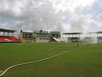
The National Cultural Centre is the primary venue for the city's performing arts, while the Theatre Guild of Guyana, opened in 1957, is the nation's oldest theatrical facility. In sports, Georgetown has a rich history of hosting international basketball via CaribeBasket and is home to the Providence Stadium, which replaced Bourda as the national test venue for cricket.
City Overview Summary
| Category | Details |
|---|---|
| Government Type | Mayor-Council |
| Total Area | 37 km² (14 sq mi) |
| Population Density | 3,400/km² |
| Time Zone | UTC-04:00 (GYT) |
| Key Infrastructure | Seawall, Kokers, Demerara River Bridge |
Frequently Asked Questions
Why is Georgetown called the "Garden City of the Caribbean"?
The city earned this nickname due to its lush greenery and the integration of gardens and boulevards within its urban layout.
How does Georgetown prevent flooding given its low elevation?
The city uses a combination of a protective seawall to keep the Atlantic Ocean out and a network of canals with kokers (sluices) to drain excess rainwater and runoff.
What is the significance of the Umana Yana?
The Umana Yana is a conical thatched building constructed by Wai-Wai Amerindians using traditional techniques. It was originally built for the 1972 Non-Aligned Foreign Ministers Conference.
Which international organization is headquartered in Georgetown?
The Secretariat of the Caribbean Community (CARICOM), which includes 15 member-states and five associate partners, is based in the city.
What are the main airports serving the city?
The Cheddi Jagan International Airport is the major hub located 41 km south, while the Eugene F. Correia International Airport handles regional, international, and CARICOM flights closer to the city center.