Gateshead: A Journey Through History, Topography, and Modern Regeneration
Situated on the southern bank of the River Tyne in Tyne and Wear, Gateshead is a vibrant town that serves as a major hub within the North East of England. From its rapid expansion during the Industrial Revolution to its modern-day urban regeneration, Gateshead offers a unique blend of dramatic landscapes and evolving urban spaces.
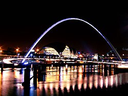
The town's identity is deeply tied to its geography. Unlike the flat, low-lying Team Valley on its western edge, Gateshead is defined by its rising topography. The land climbs 230 feet (70 m) from the Quays to the town centre, reaching an elevation of 525 feet (160 m) at Queen Elizabeth Hospital in Sheriff Hill. These heights provide spectacular views, with lookouts at Windmill Hills and Windy Nook offering vistas across the Tyne valley toward Newcastle, Sunderland, and the North Sea.
Key Facts
- Location: Tyne and Wear, England, on the southern bank of the River Tyne.
- Population: 196,151 (based on the 2021 census).
- Topography: Rises from the Quays to 525 feet (160 m) at Sheriff Hill.
- Governance: Part of the Gateshead Metropolitan Borough.
- Major Landmarks: Angel of the North, Saltwell Park, and The Glasshouse.
A History of Growth and Change
Gateshead experienced significant transformation during the Industrial Revolution. Between 1801 and 1901, the population surged by over 100,000 residents, causing the town to expand steadily toward the south.
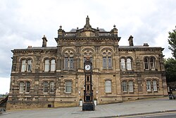
In recent decades, the focus has shifted toward urban regeneration—the process of improving decaying urban areas through investment and development. A major milestone in this effort was the £150 million Trinity Square development, which opened in May 2013. This project brought new student accommodation, a cinema, a health centre, and various retail shops to the heart of the town.
Urban Evolution and Landmarks
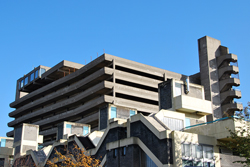
The town's skyline and landscape have been shaped by various architectural eras. While some areas reflect former brutalist styles, newer developments continue to reshape the town centre. One notable piece of local history is the Trinity Centre Car Park, which was famously featured in the film Get Carter before its demolition.
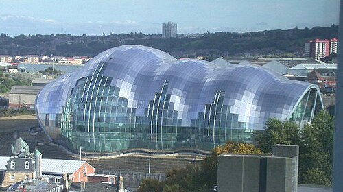
Today, the town is home to iconic structures such as the Angel of the North, a world-renowned landmark, and The Glasshouse International Centre for Music, which stands as a testament to the region's cultural importance.

Geography and Climate
The diverse landscape of Gateshead includes both industrial zones and protected green spaces. The town maintains a green belt—an area of open land around a city where building is restricted—to safeguard the countryside from encroachment and prevent unrestricted urban sprawl.
The climate in Gateshead is typical of the North East, with moderate temperatures throughout the year. Summer months see mean daily maximums around 19-20°C (66-68°F), while winter temperatures typically hover around 7°C (45°F).
Local Districts and Areas
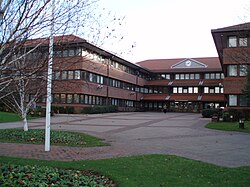
Gateshead is composed of numerous distinct wards and districts, ranging from the bustling town centre to residential areas like Low Fell and Saltwell. Key areas include:
- Bridges' ward: The central urban core.
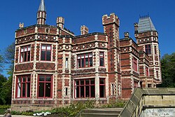
- Saltwell's ward: Home to the historic Saltwell Park and Saltwell Towers.
- Team Valley: A prominent trading estate on the western edge.
- Whickham and Low Fell: Established residential communities.
Infrastructure and Connectivity
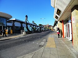
Transport links are vital to the town's economy. While the East Coast Main Line passes through Gateshead on its route between Newcastle and Chester-le-Street, there are currently no stations on this specific line within the town, as local stations like Low Fell and Bensham closed in the mid-20th century. However, National Rail services remain accessible via Dunston and MetroCentre stations.
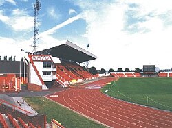
For sports and large-scale events, the Gateshead International Stadium serves as a major venue for the community.
Summary of Gateshead Profile
| Category | Details |
|---|---|
| Metropolitan Borough | Gateshead |
| Metropolitan County | Tyne and Wear |
| Postcode Districts | NE8-NE11 |
| Dialling Code | 0191 |
| Police Force | Northumbria |
| Fire Service | Tyne and Wear |
Frequently Asked Questions
What is the population of Gateshead?
According to the 2021 census, the population of Gateshead was 196,151.
What are the main landmarks in Gateshead?
Notable landmarks include the Angel of the North, The Glasshouse International Centre for Music, Saltwell Towers, and the Gateshead Quays.
How does the topography of Gateshead affect its views?
Because the land rises significantly from the River Tyne to areas like Sheriff Hill, the town offers impressive elevated views over the Tyne valley and across Tyneside.
What is the purpose of the green belt in Gateshead?
The green belt is designed to safeguard the countryside from encroachment and to check unrestricted urban sprawl.
Is there rail access in Gateshead?
Yes, National Rail services are provided by Northern at Dunston and MetroCentre stations, though the East Coast Main Line does not have active stations within the town itself.