Extratropical Cyclones: The Engines of Mid-Latitude Weather
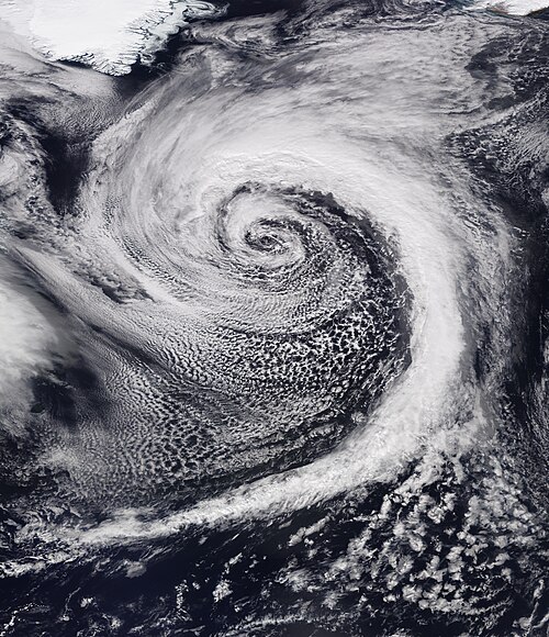
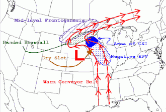
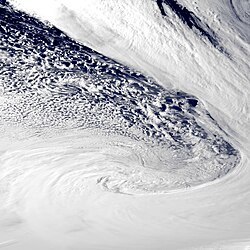
Extratropical cyclones, often referred to as mid-latitude cyclones or wave cyclones, are massive low-pressure systems that serve as the primary drivers of weather across much of the Earth's middle latitudes. Unlike tropical cyclones, which are fueled by warm ocean waters, these systems are characterized by their ability to produce rapid changes in temperature and dew point along broad lines known as weather fronts. These fronts surround the center of the cyclone, marking the boundaries between different air masses.
These large-scale (synoptic) systems are responsible for a vast spectrum of weather conditions. Depending on their intensity and structure, they can bring anything from mild showers and cloudiness to severe hazards such as heavy hail, thunderstorms, blizzards, and even tornadoes.
Key Facts
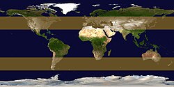
- Location: Typically occur between 30° and 60° latitude from the equator.
- Defining Feature: Presence of weather fronts and rapid temperature/dew point shifts.
- Explosive Growth: A "bomb cyclone" occurs when pressure drops more than 1 millibar per hour.
- Extreme Intensity: The strongest recorded extratropical cyclone reached a pressure of approximately 899.91 mbar in the Southern Ocean.
- Severe Weather: They are linked to major tornado outbreaks and devastating winter storms.
Formation and Cyclogenesis
Extratropical cyclones form within the extratropical regions of the Earth through two primary processes: cyclogenesis (the development of a cyclone) or extratropical transition (when a tropical system evolves into a mid-latitude system). Climatological data shows these systems are incredibly common; between 1979 and 2018, tens of thousands were detected in both the Northern and Southern Hemispheres.
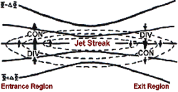
The intensity of a cyclone is often dictated by upper-level atmospheric forces. When atmospheric pressure falls rapidly due to strong upper-level forces, the process is known as explosive cyclogenesis. Meteorologists refer to these rapidly intensifying systems as "bombs." These systems can drop to pressures below 980 millibars under favorable conditions, such as being positioned near a natural temperature gradient like the Gulf Stream or within a specific quadrant of an upper-level jet streak.
The strength of upper-level divergence—a process where air spreads out in the upper atmosphere—is a critical factor. The stronger the divergence above the system, the deeper and more intense the surface cyclone can become.
Structure and Evolution
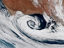
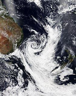
While the internal structure of these cyclones is complex, they are fundamentally defined by their pressure gradients and wind distributions. In the Northern Hemisphere, they typically rotate counter-clockwise, while in the Southern Hemisphere, they spin clockwise.
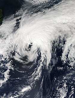
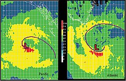
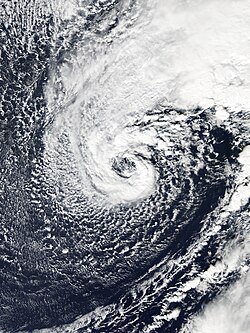
Some cyclones undergo a process called warm seclusion, where a pocket of warm air becomes trapped near the center, often creating a distinct eye-like feature. This can occasionally lead to tropical cyclogenesis, where an extratropical system begins to take on tropical characteristics.
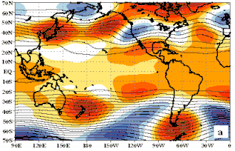
The movement of these systems is often influenced by the prevailing wind patterns, such as a zonal flow, where the dominant wind moves from west to east.
Severe Weather and Historical Impact
The impact of extratropical cyclones can be catastrophic. While many tropical cyclones dissipate as they transition to extratropical status, they often retain hurricane-force or gale-force winds. For example, Hurricane Wilma maintained Category 3-force winds as it began to lose its tropical characteristics in 2005.
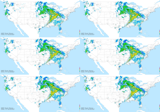
Beyond wind, these systems are major drivers of extreme precipitation. In summer, they may cause devastating floods through torrential rainfall, as seen in the July 2016 North China cyclone. In winter, they are often responsible for massive snowstorms and deadly blizzards.
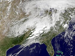
Historically, these systems have been linked to some of the most violent weather events on record, including major tornado outbreaks in 1965, 1974, and 2011. They have also been responsible for historic winter storms that caused hundreds of deaths, such as those in 1888, 1950, and 1993.
Record-Breaking Storms
Meteorologists track the most intense systems to better understand atmospheric limits. The most intense extratropical cyclone ever recorded occurred in the Southern Ocean in October 2022, with an estimated pressure as low as 899.91 mbar.
| Region | Storm/Event | Notable Characteristic |
|---|---|---|
| Southern Ocean | October 2022 Cyclone | Most intense on record (~899.91 mbar) |
| North Atlantic | Braer Storm (1993) | Reached 914 mbar |
| North Pacific | November 2014 Cyclone | Related to Typhoon Nuri; 920 mbar |
| North Atlantic | Hurricane Sandy (2012) | Transitioned extratropical; $65 billion in damage |
Frequently Asked Questions
What is the difference between a tropical cyclone and an extratropical cyclone?
The primary difference lies in their energy source and structure. Tropical cyclones are fueled by warm ocean waters and lack fronts, whereas extratropical cyclones are driven by temperature gradients and are characterized by the presence of weather fronts.
What is a "bomb cyclone"?
A bomb cyclone is a term used for a system undergoing explosive cyclogenesis, which is defined as a drop in atmospheric pressure of more than 1 millibar per hour.
Can an extratropical cyclone cause hurricane-force winds?
Yes. While they differ from tropical hurricanes, extratropical cyclones can certainly produce hurricane-force winds, especially during intense development or when transitioning from a tropical system.
Where do these cyclones most commonly form?
They typically form in the mid-latitude regions of the Earth, generally between 30° and 60° latitude in both the Northern and Southern Hemispheres.
How do extratropical cyclones affect the weather?
They drive much of the weather in the mid-latitudes, producing a wide range of conditions including wind, clouds, rain, snow, thunderstorms, blizzards, and tornadoes.