Emmaus, Pennsylvania: A Journey Through History and Community
Nestled in the heart of Lehigh County, the borough of Emmaus stands as a testament to colonial heritage and steady community growth. Located within the Lehigh Valley—the third-largest metropolitan area in Pennsylvania—Emmaus offers a unique blend of historic charm and modern convenience. Recognized by Money magazine as one of the "Best Places to Live" in the United States in both 2007 and 2009, this borough provides a high quality of life for its residents.
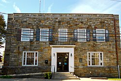
Key Facts
- Established: 1759
- Location: Lehigh County, Pennsylvania, within the Lehigh Valley
- Population: 11,652 (as of the 2020 Census)
- Land Area: 2.90 square miles
- Primary School District: East Penn School District
- Major Access: PA Route 29 and Interstate 476
A Rich Historical Legacy
The roots of Emmaus stretch back to the early 1700s, when German Protestants fleeing religious persecution settled the area. These early settlers were primarily farmers of the Lutheran and Reformed faiths. In 1741, Sebastian Heinrich Knauss and Jacob Ehrenhardt donated the land to the Moravian Church to establish a closed, faith-based village originally known as Salzburg.
By 1759, Emmaus had become one of four leading Moravian communities in the Thirteen Colonies, alongside Bethlehem, Lititz, and Nazareth. In 1761, Bishop August Gottlieb Spangenberg renamed the town Emmaus, drawing inspiration from the Biblical village mentioned in the Gospel of Luke. For nearly a century, the town remained a closed Moravian community.
Historic Landmarks
Emmaus is home to several structures listed on the National Register of Historic Places, preserving its 18th and 19th-century character:
- Shelter House: Built in 1734 by Pennsylvania Dutch settlers, it is the oldest continuously occupied structure in the Lehigh Valley.
- 1803 House: Constructed by Revolutionary patriot militia member Jacob Ehrenhardt, Jr.
- Kemmerer House: A historic farmstead house built between 1840 and 1950.
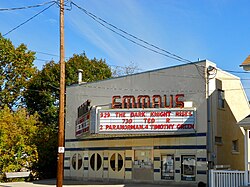
Industrial and Civic Evolution
The 19th century brought significant economic shifts to the borough. The discovery of iron ore led to the rise of the Donaldson Iron Company, which manufactured cast iron products. The arrival of the Reading Company railroad in 1859 facilitated further growth, and the town was officially incorporated as a borough that same year. Beyond iron, Emmaus also became a center for silk and cigar manufacturing.
The community has also shown deep civic commitment. During the American Civil War, residents contributed heavily to the Union army, with approximately 70 percent of the 47th Pennsylvania Infantry Regiment comprising volunteers from the Emmaus and Allentown area. To honor these veterans, the Emaus Honor Roll was erected in 1930.
Geography and Demographics
Emmaus covers a total area of 2.9 square miles, consisting entirely of land. It is situated at an elevation of 436 feet and borders the South Mountain, a large part of the Appalachian mountain range. The climate is classified as a hot-summer humid continental climate, with average temperatures ranging from 28.9°F in January to 73.5°F in July.
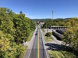
As of the 2020 Census, the population reached 11,652, with a median age of 40.7 years. The borough is highly urbanized, with 99.9% of residents living in urban areas. The community is diverse, with a racial makeup that includes White (83.7%), Hispanic or Latino (10.1%), and various other groups.
Quick Reference Data
| Category | Details |
|---|---|
| County | Lehigh |
| ZIP Codes | 18049, 18098, 18099 |
| Area Code | 610 |
| Major Hospital | Lehigh Valley Hospital–Cedar Crest |
| Primary Airport | Lehigh Valley International Airport |
Modern Life: Commerce and Education
Today, Emmaus is a vibrant hub of local commerce and culture. The borough hosts various community events through the Emmaus Arts Commission, such as the "Art in the Garden" and the annual Halloween parade, which is one of the largest in the Lehigh Valley. Local businesses like Yocco's Hot Dogs maintain a strong regional presence.
Educationally, the borough is served by the East Penn School District. This district manages a comprehensive system including Emmaus High School, two middle schools, seven public elementary schools, and the Seven Generations Charter School.
Frequently Asked Questions
What is the history behind the name Emmaus?
The name was chosen by Moravian Bishop August Gottlieb Spangenberg in 1761. It refers to the Biblical village of Emmaus, where Jesus appeared to his disciples following his resurrection.
How has the spelling of the town changed over time?
From 1759 to 1830, it was spelled "Emmaus." From 1830 to 1938, it used the Pennsylvania Dutch spelling "Emaus." In 1938, the local Rotary Club successfully petitioned to return to the English "Emmaus" spelling to match the King James Version of the Bible.
What are the main transportation links to Emmaus?
Emmaus is accessible via PA Route 29 and is near Interstate 476 (the Pennsylvania Turnpike Northeast Extension). Public transit is provided by LANTA via the Route 104 service.
Is Emmaus a growing area?
While the population within the borough limits has stabilized due to housing reaching the borough lines in all directions, the surrounding areas, such as neighboring Lower Macungie Township, continue to experience growth.
What industries were historically important to Emmaus?
Historically, the town's economy was driven by iron ore mining and processing, as well as silk and cigar manufacturing.