Dasht-e Lut: The Vast Landscapes of Iran's Great Desert
Iran is a central part of the Afro-Asian belt of deserts, a massive climatic stretch that extends from Mauritania in the west all the way to Mongolia in the east. Within this region, Iran's geography is defined by a high plateau encircled by mountains and segmented into various drainage basins.
One of the most prominent of these basins is the Dasht-e Lut. Spanning 480 kilometers (300 mi) in length and 320 kilometers (200 mi) in width, it represents one of the most extreme environments on the Iranian plateau.
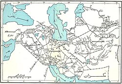
Geography and Climate
Covering approximately 51,800 square kilometers (20,000 sq mi), the Dasht-e Lut is the second largest desert in Iran, surpassed only by the Dasht-e Kavir. The region is characterized by extreme aridity, though it experiences a brief wet season during the spring. During this time, water flows down from the Kerman mountains, but the moisture evaporates quickly, leaving behind a landscape dominated by salt, sand, and rock.
Diverse Geological Formations
The Dasht-e Lut is not a uniform wasteland but a collection of distinct geological zones, each shaped by different natural forces.
The Eastern Salt Flats
The eastern portion of the desert consists of a low plateau covered in salt flats. In these areas, elevations drop to approximately 110 meters above sea level.
The Central Yardangs
The center of the desert features a striking landscape sculpted by wind erosion. This area is characterized by yardangs—parallel ridges and furrows carved into the earth. These formations extend over 150 kilometers (93 mi) and can reach heights of 75 meters (246 ft). This central region is further complicated by a network of sinkholes and ravines.
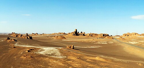
The Southeastern Dunes
To the southeast, the landscape shifts into a vast expanse of sand similar to a Saharan erg (a broad area of desert covered with wind-swept sand). This region hosts some of the tallest sand dunes in the world, reaching heights of up to 300 meters (980 ft).
Key Facts
- Total Area: Approximately 51,800 square kilometers (20,000 sq mi).
- Dimensions: 480 km long by 320 km wide.
- Highest Dunes: Reach up to 300 meters (980 ft) in the southeast.
- Wind Formations: Central ridges (yardangs) reach 75 meters in height.
- Lowest Point: Around 110 meters above sea level in the eastern salt flats.
| Region | Primary Feature | Notable Dimension/Elevation |
|---|---|---|
| East | Salt Flats | ~110 m above sea level |
| Center | Yardangs (Ridges/Furrows) | Up to 75 m high |
| Southeast | Sand Dunes (Erg) | Up to 300 m high |
Frequently Asked Questions
How large is the Dasht-e Lut desert?
The desert covers about 51,800 square kilometers (20,000 sq mi) and measures 480 kilometers by 320 kilometers.
Is Dasht-e Lut the largest desert in Iran?
No, it is the second largest; the Dasht-e Kavir is the largest desert in the country.
What are the tall structures in the center of the desert?
The center contains yardangs, which are parallel ridges and furrows sculpted by the wind, reaching heights of up to 75 meters.
Does it ever rain in the Dasht-e Lut?
Yes, there is a wet season during the spring when water flows from the Kerman mountains, though it dries up quickly.
How high are the sand dunes in the southeast?
The dunes in the southeastern erg are among the tallest in the world, reaching heights of 300 meters (980 ft).