Cook Islands: Governance, Geography, and Strategic Relations
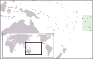
Located in the heart of the South Pacific Ocean, the Cook Islands represent a unique model of political autonomy and environmental stewardship. Comprising fifteen small islands, this nation balances a modest landmass with an expansive maritime domain, maintaining a specialized relationship with New Zealand while carving out its own identity on the global stage.
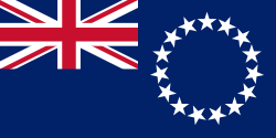
Political Structure and Governance
The Cook Islands operate as a self-governing parliamentary democracy. Its political status is defined as being in free association with New Zealand, a arrangement that allows the islands to manage their own internal affairs while maintaining specific ties to the New Zealand government.
While the Cook Islands have historically relied on New Zealand for certain functions, they have recently adopted an increasingly independent foreign policy, asserting more control over their international relations and diplomatic presence.
Geography and Territory
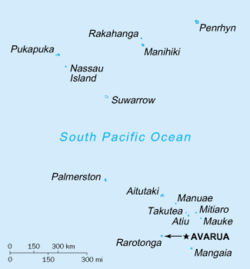
The physical footprint of the Cook Islands is a study in contrasts. The total land area of the fifteen islands is relatively small, totaling 240 square kilometres (92.7 sq mi). However, their influence extends far beyond the shoreline through their Exclusive Economic Zone (EEZ)—the maritime area over which a state has special rights regarding the exploration and use of marine resources.
The Cook Islands EEZ covers a massive 1.8 million square kilometres (0.7 million sq mi) of the South Pacific Ocean, making the nation a significant maritime power in the region.
Population and Infrastructure
The primary hub of activity is the island of Rarotonga. With a population of approximately 10,000 people, it serves as the main population centre and the gateway to the nation, hosting the country's international airport.
Key Facts
- Government: Self-governing parliamentary democracy in free association with New Zealand.
- Land Area: 240 square kilometres.
- Maritime Domain: 1.8 million square kilometres (EEZ).
- Main Island: Rarotonga (Population c. 10,000).
- Defence: Managed by New Zealand in consultation with and at the request of the Cook Islands.
| Category | Detail |
|---|---|
| Number of Islands | 15 |
| Total Land Area | 240 sq km |
| EEZ Area | 1.8 million sq km |
| Primary Population Centre | Rarotonga |
| Political Status | Free association with New Zealand |
Frequently Asked Questions
What is the relationship between the Cook Islands and New Zealand?
The Cook Islands are a self-governing parliamentary democracy in free association with New Zealand. This means they manage their own internal governance while maintaining a formal link to New Zealand.
Who is responsible for the defence of the Cook Islands?
Defence is the responsibility of New Zealand, which acts in consultation with the Cook Islands and upon their specific request.
How large is the Cook Islands' maritime territory?
While the land area is only 240 square kilometres, the Exclusive Economic Zone (EEZ) covers 1.8 million square kilometres of ocean.
Where is the main airport located?
The international airport is located on the island of Rarotonga, which is also the nation's main population centre.
Is the Cook Islands' foreign policy independent?
Yes, in recent times, the Cook Islands have moved toward adopting an increasingly independent foreign policy.