Colorado River basinColorado River tributariesGrand Canyon geologyColorado River water allocationColorado River dams

Colorado River: Geography, History, and the Lifeline of the American West

Colorado River: Geography, History, and the Lifeline of the American West The Colorado River is one of the most significant waterways in North America, carving through vast landscapes and...

Colorado River: Geography, History, and the Lifeline of the American West

The Colorado River is one of the most significant waterways in North America, carving through vast landscapes and serving as a vital resource for millions of people. Stretching approximately 1,450 miles (2,330 km), this river system sustains diverse ecosystems and supports massive human populations across the arid regions of the United States and Mexico.
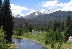
Headwaters of the Colorado River in Rocky Mountain National Park, Colorado

From its high-altitude beginnings in the Rocky Mountains to its eventual mouth in the Gulf of California, the Colorado River is a master of transformation. It has shaped some of the world's most iconic geological features, most notably the Grand Canyon, through millions of years of erosion and sediment transport.

Key Facts
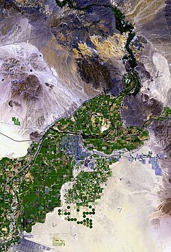
Top-down view of green agricultural lands surrounded by desert
Satellite view of the Colorado River valley near Yuma, Arizona; Interstate 8 runs from left to right just below center.
  • Length: Approximately 1,450 miles (2,330 km).
  • Basin Size: Covers 246,000 square miles (640,000 km²).
  • Source: La Poudre Pass in the Rocky Mountains, Colorado, at an elevation of 10,184 feet.
  • Mouth: The Colorado River Delta, emptying into the Gulf of California.
  • Major Tributaries: The Green River and the Gila River are among its longest and most significant contributors.
  • Primary Use: A vast majority of the basin's water is used for livestock feed production.

Geography and Hydrology
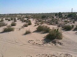
Colorado River as it exits the United States into Mexico beneath the San Luis Colorado-Colonia Miguel Alemán Bridge (September 2009)

The Colorado River basin is a massive drainage area that spans multiple states and countries. It flows through Colorado, Utah, Arizona, Nevada, California, Baja California, and Sonora. The river's journey begins at La Poudre Pass in the Rocky Mountains, where it starts at an elevation of 10,184 feet (3,104 m).
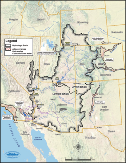
Map showing the Upper and Lower Colorado River Basin, and adjacent areas supplied by Colorado River water.

The river is fed by numerous tributaries—smaller rivers or streams that flow into a larger main stem. Some of the most prominent include the Green River, which is 730 miles long, and the Gila River, which spans 649 miles. These tributaries significantly increase the river's volume and watershed area as it moves downstream.
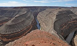
View of a river winding through a series of narrow gorges that dramatically double back on each other
The San Juan River near Mexican Hat, Utah
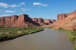
View of a brownish river flowing between vegetated banks, with high bluffs rising in the background
The Green River at Mineral Bottom, just north of Canyonlands National Park

Major Tributaries at a Glance

Statistics of the Colorado's Longest Tributaries
Name State Length (mi) Watershed (mi) Discharge (cfs)
Green River Utah 730 48,100 6,048
Gila River Arizona 649 58,200 247
San Juan River Utah 383 24,600 2,192
Little Colorado River Arizona 356 26,500 424

Geological Impact and the Grand Canyon
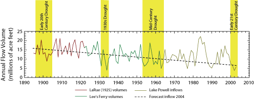
The average annual discharge of the Colorado River has shown a slight but noticeable decreasing trend between 1895 and 2004.
Annual Colorado River discharge volumes at Lee's Ferry between 1895 and 2004

The Colorado River is famous for its ability to reshape the earth. Over millions of years, the river has cut through layers of rock to create deep canyons. In the Grand Canyon, the river's path has been influenced by volcanic activity; for example, basalt flows from the Uinkaret volcanic field have dammed the river over 10 times in the last 2 million years.
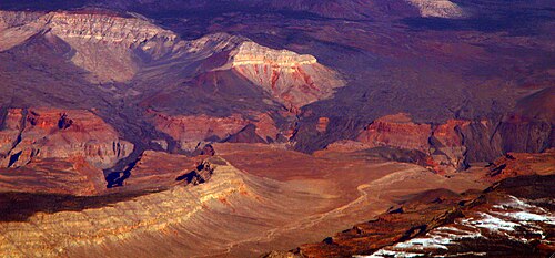
View showing hardened flows of dark volcanic rock descending over the side of a canyon
Remnants of basalt flows from the Uinkaret volcanic field are seen here descending into the Grand Canyon, where they dammed the Colorado over 10 times in the past 2 million years.
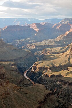
A narrow river flows through a narrow gorge flanked by high rocky bluffs
Colorado River in the Grand Canyon seen from Pima Point, near Hermit's Rest
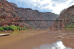
The Black Suspension Bridge crosses the Colorado River in the Grand Canyon at Phantom Ranch, Arizona.

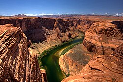
The river's appearance has also changed due to human intervention. Historically, the river was known for its reddish color caused by high sediment loads (natural particles of rock and soil carried by the water). However, the construction of various dams has trapped much of this sediment, resulting in a clearer, green hue in certain sections, such as lower Glen Canyon.
View of a narrow green river flowing between high, reddish-brown cliffs
The Colorado was named for the reddish color caused by its natural sediment loads, but damming the river has caused it to acquire a clear green hue as seen here in lower Glen Canyon.

Human Engineering and Water Management
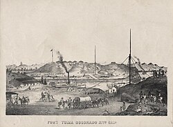
Lithograph of Fort Yuma, c. 1875

To support the growing populations and agricultural needs of the American West, engineers have extensively modified the river through transmountain diversions (moving water from one basin to another) and the construction of massive dams. These structures create reservoirs that store water for use during dry periods.
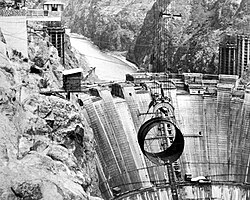
Hoover Dam under construction, 1934
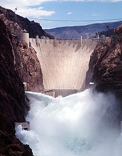
Front view of a dam in a narrow canyon, with water shooting out of the gates
Hoover Dam releasing water in 1998
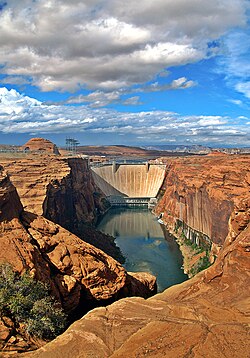
Glen Canyon Dam, the largest dam of the Colorado River Storage Project

Key infrastructure includes the Hoover Dam, the Glen Canyon Dam, and the Imperial Dam. These projects facilitate large-scale irrigation and provide water to cities and agricultural valleys. For instance, the Imperial Dam diverts water into the All-American Canal to support the Imperial Valley.
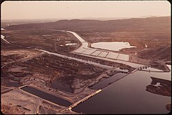
The Imperial Dam (bottom right) diverts water into the All-American Canal (center) running towards Imperial Valley.
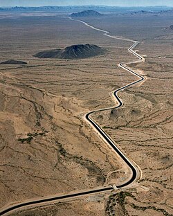
The main canal of the Central Arizona Project, crossing the Sonoran Desert

However, these developments come with environmental and social consequences. The management of the river involves complex water allocations between various states and Mexico. Currently, the United States holds approximately 90.9% of the allocated water, with California, Colorado, and Arizona being the largest domestic users.
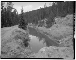
The Grand Ditch, one of the earliest water diversions of the Colorado River, is still in use today.
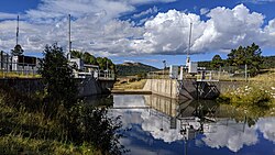
The Little Oso Diversion Dam diverts water from the Little Navajo River and transports it through a series of tunnels into the Rio Grande basin as part of the San Juan–Chama Project.

Water Usage and Consumption

A significant portion of the water used in the Colorado River basin is dedicated to agriculture. Notably, more than four times the amount of water used for crops intended for direct human consumption is used to grow feed for livestock.

Most of the Colorado River basin water used by humans is used to grow feed for livestock—more than four times the amount used for crops for direct human consumption.[308]

History and Exploration

Historic photograph of the cable ferry at Lee's Ferry, prior to construction of the Navajo Bridge.

The history of the Colorado River is intertwined with the history of the American West. Long before European arrival, indigenous peoples inhabited the river's banks. Later, Spanish explorers like Francisco Vázquez de Coronado led expeditions through the region in the mid-16th century.
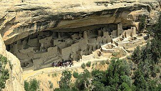
Cliff Palace, Mesa Verde National Park
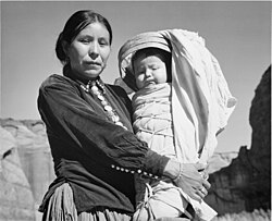
Black and white photograph of a Native American woman holding a child
Navajo woman and child, photographed by Ansel Adams, c. 1944
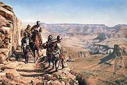
La conquista del Colorado (2017), by Augusto Ferrer-Dalmau, depicts Francisco Vázquez de Coronado's 1540–1542 expedition. García López de Cárdenas can be seen overlooking the Grand Canyon.

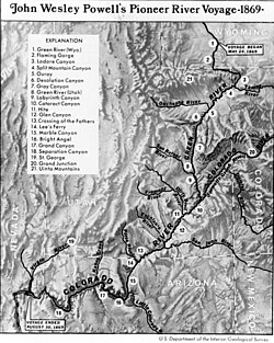
In the 19th century, American exploration became more prominent. John Wesley Powell led a significant expedition through the river in 1869, providing some of the first detailed accounts of the river's difficult terrain and canyon systems.
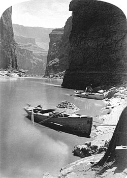
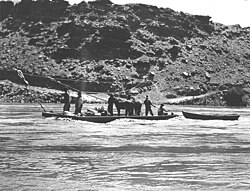
Boats of John Wesley Powell's second Colorado River expedition in Marble Canyon, 1872.
Route of Powell's first expedition, 1869.

Frequently Asked Questions

View of a reservoir where the water level has dropped, showing white deposits on the surrounding mountains
Lake Mead in 2010, showing the "bathtub ring" left behind by low water levels
View of a wide river flowing through a forested area, with jagged mountains in the background
Heavily forested banks of the Colorado River near Topock, Arizona
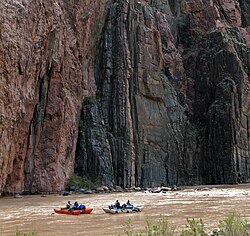
View of two small boats in a river, with high cliffs rising immediately behind them
A rafting party on the Colorado River

Where does the Colorado River begin?

The Colorado River originates at La Poudre Pass in the Rocky Mountains of Colorado, at an elevation of 10,184 feet.

What are the main uses of the Colorado River's water?

The water is used extensively for municipal supplies, industrial needs, and agriculture. A major portion of the basin's water is used to grow livestock feed.

How has damming affected the river's color?

The river was originally reddish due to natural sediment. Dams now trap much of this sediment, which can cause the water to appear clearer and more green in certain areas.

Which states rely on the Colorado River?

The river provides water to Colorado, Utah, Arizona, Nevada, and California in the United States, as well as parts of Mexico.

What is the significance of the Green River?

The Green River is the Colorado's longest tributary, contributing significantly to the river's total length and discharge volume.

References

  1. Discharge data is for Green River, Utah, 117.6 miles (189.3 km) upstream from the mouth. The stream gauge here measures flow from an area of 44,850 square miles (116,200 km2), representing about 93.2 percent of the basin.[43]
  2. Before large irrigation and municipal diversions, the Gila River discharged about 1.3 million acre-feet (1.6 km3) per year,[40] which equals a flow of nearly 2,000 cubic feet per second (57 m3/s).
  3. Discharge data is for Bluff, Utah, located about 113.5 miles (182.7 km) above the confluence with the Colorado. The gauge measures flow from an area of 23,000 square miles (60,000 km2), about 93.5 percent of the basin.[46]
  4. Discharge data is for Littlefield, Arizona, about 66 miles (106 km) from the confluence with the Colorado, and also upstream of the confluence with its major tributary, the Muddy River. The gauge measures flow from an area of 5,090 square miles (13,200 km2), about 39.1 percent of the total basin.[53]
  5. American population (9.7 million) calculated from statistics from the U.S. Census Bureau[66] and the State of Colorado.[67] The population in Mexico is about 3 million.[68]