Coconino County: Arizona's Vast Landscape of Natural Wonders
Located in the north-central region of Arizona, Coconino County is a land of immense scale and breathtaking diversity. From the towering peaks of the San Francisco Peaks to the depths of the Grand Canyon, it is a region defined by its dramatic geography and rich cultural heritage. As the largest county in Arizona, it serves as a critical hub for tourism, education, and indigenous culture in the American Southwest.
The county takes its name from Cohonino, a designation used for the Havasupai people. Today, it is recognized as the second-largest county by area in the contiguous United States, trailing only San Bernardino County in California.

Key Facts
- County Seat: Flagstaff, which is also the largest city.
- Total Area: 18,661 square miles, representing 16.4% of Arizona's total landmass.
- Population: 145,101 (2020 Census).
- Scale: Larger in land area than nine U.S. states, including Massachusetts and New Jersey.
- Indigenous Land: Home to 7,142 square miles of federally designated Indian reservations.
History and Formation
The development of the region accelerated following the completion of the Atlantic & Pacific Railroad in 1883. This infrastructure sparked rapid growth in what was then the northern portion of Yavapai County. Due to the difficulty of traveling to Prescott to conduct official business, residents petitioned for their own jurisdiction in 1887.
While an initial proposal to create "Frisco County" was not realized, Coconino County was officially established on February 18, 1891, with Flagstaff designated as the county seat.
Geography and Natural Protected Areas
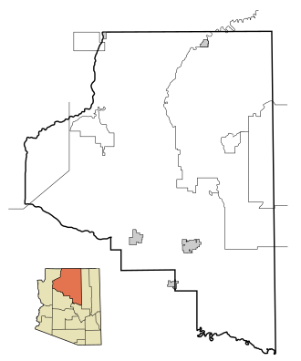
Coconino County is a geographical giant. Of its 18,661 square miles, 18,619 square miles are land, with water covering only 0.2% of the total area. Its borders touch Mohave, Yavapai, Gila, and Navajo counties in Arizona, as well as San Juan and Kane counties in Utah.
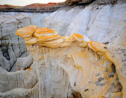
The county is renowned for its vast network of protected lands, including several National Forests and Monuments. Notable areas include:
- National Parks: A significant portion of the Grand Canyon National Park.
- National Forests: Coconino, Kaibab, Apache-Sitgreaves, and Prescott National Forests.
- National Monuments: Sunset Crater Volcano, Vermilion Cliffs, Walnut Canyon, and Wupatki.
- Recreation: Part of the Glen Canyon National Recreation Area.
Indigenous Territories
The county holds the second-largest amount of federally designated Indian reservations in Arizona. These include the Navajo, Hualapai, Hopi, Havasupai, and Kaibab reservations. Notably, the Havasupai Reservation is the only one located entirely within the county's borders.
Demographics and Community
As of the 2020 census, the population stood at 145,101, with a median age of 32.5 years. The population is diverse, with 57.4% identifying as White, 25.0% as American Indian and Alaska Native, and 15.0% as Hispanic or Latino. Approximately 67.6% of residents live in urban areas, while 32.4% reside in rural settings.
Major Communities
Flagstaff serves as the primary urban center, but the county includes several other significant cities and towns such as Page, Sedona (partially), and Williams. It also contains numerous census-designated places (CDPs) and historic ghost towns like Canyon Diablo and Two Guns.
| Category | Detail |
|---|---|
| Founded | February 18, 1891 |
| Total Area | 18,661 sq mi |
| 2020 Population | 145,101 |
| Largest City | Flagstaff |
| Primary Industry Sectors | Accommodation, Food Services, Health Care |
Economy and Education
The economy is heavily influenced by tourism, government services, and education. In 2019, the largest employment sector was Accommodation and Food Services, accounting for 16.6% of jobs. Other major employers include Northern Arizona University, W. L. Gore & Associates, and the Flagstaff Medical Center.
Education is a cornerstone of the community, with Northern Arizona University providing tertiary education alongside Coconino County Community College and the Diné College Tuba City Center. The region is also served by various K-12 districts and Bureau of Indian Education (BIE) schools, such as the Tuba City Boarding School.
Frequently Asked Questions
How large is Coconino County compared to U.S. states?
Coconino County is larger than nine of the smallest U.S. states, including Connecticut, Delaware, Hawaii, Maryland, Massachusetts, New Hampshire, New Jersey, Rhode Island, and Vermont.
What is the significance of the name Coconino?
The name is derived from "Cohonino," which was a name applied to the Havasupai people.
Which city serves as the county seat?
Flagstaff is both the county seat and the largest city in Coconino County.
What are the primary economic drivers in the region?
The economy is driven largely by the tourism industry (accommodation and food services), healthcare, and government employment, including the National Park Service and various school districts.
Which Indian reservations are located within the county?
The county includes portions of the Navajo, Hualapai, Hopi, and Kaibab reservations, as well as the Havasupai Reservation, which is entirely contained within the county borders.