Charleston South CarolinaThe Holy CityCharleston historyRainbow RowThe Battery

Charleston, South Carolina: A Journey Through the Holy City

Charleston, South Carolina: A Journey Through the Holy City Known affectionately as The Holy City or "Chucktown," Charleston, South Carolina, is a coastal gem where deep historical roots ...

Charleston, South Carolina: A Journey Through the Holy City

Known affectionately as The Holy City or "Chucktown," Charleston, South Carolina, is a coastal gem where deep historical roots meet modern Southern charm. Founded in 1670 and named after King Charles II of England, the city serves as a living museum of American history, from its colonial beginnings to its role in the American Civil War and its evolution into a contemporary economic hub.

The city's motto, "Ædes Mores Juraque Curat" (She Guards Her Temples, Customs, and Laws), reflects a community dedicated to preserving its unique heritage and architectural splendor.
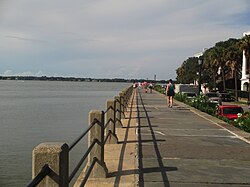
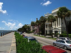
The downtown Charleston waterfront on the Battery

Key Facts

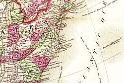
Map of the Carolinas, Virginia, and Georgia relative to Bermuda
  • Founded: 1670
  • Population: 150,227 (2020 Census)
  • Nickname: The Holy City, Chucktown
  • Geography: Spans Charleston and Berkeley counties, featuring a land area of 115.03 square miles.
  • Key Landmark: The Arthur Ravenel Jr. Bridge, once the longest cable-stayed bridge in the Western Hemisphere.
  • Economic Driver: The Port of Charleston, featuring the deepest harbor on the East Coast at 52 feet.

A Legacy of Architecture and History
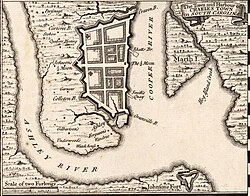
Herman Moll's 1733 Town and Harbour of Charles Town in South Carolina, showing the town's defensive walls.

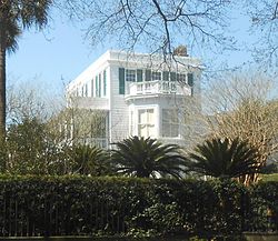
Charleston is world-renowned for its preserved colonial and antebellum architecture. One of the city's oldest treasures is the Pink House, constructed of Bermudian limestone between 1694 and 1712, which remains the oldest stone building in the city.
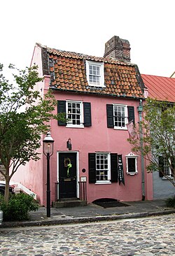
The Pink House, at 17 Chalmers Street, was built of Bermudian limestone between 1694 and 1712 and is the oldest stone building in Charleston.

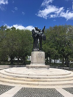
The city's layout is defined by its relationship with the water. The Battery, a historic waterfront promenade, is lined with grand homes and monuments, including a 1932 memorial to the Confederate defenders of Fort Sumter. Nearby, the iconic Rainbow Row consists of 13 colorful houses along East Bay Street that once served as the town's commercial center during the colonial period.
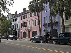
Rainbow Row's 13 houses along East Bay Street formed the commercial center of the town in the colonial period.

From Colonialism to Conflict

The early history of Charleston was shaped by its interactions with indigenous peoples and its role as a strategic port. Early records include the "Catawba Deerskin Map," a hand-painted map created by a Catawba chief for Governor Francis Nicholson.

A map of the "Several Nations of Indians to the Northwest of South Carolina" or the "Catawba Deerskin Map", an annotated copy of a hand-painted deerskin original made by a Catawba chief for Governor Francis Nicholson. "This map describing the scituation [sic] of the several nations of Indians to the NW of South Carolina was coppyed [sic] from a draught [sic] drawn & painted on a deer skin by an Indian Cacique and presented to Francis Nicholason Esqr. Governor of South Carolina by whom it is most humbly dedicated to his Royal Highness George, Prince of Wales".

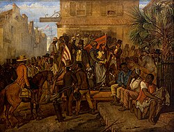
The city's trajectory was forever altered by the American Civil War. Charleston was a focal point of conflict, suffering major fires in 1861 and again during the Confederate evacuation in 1865. The scars of this era are still visible in the ruins of the city and the history of the Old Slave Mart Museum, built in 1859, which stands as a reminder of the city's role in the slave trade—a role for which the city has since issued a formal condemnation.
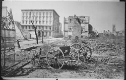
The ruins of Charleston in 1865, following major fires in 1861 and at the evacuation of the Confederates

Geography and Climate

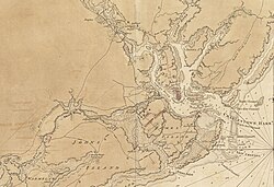
Charlestown and environs in 1780

Charleston is situated on a peninsula surrounded by the Cooper and Ashley Rivers. The city is divided into several distinct districts, including Downtown/The Peninsula, West Ashley, Johns Island, James Island, Cainhoy Peninsula, and Daniel Island.
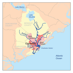
Map showing the major rivers of Charleston and the Charleston Harbor watershed

The climate is characterized by humid subtropical conditions. Summers are hot and humid, with July seeing mean maximum temperatures of approximately 97.7°F. The region is also prone to severe weather, as evidenced by the significant damage caused by Hurricane Hugo in 1989.
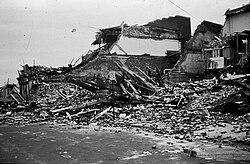
Damage left from Hurricane Hugo in 1989

Modern Economy and Infrastructure

Ladson House, built in 1792 for Lieutenant Governor James Ladson

Today, Charleston is a powerhouse of industry and education. The metropolitan area is supported by major employers such as Joint Base Charleston, the Medical University of South Carolina (MUSC), and Boeing South Carolina.

Top Employers in the Charleston Metropolitan Area (2023)
Employer Number of Employees
Joint Base Charleston 24,900
Medical University of South Carolina 17,000
Boeing South Carolina 6,500
Roper St. Francis Healthcare 6,100
Charleston County School District 6,000

Transportation has seen massive upgrades, most notably the 2005 completion of the Arthur Ravenel Jr. Bridge, which connects the peninsula to Mount Pleasant. Additionally, the Port of Charleston continues to expand, including the development of the Wanda Welch Terminal to handle increasing global trade.
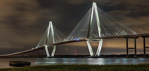
The new Arthur Ravenel Jr. Bridge, constructed in 2005 and named after the late U.S. Representative Arthur Ravenel Jr., who pushed the project to fruition, was at the time of its construction the longest cable-stayed bridge in the Western Hemisphere.

Frequently Asked Questions
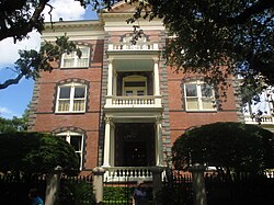
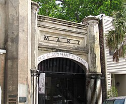
The former German Fire Co. Engine House and Old Slave Mart Museum, at 8 and 6 Chalmers Street, respectively, were built in 1859.
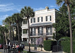
Edmondston-Alston House, built in 1828 on the Battery, showing carriage tour
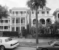
Homes along the Battery
The Poyas-Cohen Mordecai House, at 69 Meeting Street, built in 1796–1800
Alonzo J. White selling slaves in Charleston in 1853
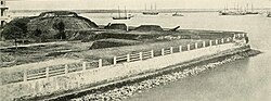
Two 10" Columbiads guarding the Battery in 1863.
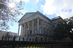
The Charleston Custom House was completed in 1870 after construction was halted in 1859 due to the tensions leading to the Civil War.
The 1932 monument in the Battery memorializing the Confederate defenders of Fort Sumter.
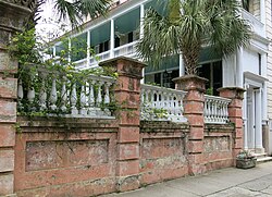
A Charleston street
A Charleston street
The Calhoun Mansion, at 16 Meeting Street, was built in 1876 by George Williams but derived its name from a later occupant, his grandson-in-law Patrick Calhoun.
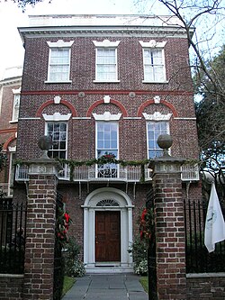
Nathaniel Russell House, built in 1808
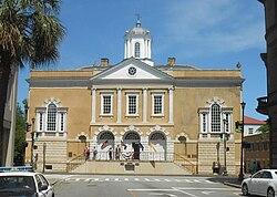
Old Exchange and Provost Dungeon, on Broad Street, built in 1767
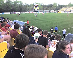
MUSC Health Stadium, home of the Charleston Battery from 1998 until 2019
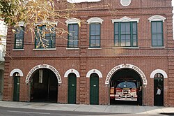
Fire Department station houses for Engines 2 and 3 of the Charleston Fire Department
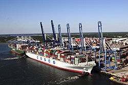
Wanda Welch Terminal in the Port of Charleston
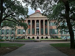
Randolph Hall, College of Charleston

Why is Charleston called "The Holy City"?

Charleston is known as the Holy City due to the numerous church steeples that define its skyline, reflecting the city's deep religious history.

What is the significance of Rainbow Row?

Rainbow Row is a series of 13 colorful historic houses on East Bay Street that represented the commercial heart of the city during the colonial era.

How deep is the Port of Charleston?

The Port of Charleston is recognized as having the deepest harbor on the East Coast, reaching a depth of 52 feet.

Who is the Arthur Ravenel Jr. Bridge named after?

The bridge is named after the late U.S. Representative Arthur Ravenel Jr., who was instrumental in pushing the project to completion.

What is the oldest stone building in Charleston?

The Pink House, located at 17 Chalmers Street and built of Bermudian limestone between 1694 and 1712, is the oldest stone building in the city.

References

  1. The female figure is sometimes glossed as Athena,[3] although the official explanation is that she is a personification of Charleston itself.[4] Similarly, although aedes properly refers to temples and originally referred to the churches depicted on the seal, the official gloss is that it intends the city's "buildings".
  2. As defined by the Office of Management and Budget, for use by the U.S. Census Bureau for statistical purposes only.
  3. The Brown Fellowship Society, initially a burial society, operated from 1790 to 1945.
  4. Savannah, Georgia, and Richmond, Virginia, came closest, reaching 40% at times.[47]
  5. A monument to Vesey as a freedom fighter was long opposed by Charleston's white community but was finally begun in 2010 after a compromise placed it in Hampton Park, out of the historic district and far from the original proposed site in Marion Square.[53]