Calama: The Desert Hub of Northern Chile
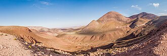
Nestled within the arid expanse of the Atacama Desert, Calama is a vital city and commune in northern Chile. Serving as the capital of the El Loa Province in the Antofagasta Region, it is recognized as one of the driest urban centers on Earth. The city is defined by its stark contrast between the surrounding desert and the life-giving waters of the River Loa, Chile's longest river, which flows directly through the city.
Beyond its urban center, the commune is a cultural mosaic, encompassing various Quechua communities—including Toconce, Cupo, and Estación San Pedro—as well as Lickan-antay communities such as Caspana, Lasana, and San Francisco de Chiu Chiu.
Key Facts
- Location: Atacama Desert, Antofagasta Region, Chile.
- Climate: BWk (Cold desert climate) with an average annual precipitation of only 5 mm.
- Population: 147,886 (as of the 2012 census).
- Elevation: 2,260 meters (7,410 feet) above sea level.
- Economy: Historically tied to copper mining, specifically the nearby Chuquicamata mine.
- Geography: Situated on a plain created by the River Loa, flanked by the Andes and the Cordillera de Domeyko.
Etymology and Origins
The name "Calama" is believed to originate from Kunza, the ancestral language of the Lickan-antay people. There are two primary theories regarding its meaning:
- Town in the middle of the water: Proposed by Hector Pumarino Soto, this theory suggests the name comes from Ckara-ama, referring to how the city and its oasis were once surrounded by the River Loa and fertile swamps, resembling an island in the desert.
- Place where partridges abound: Proposed by Emilio Vaïsse, this theory suggests the name comes from Ckolama, referencing the abundance of partridges in the western swamp sectors.
Historical Evolution
Prehispanic and Hispanic Eras
Evidence of early habitation includes the caves of Yalquincha, the Copper Mummy, and the chullpas (pre-Columbian cemeteries) of Topáter. Calama was a strategic shelter on the Camino del Inca, providing corn and alfalfa to Inca troops and Chasquis (messenger runners). Interestingly, early Spanish explorers like Diego de Almagro noted the presence of copper horseshoes made via mysterious Incan techniques.
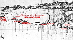
During the Spanish colonial period, the hostile climate limited total control, but Calama remained a critical provision point for trade routes connecting the port of Cobija to the silver deposits of Potosí.
Bolivian and Chilean Administration
Following Bolivia's independence in 1825, Calama became a key town in the Atacama Province of the Departamento de Litoral. By 1840, it became the provincial capital, boosting its role as a communication hub for mail between Cobija and Potosí.
The administration shifted to Chile following the conflict that began in 1879. Under Chilean rule, Calama was established as a municipality on October 13, 1888. The arrival of the Antofagasta-Bolivia Railway in 1886 further accelerated its growth. In more recent history, the city expanded significantly after a devastating earthquake in 1955 and again between 2003 and 2007, when residents of the dismantled town of Chuquicamata—once the world's largest open-pit copper mine—relocated to Calama for environmental and safety reasons.
Geography and Climate
Calama's landscape is a blend of high-altitude desert and the Andes Mountain Range. The city sits on a plain created by the River Loa, bounded to the north by the foothills of Sierra Moreno and the peaks of Cerro Poquis (4,589 m), and to the south by the Cordillera de Domeyko.
The climate is classified as BWk, characterized by extreme temperature swings. While summer highs can exceed 30°C (86°F), winter lows often drop below 0°C (32°F). Precipitation is minimal, rarely exceeding 35 mm annually.
| Feature | Detail |
|---|---|
| Average Annual Precipitation | 5 mm (0.20 in) |
| Average Annual Temperature | 11.2 °C (52.2 °F) |
| Maximum Altitude (Nearby) | Cerro Poquis: 4,589 m |
| Climate Classification | BWk (Cold Desert) |
| Primary Water Source | River Loa |
Demographics and Administration
As of the 2012 census, Calama had a population of 147,886, with a heavy concentration in urban areas (136,600 residents). The commune is managed by a municipal council led by an alcalde (mayor), who is elected every four years. For transportation, the city is served by the El Loa Airport.
Frequently Asked Questions
Why is Calama considered one of the driest cities in the world?
Calama is located in the Atacama Desert and experiences an average annual precipitation of only 5 mm (0.20 inches), making it one of the most arid urban environments on Earth.
What is the significance of Chuquicamata to Calama?
Chuquicamata was once the largest open-pit copper mine in the world. The nearby town of the same name was dismantled between 2003 and 2007 for environmental reasons, leading to a population surge in Calama as residents relocated there.
What does the name "Calama" mean?
Depending on the Kunza linguistic interpretation, it either means "town in the middle of the water" (referring to the oasis and River Loa) or "place where partridges abound."
Which river flows through the city?
The River Loa, which is the longest river in Chile, flows through Calama and provides the necessary water for the city's oasis.
What are the primary geographic boundaries of the commune?
The commune is bounded to the north by the foothills of the Loa River (including Sierra Moreno and Cerro Poquis) and to the south by the Cordillera de Domeyko.