Cairo EgyptHistoric CairoEgyptian historyCairo populationIslamic Cairo

Cairo: The Historic Heart and Vibrant Metropolis of Egypt

Cairo: The Vibrant Heart of Egypt Known famously as the City of a Thousand Minarets, Cairo is a sprawling metropolis that serves as the capital of Egypt. Situated on the banks of the Nile...

Cairo: The Vibrant Heart of Egypt

Known famously as the City of a Thousand Minarets, Cairo is a sprawling metropolis that serves as the capital of Egypt. Situated on the banks of the Nile, it is a city where ancient history meets rapid modern development. As the largest city in both Africa and the Middle East, Cairo is a massive urban center with a population exceeding 22 million in its metropolitan area.

From the Roman remains of the Babylon Fortress to the towering modern skyscrapers and the bustling streets of Islamic Cairo, the city offers a unique window into centuries of human civilization. Whether exploring its UNESCO World Heritage sites or navigating its complex transport networks, Cairo remains one of the most significant cultural and economic hubs in the world.
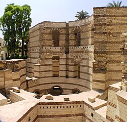
The remains of a circular Roman tower at Babylon Fortress, late 3rd century, in Old Cairo
: The remains of a circular Roman tower at Babylon Fortress, late 3rd century, in Old Cairo

Key Facts

A man on a donkey walks past a palm tree, with a mosque and market behind Mohamed kamal
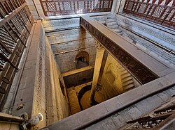
The Nilometer in Cairo, built by the order of the Abbasid caliph al-Mutawakkil (r. 847–861)
  • Nickname: City of a Thousand Minarets
  • Status: Capital of Egypt
  • Metropolitan Population: Approximately 22,200,000
  • UNESCO Site: Historic Cairo (designated 1973)
  • Major River: The Nile
  • Primary Language: Arabic

A Journey Through Time: History and Foundations
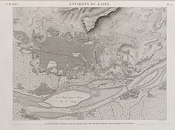
A map of Cairo in 1809, from the Description de l'Égypte

The history of Cairo is a layered narrative of successive civilizations. The earliest major foundation in the region was Fustat, established between 641–642 AD. Following this, the city of Cairo itself was founded in 969 AD, marking a significant era of expansion under the Fatimid Caliphate.
A man on a donkey walks past a palm tree, with a mosque and market behind Mohamed kamal
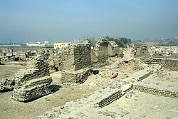
Excavated ruins of Fustat, 2004
: Excavated ruins of Fustat, 2004

Throughout the centuries, the city underwent various transformations under the rule of the Ayyubids, the Mamluks, and later the Ottomans. The Citadel of Cairo, commissioned in 1176, stands as a testament to the city's strategic importance during the medieval period.
A multi-domed mosque dominates the walled Citadel, with ruined tombs and a lone minaret in front.
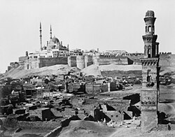
The Cairo Citadel, seen above in the 19th century, commissioned in 1176
: The Cairo Citadel, seen above in the 19th century, commissioned in 1176

Islamic and Medieval Heritage

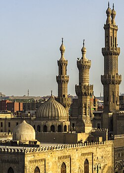
Cairo's architectural landscape is defined by its stunning Islamic monuments. The Mosque of Ibn Tulun (built 876–879 AD) and the Al-Azhar Mosque (built 970–972 AD) are cornerstone structures of the city's religious and cultural identity. Visitors can also wander through Al-Muizz Street, a historic thoroughfare in Islamic Cairo that showcases incredible architectural detail.
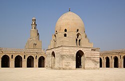
The Mosque of Ibn Tulun, built by Ahmad Ibn Tulun in 876–879 AD
: The Mosque of Ibn Tulun, built by Ahmad Ibn Tulun in 876–879 AD
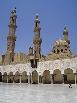
The Al-Azhar Mosque, built in 970–972 in the wake of the establishment of Cairo as the capital of the Fatimid Caliphate
: The Al-Azhar Mosque, built in 970–972 in the wake of the establishment of Cairo as the capital of the Fatimid Caliphate
Al-Azhar Mosque, view of Fatimid-era courtyard and Mamluk minarets
: Al-Azhar Mosque, view of Fatimid-era courtyard and Mamluk minarets
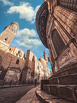
Al-Muizz Street in Islamic Cairo
: Al-Muizz Street in Islamic Cairo

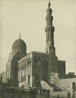
The Mamluk era left behind grand complexes, such as the Mausoleum-Madrasa-Hospital complex of Sultan Qalawun and the funerary complex of Sultan Qaytbay. These structures highlight the sophisticated urban planning and artistic achievement of the period.
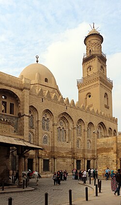
The Mausoleum-Madrasa-Hospital complex of Sultan Qalawun, built in 1284–1285 in the centre of Cairo, over the remains of a Fatimid palace
: The Mausoleum-Madrasa-Hospital complex of Sultan Qalawun, built in 1284–1285 in the centre of Cairo, over the remains of a Fatimid palace
Funerary complex of Sultan Qaytbay, built in 1470–1474 in the Northern Cemetery (seen in 1880)
: Funerary complex of Sultan Qaytbay, built in 1470–1474 in the Northern Cemetery (seen in 1880)

Geography and Urban Structure

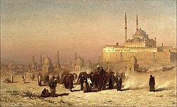
Louis Comfort Tiffany (1848–1933). On the Way Between Old and New Cairo, Citadel Mosque of Mohammed Ali, and Tombs of the Mamelukes, 1872. Oil on canvas. Brooklyn Museum.

Cairo is organized into several major administrative areas: the Northern, Eastern, Western, and Southern areas. This vast metropolitan region is divided into numerous districts and police wards, known as qisms. The city's layout is heavily influenced by the Nile, which provides both life and a central axis for the urban sprawl.
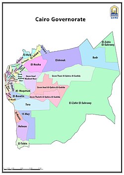
Cairo city administrative boundary and districts in English
: Cairo city administrative boundary and districts in English

The Metropolitan Districts

The metropolitan area is incredibly diverse, ranging from the historic quarters of Old Cairo to the modern developments in New Cairo and the satellite cities managed by the New Urban Communities Authority (NUCA). The city is also characterized by its various islands, such as Gezira/Zamalek, which offer a different urban experience within the Nile's embrace.
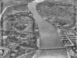
An aerial view in 1904 from a balloon of the central-eastern edge of Cairo, showing the early development of Gezira/Zamalek Island (centre left), and Downtown (lower right), as well as Bulaq (upper right).
: An aerial view in 1904 from a balloon of the central-eastern edge of Cairo, showing the early development of Gezira/Zamalek Island (centre left), and Downtown (lower right), as well as Bulaq (upper right).
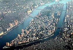
An aerial view looking south, with the Zamalek and Gezira districts on Gezira Island, surrounded by the Nile
: An aerial view looking south, with the Zamalek and Gezira districts on Gezira Island, surrounded by the Nile

Modern Cairo: Economy and Infrastructure
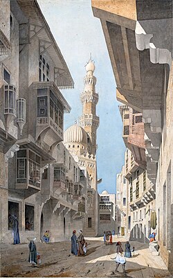
A street in Cairo by Gabriel Toudouze, 1844

Today, Cairo is a massive economic engine. With a nominal GDP of $103.6 billion (2024) for the metropolitan area, it supports a wide range of industries, including automobile manufacturing. Major companies such as General Motors Egypt and the Ghabbour Group operate within the region.

Transport and Connectivity

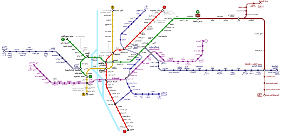
Moving through Cairo requires navigating a complex web of transport options. The city is currently expanding its infrastructure through projects like the Cairo Metro, the monorail, and the Bus Rapid Transit (BRT) system. Major landmarks like Ramses Station serve as vital hubs for rail travel, while the Cairo International Airport connects the city to the world.
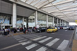
Façade of Terminal 3 at Cairo International Airport
: Façade of Terminal 3 at Cairo International Airport
Cairo Metro, LRT, BRT and monorail expansion plans
: Cairo Metro, LRT, BRT and monorail expansion plans
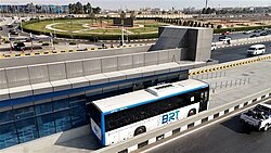
An Egyptian-made Cairo BRT bus on Cairo's Ring Road
: An Egyptian-made Cairo BRT bus on Cairo's Ring Road
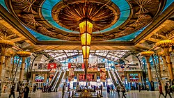
The interior of Ramses Station
: The interior of Ramses Station

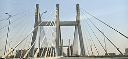
Road networks, including the 6th October Bridge and the Rod El Farag Axis Bridge, are essential for managing the city's high traffic volumes, though congestion and smog remain ongoing urban challenges.
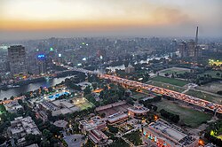
Traffic on the 6th October Bridge in Cairo
: Traffic on the 6th October Bridge in Cairo
Rod El Farag Axis Bridge in Cairo
: Rod El Farag Axis Bridge in Cairo
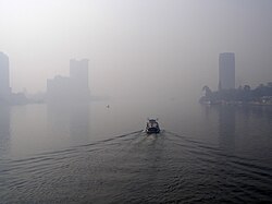
Smog in Cairo
Smog in Cairo
: Smog in Cairo

Culture, Education, and Landmarks

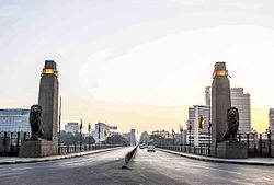
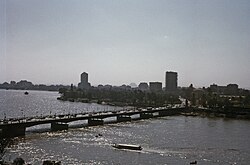
The Qasr El Nil Bridge

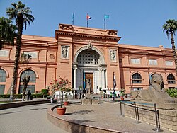
Cairo is a center for learning and the arts. It hosts prestigious institutions such as Cairo University, Al-Azhar University, and the American University in Cairo. The city's cultural life is further enriched by the Cairo Opera House and the world-renowned Egyptian Museum located at Tahrir Square.
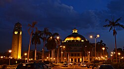
Cairo University is the largest university in Egypt, and is located in Giza.
: Cairo University is the largest university in Egypt, and is located in Giza.
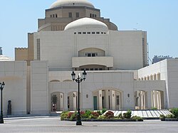
Cairo Opera House, at the National Cultural Center, Zamalek district
: Cairo Opera House, at the National Cultural Center, Zamalek district
Main entrance of the Egyptian Museum, located at Tahrir Square
: Main entrance of the Egyptian Museum, located at Tahrir Square

From the heights of the Cairo Tower to the historic Hanging Church in Old Cairo, the city's landmarks offer a profound connection to both the spiritual and the secular history of Egypt.
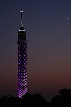
Cairo Tower at night
: Cairo Tower at night
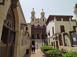
The Hanging Church in Old Cairo
: The Hanging Church in Old Cairo

City Overview Summary

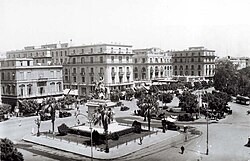
View of the Continental hotel in 1920
Cairo Metropolitan Statistics and Data
Category Detail
Population (2023) 9,801,536 (City); 22,200,000 (Metro)
Area (Metro) 2,744 km²
GDP (Nominal 2024) $103.6 Billion (Metro)
Time Zone UTC+2 (EET) / UTC+3 (EEST)
Elevation 23 m (75 ft)

Frequently Asked Questions
View of Qasr El Nil Bridge in Cairo, 1965
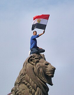
A protester holding an Egyptian flag during the protests that started on 25 January 2011
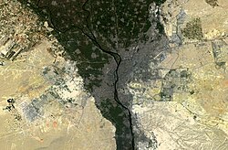
Greater Cairo seen from Sentinel-2A
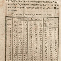
Cairo weather observations by French savants
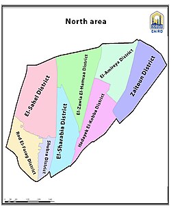
Map of Northern Area, Cairo (En)
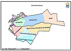
Cairo Eastern Area map
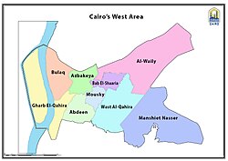
Cairo Western Area map
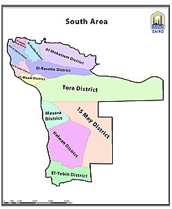
Cairo Southern Area map
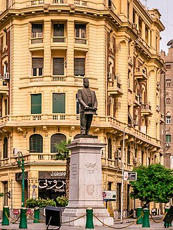
Statue of Talaat Pasha Harb, the father of the modern Egyptian economy, in Downtown Cairo
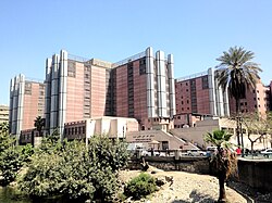
The Qasr El Eyni Hospital
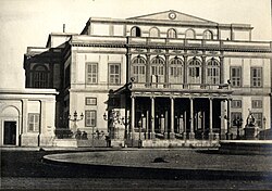
Egyptian Royal Opera House, 1869
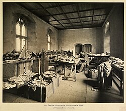
Solomon Schechter at work in Cambridge University Library, studying the fragments of the Cairo Geniza, c. 1898
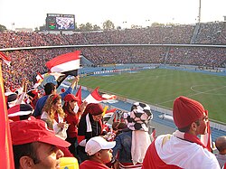
Cairo International Stadium with 75,100 seats
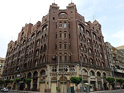
Shurbagi building in Downtown Cairo, built in 1911
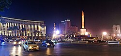
View of Tahrir Square (in 2020)
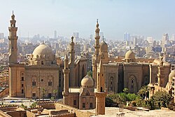
Mosque-Madrasa of Sultan Hassan and the al-Rifa'i Mosque, seen from the Citadel
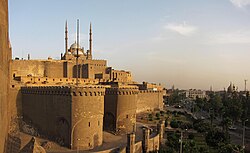
The Citadel of Cairo, with the Mosque of Muhammad Ali
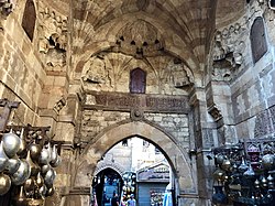
A medieval gateway in Khan al-Khalili
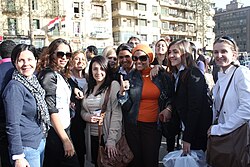
International Women's Day, Cairo in 2011

What is the nickname of Cairo?

Cairo is widely known as the City of a Thousand Minarets, a reference to its rich Islamic architectural heritage.

When was Cairo founded?

While early settlements like Fustat date back to 641–642 AD, the city of Cairo was founded in 969 AD.

What are the main transport options in Cairo?

The city utilizes a variety of transport methods, including the Cairo Metro, buses, taxis, ride-sharing services (like Uber and Careem), and the Nile Ferry. Expansion plans also include a monorail and a Bus Rapid Transit (BRT) system.

Is Cairo a UNESCO World Heritage site?

Yes, Historic Cairo was designated as a UNESCO World Heritage site in 1973.

What is the climate like in Cairo?

Cairo has an arid climate. Based on 1991–2020 normals, temperatures can reach record highs of 47.8°C (118.0°F) in the summer, while January is typically the coolest month with mean daily maximums around 18.9°C (66.0°F).