Atlas Mountains: The Majestic Spine of North Africa
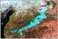
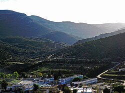
The Atlas Mountains are a formidable mountain range stretching approximately 2,500 km (1,600 mi) across the Maghreb region of North Africa. Acting as a dramatic natural barrier, they separate the vast Sahara Desert from the Mediterranean Sea and the Atlantic Ocean, winding through the territories of Morocco, Algeria, and Tunisia.
Named after the Titan Atlas from mythology, these mountains are the ancestral home of the Berber populations (Imazighen). In several Berber languages, the words for mountain—Adrar and adras—are believed to be cognates of the name Atlas.
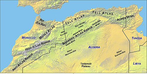
Key Facts
- Highest Peak: Toubkal in Morocco, reaching 4,167 m (13,671 ft).
- Total Length: Approximately 2,500 km (1,600 mi).
- Countries: Morocco, Algeria, and Tunisia.
- Primary Inhabitants: Berber populations.
- Climate: Generally cool with sunny summers and an average temperature of 25 °C.
Geological Evolution
The geology of the Atlas Mountains is complex, as the basement rock of Africa dates back to the Precambrian supereon, making it significantly older than the mountains themselves. The range formed through three distinct tectonic phases.
Phase 1: Paleozoic Collisions
Roughly 300 million years ago, the Anti-Atlas was formed during the Paleozoic Era. This occurred during the Alleghenian orogeny, a massive continental collision between Africa, North America, and Europe. At the time, this chain rivaled the modern Himalayas; remnants of this ancient system are still visible today in the Appalachians and the Fall Line region of the Eastern United States.
Phase 2: Mesozoic Extension
During the Mesozoic Era (before 66 million years ago), the Earth's crust underwent a widespread extension. This rifting separated the continents and created thick intracontinental sedimentary basins. Much of the rock currently forming the surface of the High Atlas was deposited under the ocean during this period.
Phase 3: Cenozoic Uplift
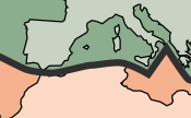
Between 66 million and 1.8 million years ago (the Paleogene and Neogene Periods), the mountains were uplifted as Africa and Europe collided at the southern end of the Iberian Peninsula. This convergent tectonic boundary—where plates slide toward each other—also led to the formation of the Alps and Pyrenees and the closure of the Strait of Gibraltar.
Interestingly, geologists note a lack of significant crustal thickening usually associated with such collisions. Recent research suggests that deep processes within the Earth's mantle may have played a primary role in lifting the High and Middle Atlas.
Regional Subranges
The Atlas system is divided into several distinct regions, each with unique characteristics.
The Moroccan Ranges
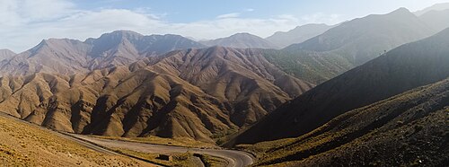
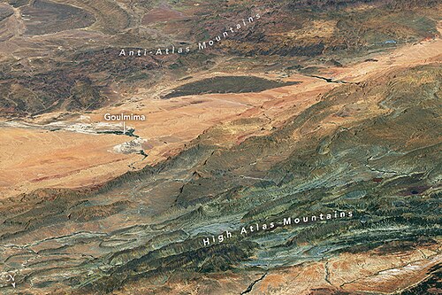
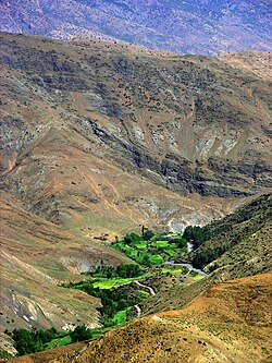
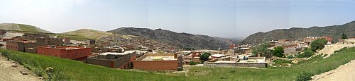
- High Atlas: The most prominent range, featuring Toubkal (4,167 m) and Ighil m'Goun (4,071 m). It is home to Berber villages in the Ourika Valley and the artificial lake Lalla Takerkoust, created by the Barrage Cavagnac hydroelectric dam.
- Middle Atlas: The northernmost Moroccan range, separated from the High Atlas by the Moulouya and Oum Er-Rbia rivers. It is a vital water catchment area and the primary habitat for the Barbary macaque. Its highest point is Jbel Bou Naceur (3,340 m).
- Anti-Atlas: Extending 500 km from the Atlantic coast to Tafilalt, this range borders the Sahara. It includes the volcanic massif of Djebel Siroua (3,304 m).

The Algerian and Tunisian Ranges
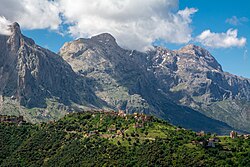
- Tell Atlas: A 1,500 km chain paralleling the Mediterranean coast. It is the most humid region of North Africa, with annual precipitation sometimes exceeding 1,500 mm. Its highest peak is Lalla Khadidja (2,308 m).
- Saharan Atlas: Marking the northern edge of the Sahara, this range is better suited for agriculture than the plateaus to its north. Djebel Aissa (2,236 m) is its highest peak outside the Aurès.
- Aurès Mountains: The easternmost portion of the entire Atlas system, spanning parts of Algeria and Tunisia.
Natural Resources, Flora, and Fauna
The Atlas Mountains are rich in mineral wealth, containing deposits of iron, lead, copper, silver, mercury, phosphate, marble, anthracite coal, and natural gas.
Biodiversity
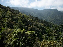
The flora varies by rainfall; the Atlas cedar and evergreen oaks are common, while the humid Kabylie range hosts cork oaks, lavender, and heather. The region is a sanctuary for diverse wildlife, including the Barbary sheep, Cuvier's gazelle, and the Atlas mountain viper.
![A male Barbary lion photographed in Algeria by Alfred Edward Pease in 1893.[13]](/images/28/bc/28bc866a2eae8f9b2f3be739ec8d9499bd92d3d9c613520a350bfebedc0096eb.jpg)
Tragically, several species are now extinct, including the Atlas bear, North African elephant, and Atlas wild ass. The Barbary lion is extinct in the wild, though descendants survive in captivity.
| Subrange | Primary Location | Highest Point | Key Characteristic |
|---|---|---|---|
| High Atlas | Morocco | Toubkal (4,167 m) | Highest peaks in North Africa |
| Middle Atlas | Morocco | Jbel Bou Naceur (3,340 m) | High biodiversity and rainfall |
| Anti-Atlas | Morocco | Djebel Siroua (3,304 m) | Volcanic origin massifs |
| Tell Atlas | Morocco, Algeria, Tunisia | Lalla Khadidja (2,308 m) | Humid Mediterranean climate |
| Saharan Atlas | Algeria, Tunisia | Djebel Aissa (2,236 m) | Northern border of the Sahara |
Frequently Asked Questions
What is the highest point of the Atlas Mountains?
The highest peak is Toubkal, located in central Morocco, with an elevation of 4,167 metres (13,671 ft).
Which countries do the Atlas Mountains span?
The range stretches across three North African countries: Morocco, Algeria, and Tunisia.
How were the Atlas Mountains formed?
They formed in three phases: Paleozoic continental collisions, Mesozoic crustal extension creating sedimentary basins, and Cenozoic uplift caused by the collision of the African and European plates.
What unique animals are found in the Atlas Mountains?
The range is home to the Barbary macaque, Barbary sheep, and Cuvier's gazelle. Several species, such as the Atlas bear and North African elephant, are now extinct.
Who are the primary inhabitants of the region?
The mountains are primarily inhabited by Berber populations, who maintain traditional villages and cultivate the high plains.