Administrative Divisions: How Sovereign States Organize Territory
Every independent sovereign state manages its land and population through administrative divisions. Also known as administrative units, subnational entities, or constituent states, these are geographical areas divided for the purpose of governance. Each unit typically possesses an administrative authority empowered to make policy or administrative decisions for its specific area. Beyond governance, these divisions are frequently utilized as polygons in geospatial analysis to map and analyze data.
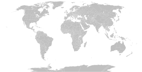
The Hierarchy of Administrative Levels
Most sovereign states employ a multi-tiered system of division. The largest units are referred to as first-level administrative divisions (or first-order divisions). Depending on the country, these may be called states, provinces, lands, oblasts, or regions.
These primary divisions are often further split into smaller units, such as districts, raions, or comarcas. The smallest tier typically consists of local governments, known as municipalities, communes, or communities. Some terms, such as prefectures, counties, departments, or governorates, are versatile and may serve as first, second, or third-level divisions depending on the national context.
The complexity of these structures often correlates with the size of the country. For instance, city-states like Vatican City have no subdivisions, while Monaco has only one. In contrast, larger nations like France and Pakistan utilize five distinct levels. The United States presents a varied model, consisting of states, territories, possessions, and a federal district, each with its own internal subdivisions.
Federations and Autonomous Regions
When communities unite under a single federal government, they are known as federated states. These may be termed as emirates, cantons, provinces, or republics. In some cases, certain regions enjoy a higher degree of self-government than others within the same country; these are called autonomous regions or de facto constituent states. This arrangement is sometimes described as asymmetric federalism or a federacy, such as the autonomous republic of Karakalpakstan within Uzbekistan.
Terminology and Local Governance
Translating administrative terms from non-English languages can be challenging due to global variations. In regions influenced by British culture, the size and title of an entity may not always align with population density. Many of these definitions are shaped by tradition, state statute law, and home rule considerations.
Local governance often involves a mix of urban and rural designations. Large cities may culturally span several counties, though they are rarely incorporated under a single municipal government. A clear example is found in Massachusetts, where Boston and Cambridge appear as one contiguous urban area to visitors but are distinct cities located in different counties.
Key Facts
- Administrative divisions are geographical areas within a sovereign state used for policy and administrative decision-making.
- First-level divisions are the largest subnational units, such as provinces or states.
- Scale variation: Small city-states may have zero or one level of division, while larger nations can have five or more.
- Federated states are constituent units of a federation, whereas autonomous regions possess a higher degree of self-rule than standard divisions.
- Geospatial use: These divisions serve as critical polygons for mapping and statistical analysis.
Summary of Administrative Terminology
| Category | Common Examples |
|---|---|
| Principal (First-Level) | State, Province, Oblast, Land, Region, Governorate |
| Intermediate Levels | District, Raion, Comarca, Department, Prefecture |
| Local Government | Municipality, Commune, Community, Parish |
| Urban/Settlement | City, Town, Borough, Village, Hamlet, Ward |
| Indigenous/Special | Tribe, Indian Reservation, Band, Ranchería |
Frequently Asked Questions
What is a first-level administrative division?
A first-level administrative division is the primary and largest subnational unit into which a sovereign state is divided, such as a U.S. state or a Canadian province.
How do federated states differ from autonomous regions?
Federated states are members of a federation under a federal government. Autonomous regions are units that may not be part of a formal federation but are granted a greater degree of self-government than other territories in the same country.
Why do administrative levels vary between countries?
The number of levels usually depends on the country's area and population; smaller nations typically require fewer levels of subdivision than larger, more populous ones.
What are the smallest units of administrative subdivision?
The smallest units are generally local governments, which may be called municipalities, communes, or communities.
How are these divisions used in data analysis?
In geospatial analysis, administrative divisions are used as polygons to define boundaries for mapping, census data, and other georeferenced big data analytics.