2011 Tōhoku Earthquake and Tsunami
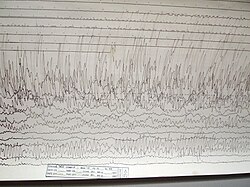
On March 11, 2011, at 14:46:24 JST, Japan was struck by one of the most powerful seismic events in recorded history. The 2011 Tōhoku earthquake, a massive megathrust event, triggered a devastating tsunami that affected the entire Pacific Rim. With a magnitude ranging between 9.0 and 9.1, the earthquake lasted for approximately six minutes, causing widespread destruction across northeastern Japan and beyond.
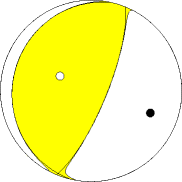
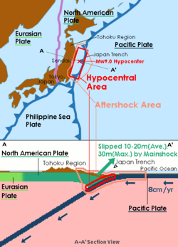
The disaster was the result of a sudden release of energy at the convergent boundary between the Pacific plate and the Okhotsk microplate. This movement occurred at a depth of 29 km (18 mi), creating a massive displacement of the seafloor that pushed a colossal volume of water toward the coastline.
Key Facts
- Magnitude: 9.0–9.1 Mw
- Epicenter: 38°19′19″N 142°22′08″E
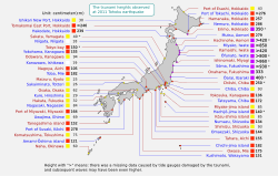
- Maximum Tsunami Height: 40.5 meters (133 ft) in Miyako, Iwate
- Casualties: 19,759 deaths, 6,242 injured, and 2,553 missing
- Economic Impact: Approximately US$360 billion in damages
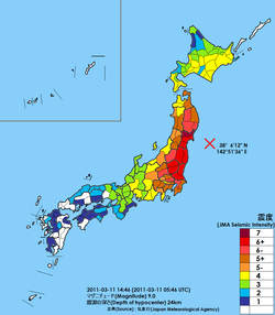
- Maximum Intensity: JMA 7 (MMI IX)
Geological Mechanism and Ground Motion
The earthquake is classified as a megathrust event, characterized by low-angle thrusting on a west-dipping fault plane. This type of faulting occurs when one tectonic plate is forced under another, building immense pressure until the rock ruptures.
The seismic energy was felt across a vast area. The Japan Meteorological Agency (JMA) recorded the highest intensity, JMA 7, in Miyagi Prefecture. Other regions, including Fukushima, Ibaraki, and Tochigi, experienced JMA 6+, while shaking was felt as far as Hokkaido and various western prefectures. The peak ground acceleration reached 2.99 g, with a peak velocity of 117.41 cm/s.
Hypocentral Region and Aftershocks
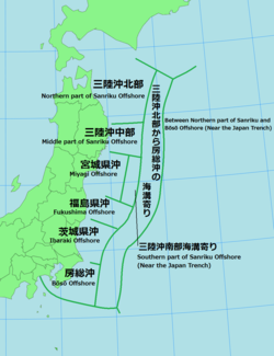
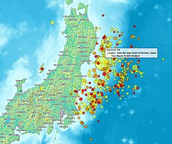
The hypocentral region—the area where the rupture originated—was centered off the coast of Tōhoku. Following the mainshock, the region experienced a prolonged period of seismic instability, with 13,386 aftershocks recorded as of March 6, 2018.
The Tsunami and Coastal Impact
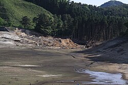
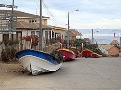
The most lethal aspect of the disaster was the resulting tsunami. The waves traveled across the Pacific Ocean, reaching as far as the west coast of the United States and Chile. In Japan, the tsunami overtopped sea walls and floodgates in numerous locations, though some areas, such as Fudai in Iwate, were spared due to a 15.5-meter (51 ft) floodgate.
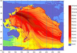
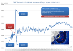
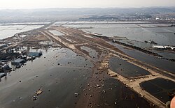
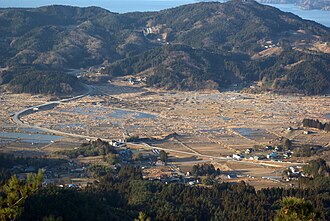
Run-up heights—the maximum vertical height above sea level reached by the water—were staggering. In the port of Ōfunato, the run-up height reached 24 meters (79 ft), while the fishery port of Onagawa saw waves of 15 meters (49 ft). The tsunami caused extensive flooding at the Sendai Airport and destroyed nearly the entire lower area of Rikuzentakata.
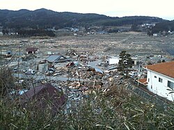
![While the tsunami was able to surmount sea walls and floodgates in many areas along the coastline of the Tohoku region, Fudai, Iwate, was spared destruction due to its 15.5-meter (51 ft) floodgate, which successfully withstood the waves.[153]](/images/16/be/16beb985308fb8f00c6273e773f1cd2d1bb50f3c7035d4d403d772c1b94bd7fa.jpg)
Global Reach and Environmental Effects
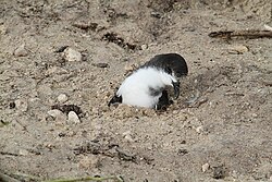
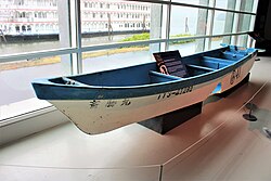
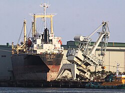
The energy of the tsunami was detected globally. Debris from the disaster, including a Japanese boat, eventually washed ashore on the United States' west coast. The event also caused ecological disruptions, such as the trapping of a Bonin petrel on Midway Atoll.
Secondary Effects and Infrastructure Damage
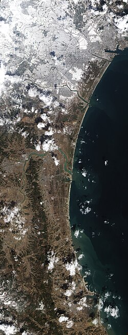
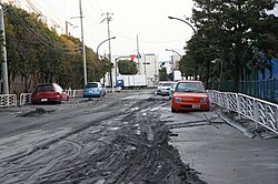
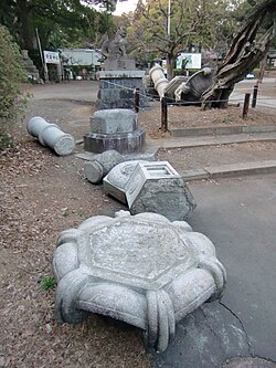
Beyond the immediate impact of the waves, the disaster triggered several secondary catastrophes. Soil liquefaction—a process where saturated soil loses strength and behaves like a liquid—was observed in Kōtō, Tokyo, and Urayasu, Chiba.
Significant land subsidence occurred along the coast, with the Oshika Peninsula in Miyagi sinking by as much as 1.2 meters (3 ft 11 in). Other coastal towns like Rikuzentakata and Kamaishi saw subsidence between 0.66 and 0.84 meters.
Energy and Industrial Failures
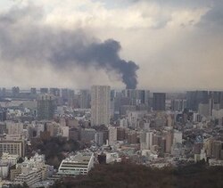
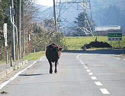
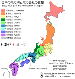
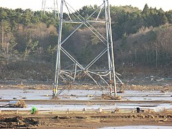
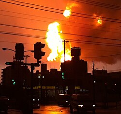
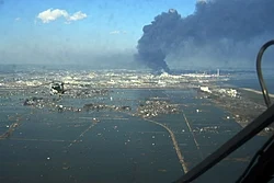
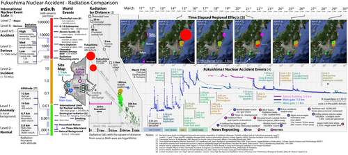
The disaster crippled Japan's energy infrastructure. Damage to transmission towers and power lines was widespread, particularly in Minamisōma. The event also caused fires at the Cosmo Oil refinery in Ichihara and the Sendai Nippon Oil refinery. Most critically, the disaster led to the Fukushima nuclear meltdowns, resulting in significant radiation leaks.
Transport and Urban Destruction
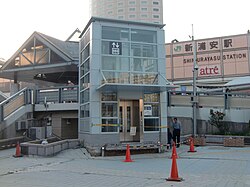
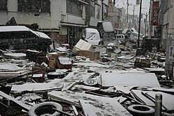
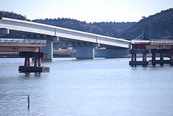
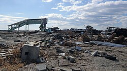
Infrastructure failures included the collapse of highway bridges and the destruction of railway stations, such as Shinchi Station. Rescue efforts were further hampered by unexpected weather conditions, as snowfall arrived in areas like Ishinomaki and Kamaishi shortly after the tsunami struck.
![VA-TF1 Rescue team from Fairfax County, Virginia searching for survivors in Kamaishi, Iwate Prefecture. Snow arrived minutes before or after the tsunami, depending on locations.[40]](/images/25/8e/258eccc1a46ce0108f56b37859c5f5e9d88b07942c14eecad91e4d21d46570dd.jpg)
Summary of Impact by Prefecture
| Prefecture | Fatalities | Missing | Injuries | Destroyed Houses |
|---|---|---|---|---|
| Miyagi | 10,567 | 1,217 | 4,148 | 83,005 |
| Iwate | 5,145 | 1,111 | 213 | 19,508 |
| Fukushima | 3,931 | 224 | 183 | 15,435 |
| Ibaraki | 66 | 1 | 714 | 2,638 |
| Tochigi | 4 | 133 | 261 | 2,118 |
Frequently Asked Questions
What caused the 2011 Tōhoku earthquake?
The earthquake was caused by a megathrust rupture at the convergent boundary where the Pacific plate subducts beneath the Okhotsk microplate.
How high were the tsunami waves?
While many areas saw waves between 10 and 20 meters, the peak tsunami height reached 40.5 meters (133 ft) in Miyako, Iwate.
What is land subsidence and did it occur here?
Land subsidence is the sinking of the Earth's surface. It occurred significantly along the Tōhoku coast, with the Oshika Peninsula sinking by 1.2 meters.
How many people were affected by the disaster?
The disaster resulted in 19,759 deaths, 2,553 missing persons, and 6,242 injuries, with over 122,000 houses completely destroyed.
Did the earthquake affect areas outside of Japan?
Yes, the tsunami traveled across the Pacific Ocean, causing damage and observations as far away as the United States, Chile, and Norway.